Airborne Quicklooks 2019
Color key: Red = zero, Pink = 1 to 10%, Orange >10 to 20%, Yellow >20 to 50%, Green >50% surface returns. Gray = high energy return but DEM is missing.
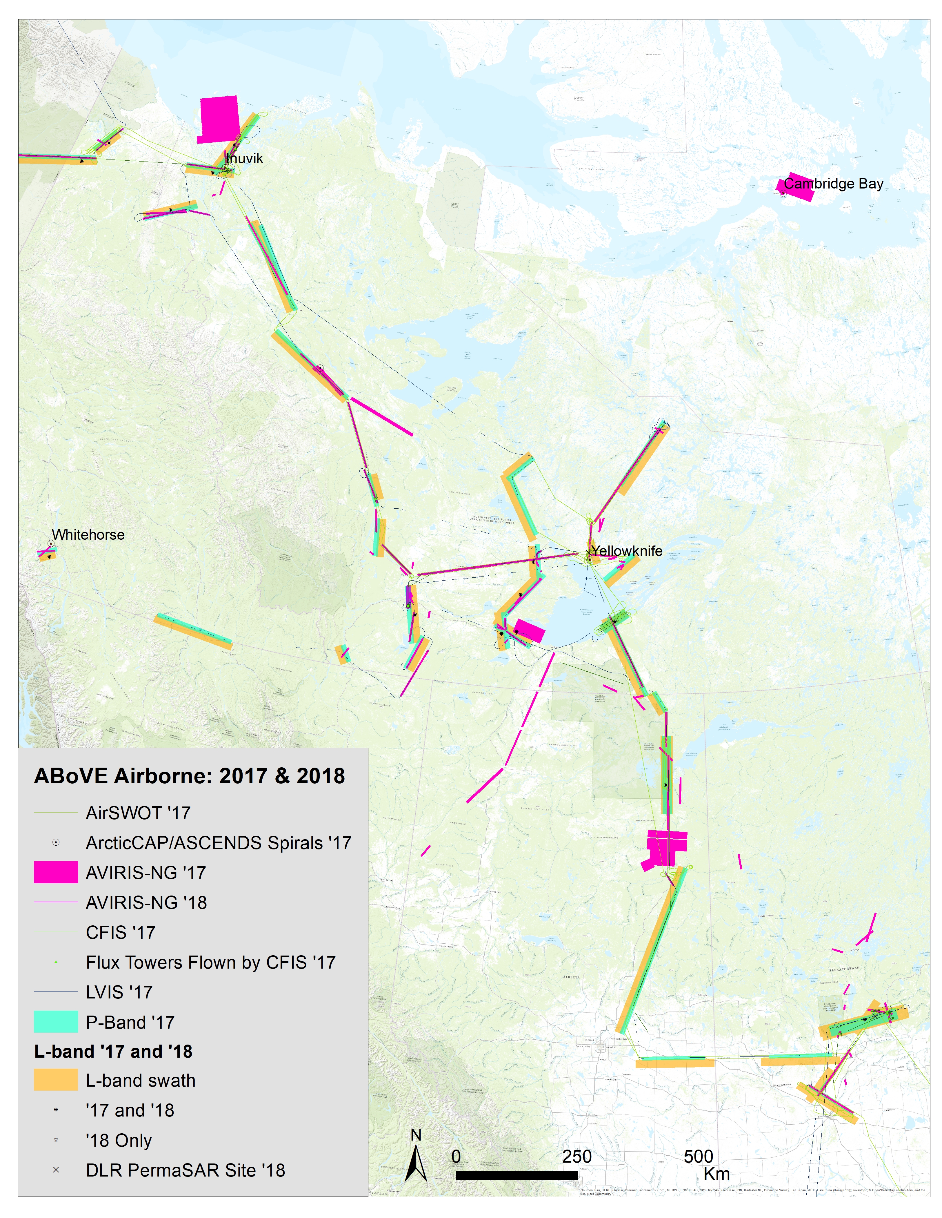
NASA conducted AVIRIS-NG flights during July 21 through 18 August, 2018. Primary mission was to obtain imagery over areas that were not imaged in 2017 due to weather conditions. Some flights were flown in "methane mode" over regions known or suspected to have high methane emissions.
NASA conducted L-Band SAR (UAVSAR) flights during 18-31 August of 2018, repeating lines flown during the 2017 campaign to establish a multi-year time series. Sites included the BERMS site in Saskatchewan, the Peace-Athabascan Delta, road-accessible sites near Yellowknife and Inuvik, and a subset of sites in Alaska and Yukon that were of greatest interest to the SAR Working Group. New flight lines were planned and executed in coordination with the German Aerospace Center (see below). The BERMS sites was flown in TomoSAR mode.
The DLR flew their F-SAR instrument over regions of the ABoVE Domain in the Northwest Territories and Saskatchewan in August 2018. DLR and ABoVE will share airborne and ground validation data from the coordinated collections at the Boreal Ecosystem Research and Monitoring Sites (BERMS) in Saskatchewan and at the Baker Creek watershed near Yellowknife, NT.
During the active flight season, the NEON project flies two Airborne Observation Platforms (AOP) to collect data across NEON field sites. See the NEON Airborne Remote Sensing webpage.
August 15: NASA2 will depart JSC for Yellowknife via Saskatoon. Calendar with flight plans will be posted soon.