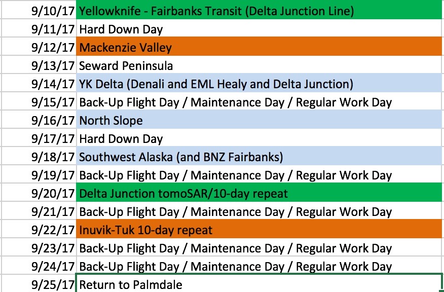
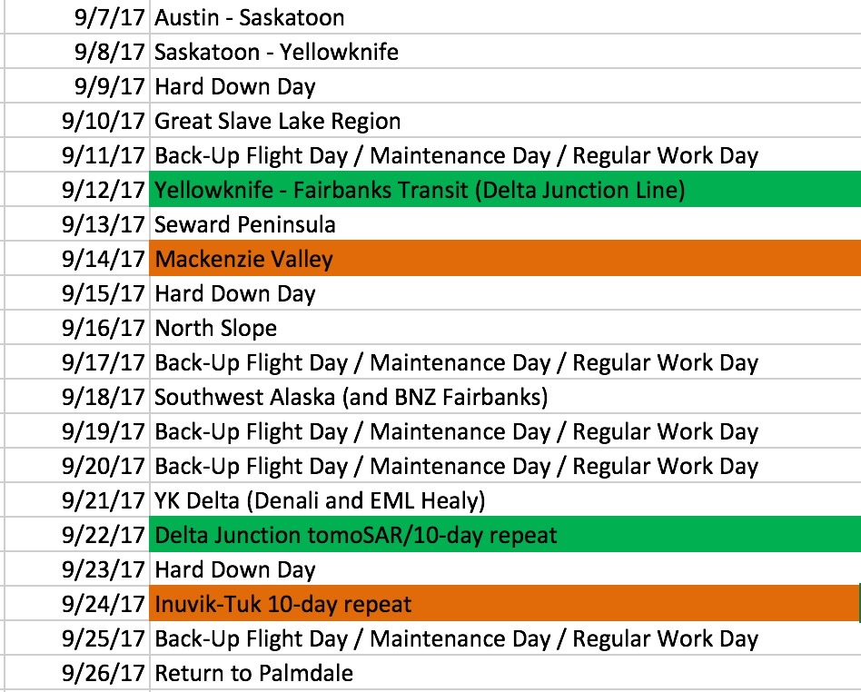
Wed —Sep 13— UAVSAR L-band ArctiC-C (Scientific Aviation Mooney N617DH)
-
Sensor/Aircraft Location
L-band SAR (NASA C-20 NASA502) Fairbanks AK
ArctiC-C (Scientific Aviation Mooney N617DH) Whitehorse, Yukon
P-band SAR (NASA G-III NASA2) will deploy again in October
Sensor/Aircraft Summaries
L-band SAR / AFRC C-20A (NASA502)
Wednesday 9/13
A problem with the aircraft is being addressed. We will not be able to fly on Thursday 9/14. Stand by for revised schedule. We will respect and accommodate field crew schedules.
ArctiC-C/N617DH
September campaign started Friday 9/8
Tuesday 9/12
Aircraft maintenance in Whitehorse, Yukon. Waiting for a part to arrive. Unlikely to make it to Fairbanks until Wednesday.
ABoVE flying over; awaiting preliminary data products
LVIS (Dynamic Aviation B-200T N44U)
CFIS (Twin Otter International DHC6 N331AR)
AVIRIS-NG (Dynamic Aviation B-200 N53W)
ASCENDS (NASA DC-8)
NEON Airborne Observing Platform (Twin Otter International N70AR)
AirSWOT (NASA AFRC B-200 N801NA)
Mon —Sep 11— UAVSAR L-band ArctiC-C (Scientific Aviation Mooney N617DH)
-
Sensor/Aircraft Location
L-band SAR (NASA C-20 NASA502) Fairbanks AK
ArctiC-C (Scientific Aviation Mooney N617DH) Whitehorse, Yukon
P-band SAR (NASA G-III NASA2) will deploy again in October
Sensor/Aircraft Summaries
L-band SAR / AFRC C-20A (NASA502)
Tuesday 9/12
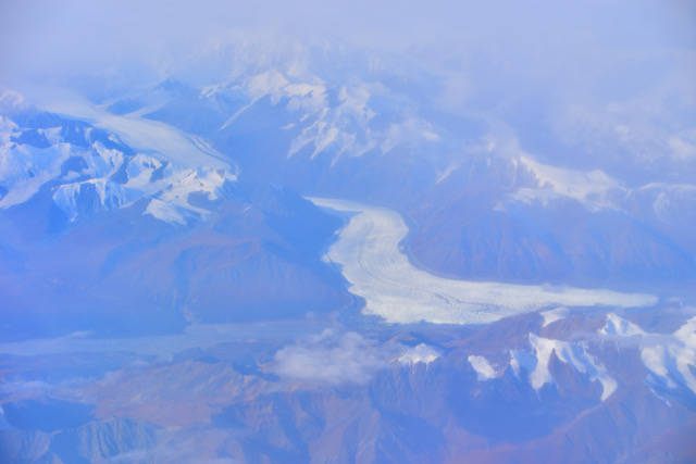
MacKenzie Valley sortie
https://uavsar.jpl.nasa.gov/cgi-bin/report.pl?planID=PLAN_1132_v07#summary
All lines collected. Some issues with radar and navigation required two repeats.
Wednesday 9/13
Down day (weather)
Thursday 9/14
Seward Peninsula sortie
https://uavsar.jpl.nasa.gov/cgi-bin/report.pl?planID=PLAN_1133_v03#summary The UAVSAR Calendar is up to date, but sorties may move by one day in case of weather. I've tried to reconcile changes with the schedules of all teams I know are in the field. Contact me with any concerns.
ArctiC-C/N617DH
September campaign started Friday 9/8
Tuesday 9/12
Aircraft maintenance in Whitehorse, Yukon. Waiting for a part to arrive. Unlikely to make it to Fairbanks until Wednesday.
ABoVE flying over; awaiting preliminary data products
LVIS (Dynamic Aviation B-200T N44U)
CFIS (Twin Otter International DHC6 N331AR)
AVIRIS-NG (Dynamic Aviation B-200 N53W)
ASCENDS (NASA DC-8)
NEON Airborne Observing Platform (Twin Otter International N70AR)
AirSWOT (NASA AFRC B-200 N801NA)
Attached Files
Tuktoyaktuk/Beaufort Sea
Mon —Sep 11— UAVSAR L-band ArctiC-C (Scientific Aviation Mooney N617DH)
-
Sensor/Aircraft Location
L-band SAR (NASA C-20 NASA502) Fairbanks AK
ArctiC-C (Scientific Aviation Mooney N617DH) Whitehorse, Yukon
P-band SAR (NASA G-III NASA2) will deploy again in October
Sensor/Aircraft Summaries
L-band SAR / AFRC C-20A (NASA502)
Monday 9/11 was a hard down day.
Tuesday 9/12
MacKenzie Valley sortie https://uavsar.jpl.nasa.gov/cgi-bin/report.pl?planID=PLAN_1132_v07#summary
Wednesday 9/13
Seward Peninsula sortie, depending on weather
https://uavsar.jpl.nasa.gov/cgi-bin/report.pl?planID=PLAN_1133_v03#summary
As of 1500 Alaska time Monday, the weather looks more favorable to fly the Seward Peninsula sortie on Thursday 9/14. We'll reassess weather post-flight on Tuesday.
The UAVSAR Calendar is up to date, but sorties may move by one day in case of weather. I've tried to reconcile changes with the schedules of all teams I know are in the field. Contact me with any concerns.
ArctiC-C/N617DH
September campaign started Friday 9/8
Monday 9/11
Aircraft maintenance in Whitehorse, Yukon. Waiting for a part to arrive. Unlikely to make it to Fairbanks until Wednesday.
*** Ground truth providers seeking information on timing of potential overflights should contact Chip Miller or Peter Griffith ***
ABoVE flying over; awaiting preliminary data products
LVIS (Dynamic Aviation B-200T N44U)
CFIS (Twin Otter International DHC6 N331AR)
AVIRIS-NG (Dynamic Aviation B-200 N53W)
ASCENDS (NASA DC-8)
NEON Airborne Observing Platform (Twin Otter International N70AR)
AirSWOT (NASA AFRC B-200 N801NA)

Attached Files
Fairbanks
UAF
Sun —Sep 10— UAVSAR L-band ArctiC-C (Scientific Aviation Mooney N617DH)
-
Sensor/Aircraft Location
L-band SAR (NASA C-20 NASA502) Fairbanks AK
ArctiC-C (Scientific Aviation Mooney N617DH) Whitehorse, Yukon
P-band SAR (NASA G-III NASA2) will deploy again in October
Sensor/Aircraft Summaries
L-band SAR / AFRC C-20A (NASA502)
Sunday 9/10: Transit to Fairbanks
https://uavsar.jpl.nasa.gov/cgi-bin/report.pl?planID=PLAN_1143_v03#summary
Radar flatlined at Ft. Liard. We were unable to get clearance from Edmonton ATC to retry.
Radar flatlined at the Delta Junction NEON site. Success on second attempt.
Monday 9/11 is a hard down day.
The UAVSAR Calendar will be updated shortly to reflect this schedule. Science sorties may move by one day in case of weather. As of 1500 Alaska Time Sunday, the weather looks more favorable to fly the Mackenzie Valley sortie on Tuesday 9/12. I've tried to reconcile changes with the schedules of all teams I know are in the field. Contact me with any concerns.
ArctiC-C/N617DH
September campaign started Friday 9/8
Sunday 9/10 Doing maintenance in Whitehorse, Yukon. Team expects to fly to Fairbanks upon completion.
*** Ground truth providers seeking information on timing of potential overflights should contact Chip Miller or Peter Griffith ***
ABoVE flying over; awaiting preliminary data products
LVIS (Dynamic Aviation B-200T N44U)
CFIS (Twin Otter International DHC6 N331AR)
AVIRIS-NG (Dynamic Aviation B-200 N53W)
ASCENDS (NASA DC-8)
NEON Airborne Observing Platform (Twin Otter International N70AR)
AirSWOT (NASA AFRC B-200 N801NA)
Attached Files
Kluane Lake
Kluane Nat'l Park
Sat —Sep 9— UAVSAR L-band ArctiC-C (Scientific Aviation Mooney N617DH)
-
Sensor/Aircraft Location
L-band SAR (NASA C-20 NASA502) Yellowknife Canada
ArctiC-C (Scientific Aviation Mooney N617DH) in Inuvik (?)
P-band SAR (NASA G-III NASA2) will deploy again in October
Sensor/Aircraft Summaries
L-band SAR / AFRC C-20A (NASA502)
Saturday 9/9: Great Slave Lake Sortie
https://uavsar.jpl.nasa.gov/cgi-bin/report.pl?planID=PLAN_1142_v03#summary
Successful flight, collected 11 out of 11 lines, aircraft operating well, radar had one anomaly on the first line but it performed nominally thereafter. Videography team under contract from Government of Northwest Territories was on board.
Sunday 9/10: Transit to Fairbanks https://uavsar.jpl.nasa.gov/cgi-bin/report.pl?planID=PLAN_1143_v03#summary
Monday 9/11 is a hard down day.
Stay tuned for revised schedule. Field Crew schedules will be respected.
ArctiC-C/N617DH
September campaign to start Friday 9/8 (weather dependent)
Yellowknife to Inuvik; then to Fairbanks on Saturday
*** Ground truth providers seeking information on timing of potential overflights should contact Chip Miller or Peter Griffith ***
ABoVE flying over; awaiting preliminary data products
LVIS (Dynamic Aviation B-200T N44U)
CFIS (Twin Otter International DHC6 N331AR)
AVIRIS-NG (Dynamic Aviation B-200 N53W)
ASCENDS (NASA DC-8)
NEON Airborne Observing Platform (Twin Otter International N70AR)
AirSWOT (NASA AFRC B-200 N801NA)
Attached Files

Daring Lake
GNWT Media
Fri —Sep 8— UAVSAR L-band ArctiC-C (Scientific Aviation Mooney N617DH)
-
Sensor/Aircraft Location
L-band SAR (NASA C-20 NASA502) Yellowknife Canada
ArctiC-C (Scientific Aviation Mooney N617DH) in Yellowknife
P-band SAR (NASA G-III NASA2) will deploy again in October
Sensor/Aircraft Summaries
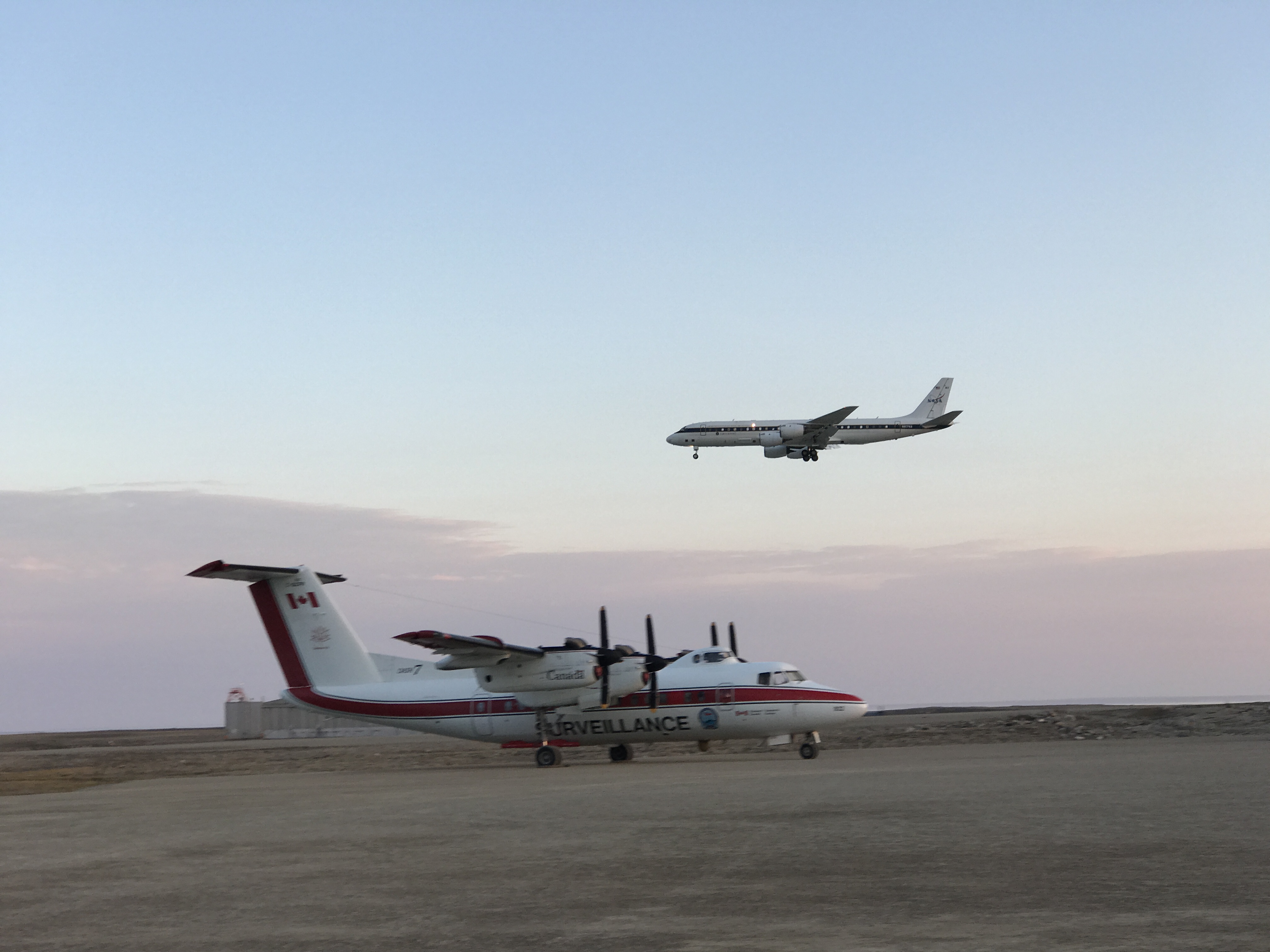
L-band SAR / AFRC C-20A (NASA502)Timelapse of NASA502 landing in Yellowknife Canada
Friday 9/8: Transit from Saskatoon to Yellowknife Canada
https://uavsar.jpl.nasa.gov/cgi-bin/report.pl?planID=PLAN_1225_v01#summary
Successful flight, collected 11 out of 1 lines, aircraft operating well, radar had one anomaly with the data recorder. Reset fiber channel network and it performed nominally thereafter.
Saturday 9/9: Great Slave Lake Sortie https://uavsar.jpl.nasa.gov/cgi-bin/report.pl?planID=PLAN_1142_v03#summary
Videography team under contract from Government of Northwest Territories will be on board.
Sunday 9/10 is a hard down day.
Monday 9/11 is a backup day.
Saturday 9/9: Great Slave Lake Sortie
ArctiC-C/N617DH
September campaign to start Friday 9/8 (weather dependent)
Yellowknife to Inuvik; then to Fairbanks on Saturday
*** Ground truth providers seeking information on timing of potential overflights should contact Chip Miller or Peter Griffith ***
ABoVE flying over; awaiting preliminary data products
LVIS (Dynamic Aviation B-200T N44U)
CFIS (Twin Otter International DHC6 N331AR)
AVIRIS-NG (Dynamic Aviation B-200 N53W)
ASCENDS (NASA DC-8)
NEON Airborne Observing Platform (Twin Otter International N70AR)
AirSWOT (NASA AFRC B-200 N801NA)
Thurs —Sep 7— UAVSAR L-band ArctiC-C (Scientific Aviation Mooney N617DH)
-
Sensor/Aircraft Location
L-band SAR (NASA C-20 NASA2) Saskatoon Canada
ArctiC-C (Scientific Aviation Mooney N617DH) in Yellowknife
P-band SAR (NASA G-III NASA2) will deploy again in October
Sensor/Aircraft Summaries
L-band SAR / AFRC C-20A (NASA502)
Thursday 9/7: Transit from Palmdale to Saskatoon Saskatchewan Canada
Flight plan
Successful flight, collected 5 out of 5 lines, radar and aircraft operating
Friday 9/8: Transit from Saskatoon to Yellowknife Canada https://uavsar.jpl.nasa.gov/cgi-bin/report.pl?planID=PLAN_1225_v01#summary
Saturday 9/9: Great Slave Lake Sortie https://uavsar.jpl.nasa.gov/cgi-bin/report.pl?planID=PLAN_1142_v03#summary
ArctiC-C/N617DH
September campaign to start Friday 9/8 (weather dependent)
Yellowknife to Inuvik; then to Fairbanks on Saturday
*** Ground truth providers seeking information on timing of potential overflights should contact Chip Miller or Peter Griffith ***
ABoVE flying over; awaiting preliminary data products
LVIS (Dynamic Aviation B-200T N44U)
CFIS (Twin Otter International DHC6 N331AR)
AVIRIS-NG (Dynamic Aviation B-200 N53W)
ASCENDS (NASA DC-8)
NEON Airborne Observing Platform (Twin Otter International N70AR)
AirSWOT (NASA AFRC B-200 N801NA) ABoVE flying over; awaiting preliminary data products
LVIS (Dynamic Aviation B-200T N44U)
CFIS (Twin Otter International DHC6 N331AR)
AVIRIS-NG (Dynamic Aviation B-200 N53W)
ASCENDS (NASA DC-8)
NEON Airborne Observing Platform (Twin Otter International N70AR)
AirSWOT (NASA AFRC B-200 N801NA)
Wed —Sep 6— UAVSAR L-band
-
Chip Miller is at JPL
Peter Griffith is headed for Saskatoon
Sensor/Aircraft Location
L-band SAR (NASA C-20 NASA2) Palmdale CA
ArctiC-C (Scientific Aviation Mooney N617DH) will deploy again in September
P-band SAR (NASA G-III NASA2) will deploy again in October
Sensor/Aircraft Summaries
L-band SAR / AFRC C-20A (NASA502)
Thursday 9/7: Transit from Palmdale to Saskatoon Saskatchewan Canada
Flight plan
Peter Griffith will fly commercially to meet plane and flight crew in Saskatoon
Friday 9/8: Transit from Saskatoon to Yellowknife Canada
Saturday 9/9: TBD
ArctiC-C/N617DH
September campaign to start as soon as next week (weather dependent)
*** Ground truth providers seeking information on timing of potential overflights should contact Chip Miller or Peter Griffith ***
ABoVE flying over; awaiting preliminary data products
LVIS (Dynamic Aviation B-200T N44U)
CFIS (Twin Otter International DHC6 N331AR)
AVIRIS-NG (Dynamic Aviation B-200 N53W)
ASCENDS (NASA DC-8)
NEON Airborne Observing Platform (Twin Otter International N70AR)
AirSWOT (NASA AFRC B-200 N801NA)
Thurs —Aug 31— AVIRIS-NG (Dynamic Aviation B-200 N53W)
-
This is a special report on the ABoVE Airborne Campaign.
Chip Miller is at JPL
Peter Griffith is at Goddard
31 August Thursday The L-band SAR (NASA C-20 NASA2) has been deployed to Houston TX on a special Hurricane Harvey mission. We fully expect to begin the ABoVE deployment on Thursday 7 September. The UAVSAR calendar will be updated shortly. In the meanwhile, we developed this schedule in consultation with the teams known to be doing field work in conjunction with the upcoming flights. If you're going to be in the field in September and expect coordination with the L-Band flights and have NOT contacted Peter or Eric Kasischke in the last 48 hours, please contact Peter Griffith ASAP.
Attached Files
20170817
Thurs-Sat 17 — 19 Aug— AVIRIS-NG (Dynamic Aviation B-200 N53W) AIRSWOT (AFRC B-200 N801NA) ArctiC-C (Scientific Aviation Mooney N617DH) UAVSAR L-band UAVSAR P-band (AirMOSS)
-
Chip Miller is in Fairbanks.
Peter Griffith is in Fairbanks.
17-19 August
Sensor/Aircraft Location
P-band SAR (NASA G-III NASA2) Fairbanks AK
ArctiC-C (Scientific Aviation Mooney N617DH) Fairbanks AK
L-band SAR (NASA C-20 30502) Palmdale CA — will deploy after P-band flights completed, planned 2 Sept
ABoVE flying complete; awaiting preliminary data products
LVIS (Dynamic Aviation B-200T N44U)
CFIS (Twin Otter International DHC6 N331AR)
ASCENDS (NASA DC-8)
NEON Airborne Observatory (Twin Otter International DHC6 N70AR)
AVIRIS-NG (Dynamic Aviation B-200 N53W)
AirSWOT (NASA AFRC B-200 N801NA)
Sensor/Aircraft Summaries
AirSWOT/N801NA
Thurs 8/17: Repeated the 2 high priority Saskatoon area lines
Ground teams re-deployed
After flying lines, AirSWOT flew to North Dakota
This completes the AirSWOT/NASA 801 mission for ABoVE
AVIRIS-NG/N53W Thurs 8/17: reflew BERMS/Saskatoon joint ground-air acquisitions in coordination with AirSWOT/NASA 801 Several additional lines north of Prince Albert flown, but conditions worsened further north
This completes the AVIRIS/N53W mission for ABoVE
P-band SAR/JSC G-III (N992NA)
Thurs 8/17: no flight day
Fri 8/18: Mackenzie Valley flight executed
7 of 7 lines successfully collected; no issues with PPA or radar
All flight plans flown successfully; all lines successfully collected
This completes the P-band SAR/G-III mission for ABoVE
Plan:
Sat 8/19: no fly
Sun 8/20: Pack
Mon 8/21: Transit to Palmdale
ArctiC-C/N617DH
Thurs 8/17: Begin August circuit flights (Campaign #4) Grand Prairie — Yellowknife — Inuvik
Fri 8/18: Inuvik — Fairbanks
Sat 8/19: no fly day
Sun 8/20: Fairbanks — Bethel — Nome TBC based on weather
Attached Files
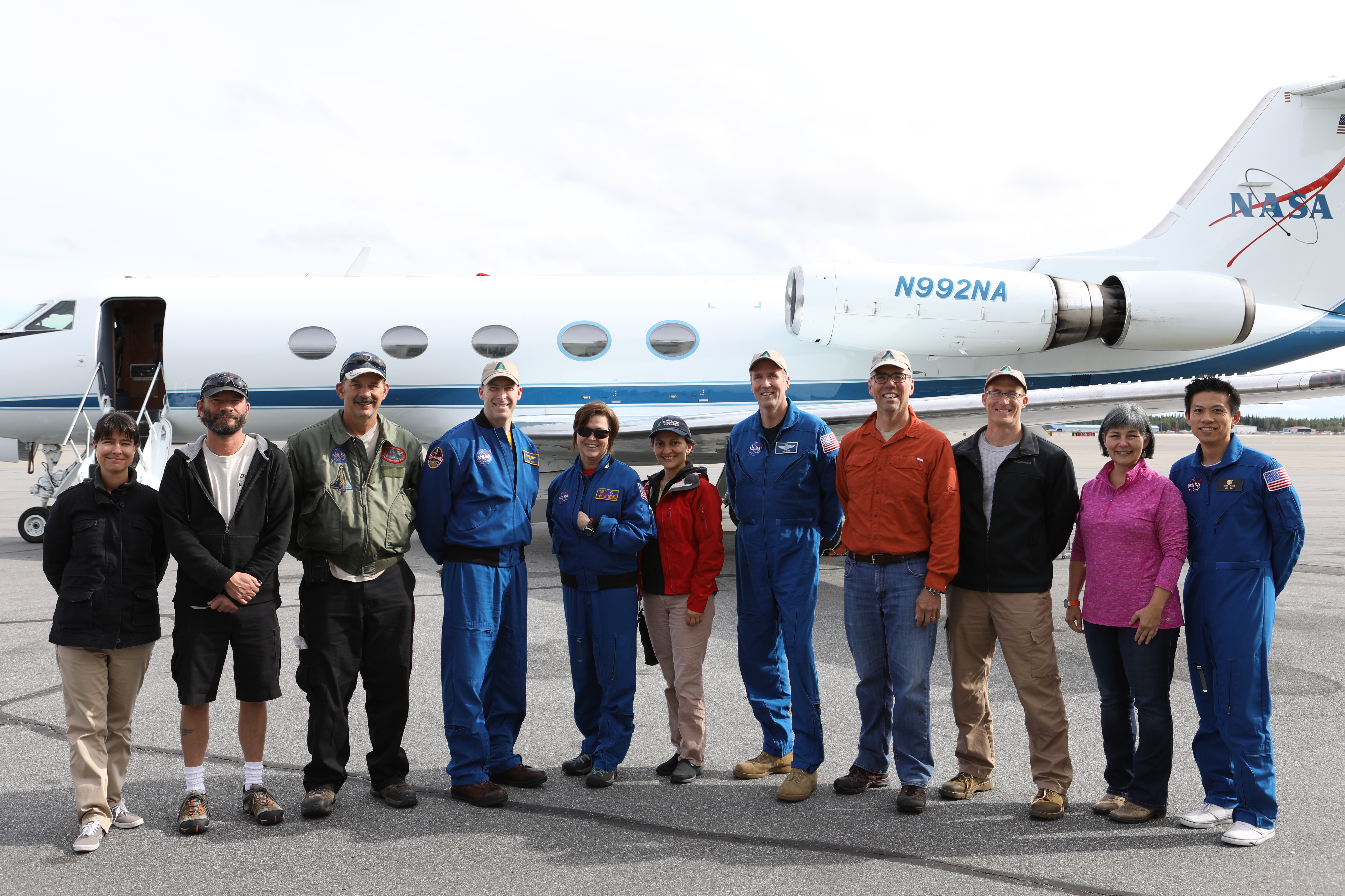
Photo of the P-band SAR team and NASA 2 at the conclusion of the August campaignThanks to Kean Tham
20170817
Wed 16 Aug— AVIRIS-NG (Dynamic Aviation B-200 N53W) AIRSWOT (AFRC B-200 N801NA) ArctiC-C (Scientific Aviation Mooney N617DH) UAVSAR L-band UAVSAR P-band (AirMOSS)
-
Chip Miller is in Fairbanks.
Peter Griffith is in Fairbanks.
16 August Wednesday
Sensor/Aircraft Location
P-band SAR (NASA G-III NASA2) Fairbanks AK
AVIRIS-NG (Dynamic Aviation B-200 N53W) Saskatoon SK
AirSWOT (NASA AFRC B-200 N801NA) Saskatoon SK
ArctiC-C (Scientific Aviation Mooney N617DH) Grand Prairie AB
L-band SAR (NASA C-20 30502) Palmdale CA — will deploy after P-band flights completed, planned 2 Sept
ABoVE flying complete; awaiting preliminary data products
LVIS (Dynamic Aviation B-200T N44U)
CFIS (Twin Otter International DHC6 N331AR)
ASCENDS (NASA DC-8)
NEON Airborne Observatory (Twin Otter International DHC6 N70AR)
Weather & Science Operations Outlook
Day-1 Outlook Valid 1500z 17 August through 2359z 17 August
A weak weather system will race across the southern portions of AB and SK early in the day on Thursday and should be clear of the BERMS and Saskatoon vicinity after 18z. With that, mainly clear skies are expected later in the day...however a moderate amount of haze from BC fires is being indicated by the GEOS model to move across southern AB and SK . Aerosol haze will be less of an issue further north towards the PAD/L. Ath. region, but even here some varying amounts of smoke haze is possible Thursday from local AB fires.
Weather conditions for the PAD/L. Ath. vicinity should be mainly cloud-free before 21z and scattered to occasionally broken coverage from 21z on.
Over Alaska, a broad gyre of low pressure will be over the state. Model quantitative precipitation forecasts are in excellent agreement with light amounts over the PAFA/Delta Junction and Yukon Flats segments. Amounts of 0.10-0.25" are possible in any pop-up shower here. Amounts of 0.25-0.50" are possible over parts of the Seward Peninsula, mainly western half.
Day-2 Outlook Valid 1500z 18 August through 2359z 18 August
A ridge of high pressure will be located over the Prairie Provinces. With that, mainly cloud-free skies. A period of broken middle or high clouds may be possible approaching the PAD/L. Ath region. Saskatoon/BERMS should be mostly sunny and no significant smoke haze expected on Friday at any site.
PAFA/Delta Junction: Any precipitation will be very light (around 0.10" of less).
Yukon Flats: Will likely remain to the south of heavier precipitation amounts expected over far northeast Alaska. Be mindful of precipitation amounts north and northeast of the Flats up to 1.00"-1.50".
Seward Peninsula: Continued mid-range precipitation chances but with amounts expected to remain light, averaging less than 0.25", isolated pockets of higher amounts possible for the far eastern Peninsula.
Day-3 Outlook Valid 1500z 19 August through 2359z 19 August
A weak trough moving through the westerlies will focus showers and thunderstorms early day Saturday in clusters across central SK including the BERMS area. This system should have moved out of the area by afternoon leaving behind manly clear and clean skies (from about 18z on).
Some late day broken to overcast conditions are possible over PAD/L. Ath. vicinity as a moist northwesterly flow becomes established. Best flying weather for clear skies before 21z Saturday. Generally clean atmosphere.
A weak pressure pattern over the state of Alaska. No large-scale forcing indicated to be strong enough to produce widespread heavy precipitation threats over Alaska. Favored areas of topography and upslope flow may see a pop-up shower or thunderstorm. The Seward Peninsula continues to carry a chance of rain with mainly light amounts of under 0.50".
Sensor/Aircraft Summaries
AirSWOT/N801NA
Wed 8/16: transited Yellowknife – Saskatoon, refueled in FMM then BERMS/Saskatoon joint ground-air acquisitions
Lines: 1. FMM-Edmonton = Clear (pave10_127aa)
2. Edmonton — Lloydminster — Mostly cloudy (pave01_220aa)
3. Mixed — Pretty good (pave09_081ab)
4. Mixed — first 2/3 good, last 1/3 was cloudy (pave02_091aa)
5. Mixed — first 1/3 cloudy, last bit smoky (pave11_201aa)
DECISION — refly the 2 high priority lines Thurs 8/17 then move on to Minot SD
Abhishek will send snapshot of updated forecast by 0830 MDT/1030 EDT
LS — had 4 field teams out all day on the river
All went well
This would complete ABoVE mission for AirSWOT/NASA 801
AVIRIS-NG/N53W Wed 8/16: BERMS/Saskatoon joint ground-air acquisitions
Flew Saskatoon circuit 2x
First circuit — some scattered cumulus below on the N-S line
2nd circuit — partly cloudy
Smoke — lower on first circuit – had a very clear visual of ground, 10 SM visibility
2nd circuit — 5 SM visibility, hazier view of the surface
Thurs 8/17: Repeat Saskatoon area lines with AirSWOT — 1100–1300 = best window
This would complete ABoVE mission for AVIRIS/N53W
P-band SAR/JSC G-III (N992NA)
ACTION — Check on whether precipitation interfered with acquisition over Coldfoot AK on
Near-term plans:
Wed 8/16: Down Day
Plan:
Thurs: Evaluate SewPen opportunity 0800 @ Hampton Inn
Fri: Mackenzie Valley
Sat (contingency): SewPen
Sun 8/20: Pack
Mon 8/21: Transit to Palmdale
ArctiC-C/N617DH
Thurs 8/17: Begin August circuit flights (Campaign #4)
Mon-Tues 14-15 Aug— AVIRIS-NG (Dynamic Aviation B-200 N53W) AIRSWOT (AFRC B-200 N801NA) ArctiC-C (Scientific Aviation Mooney N617DH) NEON Airborne Observing Platform (Twin Otter International N70AR)
-
Chip Miller is in Fairbanks.
Peter Griffith is in Fairbanks.
12-13 August Saturday-Sunday
Sensor/Aircraft Location
P-band SAR (NASA G-III NASA2) Fairbanks AK
AVIRIS-NG (Dynamic Aviation B-200 N53W) Yellowknife NWT
AirSWOT (NASA AFRC B-200 N801NA) Yellowknife NWT
NEON Airborne Observing Platform (Twin Otter International N70AR) Fairbanks AK
ArctiC-C (Scientific Aviation Mooney N617DH) Grand Prairie AB
L-band SAR (NASA C-20 30502) Palmdale CA — will deploy after P-band flights
completed, planned 2 Sept
ABoVE flying complete; awaiting preliminary data products
LVIS (Dynamic Aviation B-200T N44U)
CFIS (Twin Otter International DHC6 N331AR)
ASCENDS (NASA DC-8)
Weather & Science Operations Outlook
Day-1 Outlook Valid 1500z 16 August through 2359z 16 August
Two low pressure centers along a trough will be found near Bear Lake and L. Ath. on Wednesday. These lows will be lifting northward through the day. The Yellowknife region should remain mostly sunny in between these two lows. Further south into central and south SK, skies should clear or scattered, although varying degrees of light to moderate smoke haze advecting from BC fires will affect this area.
Yellowknife: Clear to scattered clouds throughout the day. No aerosol concerns as most of the haze stays south and east of Gr. Slave Lake.
L. Ath./northeast AB: GEOS model showing clouds and showers most prevalent to the east of the 110W longitude line. The clouds and showers there will continue to move to the northeast through the afternoon. The western portion of L. Ath. looks to have scattered to briefly broken clouds Wednesday. Local fires over north-central AB may advect some into the target zone occasionally Wednesday. Heavier smoke haze from non-local fires seems to stay over northern SK.
Saskatoon/Trout Lake: Mainly clear to scattered cloud cover. Varying amounts of light to moderate smoke from BC fires.
PAFA: Scattered showers with a couple of pop-up thunderstorms possible. Widespread heavy rainfall not expected. No aerosol issues.
Day-2 Outlook Valid 1500z 17 August through 2359z 17 August
Thursday is shaping up to be a fine weather day for most of the targets. Weather systems bringing widespread clouds and precipitation will be noticeably absent on Thursday.
Yellowknife: Clear to scattered clouds. Smoke haze from non-local fires should remain east and south of the immediate region.
L. Ath./northeast AB: Scattered clouds. Local AB fires advecting some light to modest smoke haze. Non-local fires' smoke remains further east.
Saskatoon/Trout Lake: Mainly clear early. Scattered to occasionally broken clouds later in the day. Light smoke haze from BC fires.
PAFA: Widely scattered showers, an isolated storm can not be ruled out. No widespread heavy precipitation.
Day-3 Outlook Valid 1500z 18 August through 2359z 18 August
A weather impulse/compact low may touch off some showers or a thunderstorm over the Yellowknife/Gr. Slave Lake region on Friday. Otherwise, continued good to excellent weather for the remainder of the target areas anticipated Friday.
Yellowknife: Broken to overcast at times. Showers and a thunderstorm possible.
L. Ath/ne AB/Saskatoon/Trout Lake: Clear to occasionally scattered clouds. Light smoke aerosol or less. Thicker haze stays confined to southeast of Slave Lake and well north of L. Ath.
PAFA: No weather issues. Near zero chance of heavy precipitation.
Sensor/Aircraft Summaries
P-band SAR/JSC G-III (N992NA)
Mon 8/14: YK Delta/SW Alaska combination
10 lines successfully acquired from the combined SW Alaska and YK Delta flight plans — Reducing overall flight schedule by 1 day
Radar and PPA worked flawlessly
80-100% cloud cover over entire domain, but no active precipitation during data collection
Tues 8/15: TomoSAR flight over Delta Junction
Flight plan includes 8 racetracks that give LHS and RHS views of the line at altitudes from 9000 m to 9250 m
10 “laps” actually flown successfully
2 restarts due to radar flat lining
Eric Kasischke is leading field team making simultaneous ground measurements Kevin Schaefer and his team making ground-penetrating radar measurements at 4 sites in the DJ area as well
Cloudy skies near Delta Junction (northern end of the racetrack) gave way to mostly clear skies in Tok (southern end of the racetrack) despite rain and drizzle over the last several days.
No evidence of precip during data collection
ACTION - Check on whether precipitation interfered with acquisition over Coldfoot AK on
Near-term plans:
Wed 8/16: Down Day
Thurs 8/17: Seward Peninsula — Yukon Flats (from North Slope flight plan)
Fri 8/18: Mackenzie Valley
Sat 8/19: Contingency Day
Sun 8/20: Pack
Mon 8/21: Transit to Palmdale
AVIRIS-NG/N53W
Mon 8/14: transit Yellowknife — Saskatoon with prelim collection of BERMS area lines Worked on communications and planning with controlled air space ATC
Tues 8/15: No fly day
Wed 8/16: BERMS/Saskatoon joint ground-air acquisitions
Thurs 8/17: Contingency day
AirSWOT/N801NA
Mon 8/14: No fly day
Tues 8/15: No fly day
Wed 8/16: transit Yellowknife — Saskatoon, refuel in FMM then BERMS/Saskatoon joint ground-air acquisitions
Thurs 8/17: Contingency day
August 15-16th Peace-Athabaskan Delta ground team in place.
August 16-17 Saskatoon ground team in place.
NEON Airborne Observatory/N70AR
Mon 8/14: No fly day
Tues 8/15: No fly day
NEON Alaska operations window closed. Returning to Lower 48
ArctiC-C/N617DH
Sat 8/12: No flight
Sun 8/13: No flight
Ready to begin August circuit flights. Evaluating forecasts and conditions
Sat-Sun 12-13 Aug— LVIS (Dynamic Aviation B-200T N44U) AVIRIS-NG (Dynamic Aviation B-200 N53W) CFIS (Twin Otter International DHC6 N331AR) AIRSWOT (AFRC B-200 N801NA) ArctiC-C (Scientific Aviation Mooney N617DH) NEON Airborne Observing Platform (Twin Otter International N70AR) ASCENDS (NASA DC-8)
-
Chip Miller is in Fairbanks.
Peter Griffith is in Fairbanks.
12-13 August Saturday-Sunday
Sensor/Aircraft Location
P-band SAR (NASA G-III NASA2) Fairbanks AK
AVIRIS-NG (Dynamic Aviation B-200 N53W) Yellowknife NWT
AirSWOT (NASA AFRC B-200 N801NA) Yellowknife NWT
NEON Airborne Observing Platform (Twin Otter International N70AR) Fairbanks AK
ArctiC-C (Scientific Aviation Mooney N617DH) Grand Prairie AB
L-band SAR (NASA C-20 30502) Palmdale CA — will deploy after P-band flights completed, planned 2 Sept
ABoVE flying complete; awaiting preliminary data products
LVIS (Dynamic Aviation B-200T N44U)
CFIS (Twin Otter International DHC6 N331AR)
ASCENDS (NASA DC-8)
Weather & Science Operations Outlook
Day-1 Outlook
Valid 1500z 14 August through 2359z 14 August
On Monday, a low pressure trough will be stretched across central Alaska, into the Canadian Yukon Provinces and then trail down through the central portions of AB and SK. This will be the axis for which poor weather conditions will be most likely. More specifically, from PAFA northward over the Brooks Range and North Slope looks to have multi-layer clouds and precipitation, and then running down the border between YKT and NWT, and finally trailing down north-central AB and central SK.
Yellowknife — Fort McMurray — Saskatoon: Mainly clear skies Monday for Yellowknife especially before 21z, but moderate smoke haze likely from local NWT fires as well as smoke being advected from both major BC fires. Fort McMurray and Saskatoon run higher chances of cloud cover and precipitation with the low pressure trough draped in the vicinity.
East Trout Lake area: May be an opportunity for flight earlier in the day than later as both clouds and smoke should stay clear of this area between 14-18z with increasing amounts of both restriction after that time
PAFA/Delta Junction: Pretty socked in all day with clouds/rain/fog. Heavy rainfall or thunder is not anticipated at PAFA, however.
Day-2 Outlook
Valid 1500z 15 August through 2359z 15 August
Not a great deal of change in the large-scale pattern Tuesday. The elongated trough over Alaska and Yukon moves slightly north.
Yellowknife - Fort McMurray - Saskatoon: Morning showers and thunderstorms for Yellowknife, then weather improving during the afternoon hours. Same with smoke, Yellowknife will see heavy morning smoke haze but improving visibility in the afternoon with the least aerosol found just west of Yellowknife. Further south towards Fort McMurray there will be partly cloudy skies with afternoon showers possible. Light to moderate smoke haze there. Saskatoon will be mostly sunny, also with light to at times moderate smoke haze.
East Trout Lake area: Variably cloudy with a better chance of showers and thunderstorms. Moderate smoke haze.
PAFA/Delta Junction: Continued generally overcast with shower chances. No heavy precipitation or thunder anticipated here.
Day-3 Outlook
Valid 1500z 16 August through 2359z 16 August
Improving weather for PAFA/Delta Junction. A low pressure center will be found over Inuvik with another weaker low over northern SK.
PAFA/Delta Junction: Partly cloudy, no smoke. A scattered shower possible. Near zero chance of heavy rainfall.
Yellowknife: Mostly sunny, smoke clears out.
Fort McMurray: Mostly sunny, light smoke haze.
Saskatoon: Good weather but moderate to at times heavy smoke haze from BC fires.
East Trout Lake: Partly cloudy, good visibility with light smoke haze or less.
Sensor/Aircraft Summaries
P-band SAR/JSC G-III (N992NA)
Saturday 8/12: Down Day
Sunday 8/13: North Slope depending
11 lines successfully acquired — need to check on whether precipitation interfered with last acquisition over Coldfoot AK
Eric Kasischke is leading field teams in the Delta Junction area Sat 8/12 — Tues 8/15 — will attempt to get P-band tomoSAR flight over Delta Junction during that period.
Near-term plans:
Mon 8/14: YK Delta/SW Alaska combination
Tues 8/15: TomoSAR flight over Delta Junction
Wed 8/16: Down Day
Thurs 8/17: Mackenzie Valley
Fri 8/18: Seward Peninsula
AVIRIS-NG/N53W
Friday 8/11: Fort McMurray area lines
Sat 8/12: Crew rotation; Fort McMurray #2
Sun 8/13: Big Island/Great Slave Lake outflow
Massive smoke influx to Yellowknife area limited opportunities Sunday.
Decision to relocate to Saskatoon on Mon 8/14 to be in position for Wed 8/16 acquisitions in BERMS area
AirSWOT/N801NA
Sat 8/12: Yellowknife – Daring Lake transect
Sun 8/13: Peace-Athabasca Delta — Slave River Watershed
Mon 8/14: relocate to Saskatoon
August 15-16th Peace-Athabaskan Delta ground team in place.
August 16-17 Saskatoon ground team in place.
NEON Airborne Observatory/N70AR
Sat 8/12: No flights — clouds
Sun 8/13: No flights — persistent rain and clouds
Continuing to acquire data over the Healy, Delta Junction, and Caribou-Poker Creek observation areas as conditions allow
ArctiC-C/N617DH
Sat 8/12: No flight
Sun 8/13: No flight
Ready to begin August circuit flights. Evaluating forecasts and conditions
Attached Files
Photos from AirSWOT team
20170812_1
20170812_2

20170812_3
Friday 11 Aug— AVIRIS-NG (Dynamic Aviation B-200 N53W) AIRSWOT (AFRC B-200 N801NA) ArctiC-C (Scientific Aviation Mooney N617DH) NEON Airborne Observing Platform (Twin Otter International N70AR)
-
Chip Miller is in Fairbanks.
Peter Griffith is in Fairbanks.
11 August Friday
Sensor/Aircraft Location
P-band SAR (NASA G-III NASA2) Fairbanks AK
AVIRIS-NG (Dynamic Aviation B-200 N53W) Yellowknife NWT
AirSWOT (NASA AFRC B-200 N801NA) Yellowknife NWT
NEON Airborne Observing Platform (Twin Otter International N70AR) Fairbanks AK
ArctiC-C (Scientific Aviation Mooney N617DH) Grand Prairie AB
L-band SAR (NASA C-20 30502) Palmdale CA — will deploy after P-band flights completed, planned 2 Sept
ABoVE flying complete; awaiting preliminary data products
LVIS (Dynamic Aviation B-200T N44U)
CFIS (Twin Otter International DHC6 N331AR)
ASCENDS (NASA DC-8)
Weather & Science Operations Outlook
Day-1 Outlook
Valid 1500z 12 August through 2359z 12 August
Large aerosol optical depth values can be seen stretching from northern NWT south through Great Bear Lake, through Great Slave Lake and northern AB and through the southern two thirds of BC. Western Hudson Bay near the border of MB will also have large values of aerosol optical depth. Low pressure systems in western AK and the Gulf of AK come together bringing clouds and rain which will stretch from western AK through the AK range and Kenai Peninsula south and east along southeast AK and western BC. Rain could be heavy at times. Showers and thunderstorms will be in and around PAFA though there may be a chance for a flight through Yukon Flats to PASC. Showers and thunderstorms will be passing through Old Crow, Inuvik and near Cambridge Bay.
Day-2 Outlook
Valid 1500z 13 August through 2359z 13 August
Smoke from fires near Ft. Yukon, Old Crow and Dawson are concentrated across interior Alaska and through Yukon Flats and areas north of PAFA. Large aerosol optical depth is also seen in southern BC, through much of AB and NWT including the Mackenzie River Valley, Great Slave and Great Bear Lakes, and from NWT to north of Cambridge Bay. PAFA area starts the day with clouds and heavy rain and stays in the cloud and rain much of the day. Other areas with heavy rain include western central AB, southern BC, along the YKT NWT border near and south of Ft. McPherson and near the Mackenzie Mountains.
Day-3 Outlook
Valid 1500z 14 August through 2359z 14 August
Moderate to large values of aerosol optical depth stretch across northern Nunavut and northern NWT, through the Mackenzie River Valley area over Great Slave Lake and Lake Athabasca and south through the western half of SK including just west of Saskatoon. Fires in southeastern BC continue to produce large values of aerosol optical depth in that region and western AB. Low pressure center has moved eastward to central NWT. Heavy Rain in the shape of a large comma can be seen from Tok through PAFA north through Yukon Flats and Old Crow, through Inuvik and south just west of the Mackenzie River west of Great Slave Lake and south along the western border of SK.
Sensor/Aircraft Summaries
P-band SAR/JSC G-III (N992NA)
Friday 8/11: Transit Yellowknife (CYZF) to Fairbanks (PAFA), reflying Daring Lake, then to Fairbanks via Watson Lake, Wolf Creek, Kluane, Tok, Delta Junction; Retake Line #10 from https://uavsar.jpl.nasa.gov/cgi-bin/report.pl?planID=PLAN_1164_v02#flightPlan Then resume starting with Line #3 from https://uavsar.jpl.nasa.gov/cgi-bin/report.pl?planID=PLAN_1165_v04#flightPlan (Lines 1-2 were successfully flown Wed 8/10)
All lines successfully acquired. No PPA issues after corrections implemented.
Saturday 8/12: Down Day
Sunday 8/13: SW Alaska/Yukon Delta or North Slope depending on weather
Eric Kasischke is leading field teams in the Delta Junction area Sat 8/12 — Tues 8/15 — will attempt to get P-band tomoSAR flight over Delta Junction during that period.
AVIRIS-NG/N53W
Friday 8/11: Fort McMurray area lines
Sat 8/12: Crew rotation
Weather dependent selection
AirSWOT/N801NA
8/10: No flight day
Fri 8/11: No flight day — forecasts suggest Sat 8/12 will be better for data acquisitions along the Yellowknife — Daring Lake transect
Sat 8/12: Yellowknife — Daring Lake transect
August 15-16th Peace-Athabaskan Delta ground team in place.
August 16-17 Saskatoon ground team in place.
NEON Airborne Observatory/N70AR
Thurs 8/10: No flights — rain and clouds
Fri 8/11: No flights — persistent rain and clouds
Continuing to acquire data over the Healy, Delta Junction, and Caribou-Poker Creek observation areas as conditions allow
ArctiC-C/N617DH Thurs 8/10: No flight
Fri 8/11: No flight
Ready to begin August circuit flights. Evaluating forecasts and conditions
Attached Files
Photos from Chip Miller:AVIRIS, AirSWOT & P-band teams gathered in Yellowknife

20170811
Thursday 10 Aug— AVIRIS-NG (Dynamic Aviation B-200 N53W) AIRSWOT (AFRC B-200 N801NA) ArctiC-C (Scientific Aviation Mooney N617DH) NEON Airborne Observing Platform (Twin Otter International N70AR)
-
Chip Miller is in Yellowknife Canada.
Peter Griffith is in Fairbanks.
10 August Thursday
Sensor/Aircraft Location
P-band SAR (NASA G-III NASA2) Yellowknife NWT
AVIRIS-NG (Dynamic Aviation B-200 N53W) Yellowknife NWT
AirSWOT (NASA AFRC B-200 N801NA) Yellowknife NWT
NEON Airborne Observing Platform (Twin Otter International N70AR) Fairbanks AK
ArctiC-C (Scientific Aviation Mooney N617DH) Grand Prairie AB
L-band SAR (NASA C-20 30502) Palmdale CA – will deploy after P-band flights completed, planned 2 Sept
ABoVE flying complete; awaiting preliminary data products
LVIS (Dynamic Aviation B-200T N44U)
CFIS (Twin Otter International DHC6 N331AR) ASCENDS (NASA DC-8)
Weather & Science Operations Outlook
Day-1 Outlook
Valid 1500z 11 August through 2359z 11 August Large aerosol optical depth values are seen in most of BC except extreme east and west parts of the province. Smoke from fires surrounding Dawson City will produce locally large values of aerosol optical depth in west YKT. Smoke from Russian fires is concentrated in a thin band ahead of a frontal system in northwest Alaska. NWT will see locally high values of aerosol optical depth between Lake Athabasca and eastern Great Slave Lake. Heavy rains and clouds approach the northwest part of AK as a series of fronts moves through the area. PABR will be rainy and cloudy while PASC will be in and out of the clouds during the period. Heavy showers and thunderstorms will be possible near and to the east of PAFA early spreading and moving north to along the Alaska Canada border including Yukon Flats and Old Crow. Radar transit Yellowknife to PAFA is possible, however it may be necessary to dodge occasionally strong thunderstorms between Whitehorse and Delta Junction. Yellowknife looks good early with clouds and showers present between Yellowknife and Great Bear Lake late in the period.
Day-2 Outlook
Valid 1500z 12 August through 2359z 12 August A small area near Dawson City will be impacted by local fires and the large aerosol optical depth produced there. A larger area west of Cambridge Bay in northwest Nunavut will see large aerosol optical depth values. Most of BC except the northwest corner will also see large values of aerosol optical depth. Heavy rains approach BC from west with clouds and rain along the entire west coast. Clouds and rain are likely in and around PAFA, most of southern AK, and through most of western AK. Most of southern NWT especially Mackenzie River Valley looks mostly clear near and south of Great Bear Lake. Old Crow and Inuvik look marginal with low clouds in and out most of period. AB and western portions of SK look cloud and rain free.
Day-3 Outlook
Valid 1500z 13 August through 2359z 13 August Moderate to large values of aerosol optical depth cover much of YKT including Great Bear Lake and Mackenzie River Valley, the western two thirds of AB, and near Prince George in BC. Seward Peninsula looks clear early becoming cloudy late in the period. With few exceptions most of AK will see cloudy and rainy conditions through most of the period. Rain will be heavy at times especially from Galena and McGrath through PAFA and through the Yukon Flats. Heavy Rain will be seen also in YKT near and south of Old Crow through just east of the Mackenzie River Valley. Grand Prairie AB starts off cloudy and rainy and is expected to see heavy rain by end of the period. The eastern two thirds of AB and most of SK look promising. If the line of clouds and rains stays to the east, Great Bear and Great Slave Lakes also look promising.
Sensor/Aircraft Summaries
P-band SAR/JSC G-III (N992NA)
Thursday 8/10: no flight.
Friday 8/11: Transit Yellowknife (CYZF) to Fairbanks (PAFA), reflying Daring Lake, then to Fairbanks via Watson Lake, Wolf Creek, Kluane, Tok, Delta Junction; Retake Line #10 from https://uavsar.jpl.nasa.gov/cgi-bin/report.pl?planID=PLAN_1164_v02#flightPlan Then resume starting with Line #3 from https://uavsar.jpl.nasa.gov/cgi-bin/report.pl?planID=PLAN_1165_v04#flightPlan (Lines 1-2 were successfully flown Wed 8/10)
AVIRIS-NG/N53W
Thursday 8/10: Acquired data over Daring Lake — Yellowknife transect, Scotty Creek and Fort Liard. Near ideal conditions
AirSWOT/N801NA
8/10: No flight day
Fri 8/11: No flight day — forecasts suggest Sat 8/12 will be better for data acquisitions along the Yellowknife — Daring Lake transect
Sat 8/12: Yellowknife — Daring Lake transect
August 15-16th Peace-Athabaskan Delta ground team in place.
August 16-17 Saskatoon ground team in place.
NEON Airborne Observatory/N70AR
Thurs 8/10: No flight
Continuing to acquire data over the Healy, Delta Junction, and Caribou-Poker Creek observation areas as conditions allow
ArctiC-C/N617DH
Thurs 8/10: No flight
Fri: TBC
Ready to begin August circuit flights. Evaluating forecasts and conditions
Attached Files
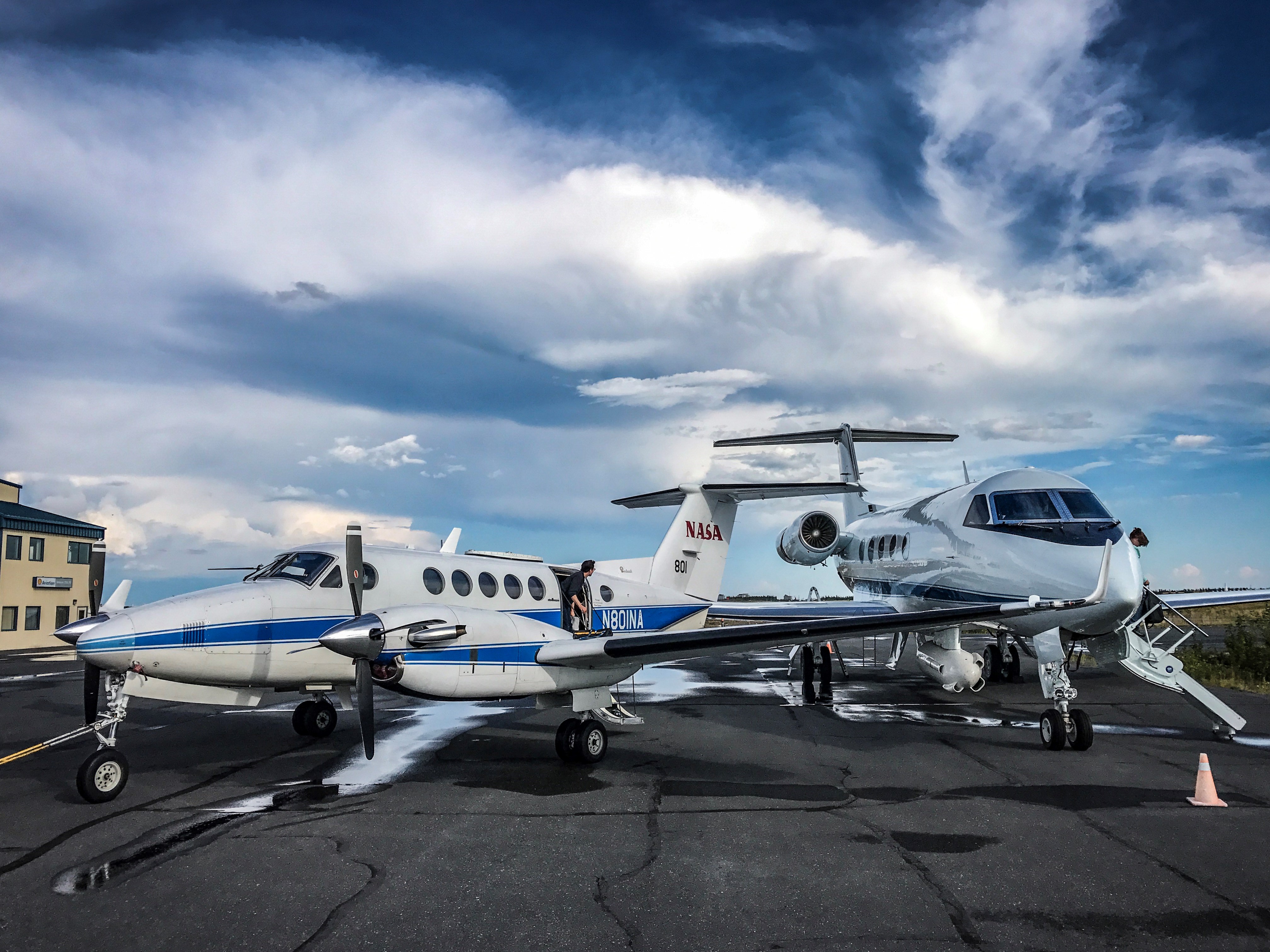
Photos from Scott Howe (NASA 801):NASA 801 and NASA 2 parked on the ramp in Yellowknife NT.
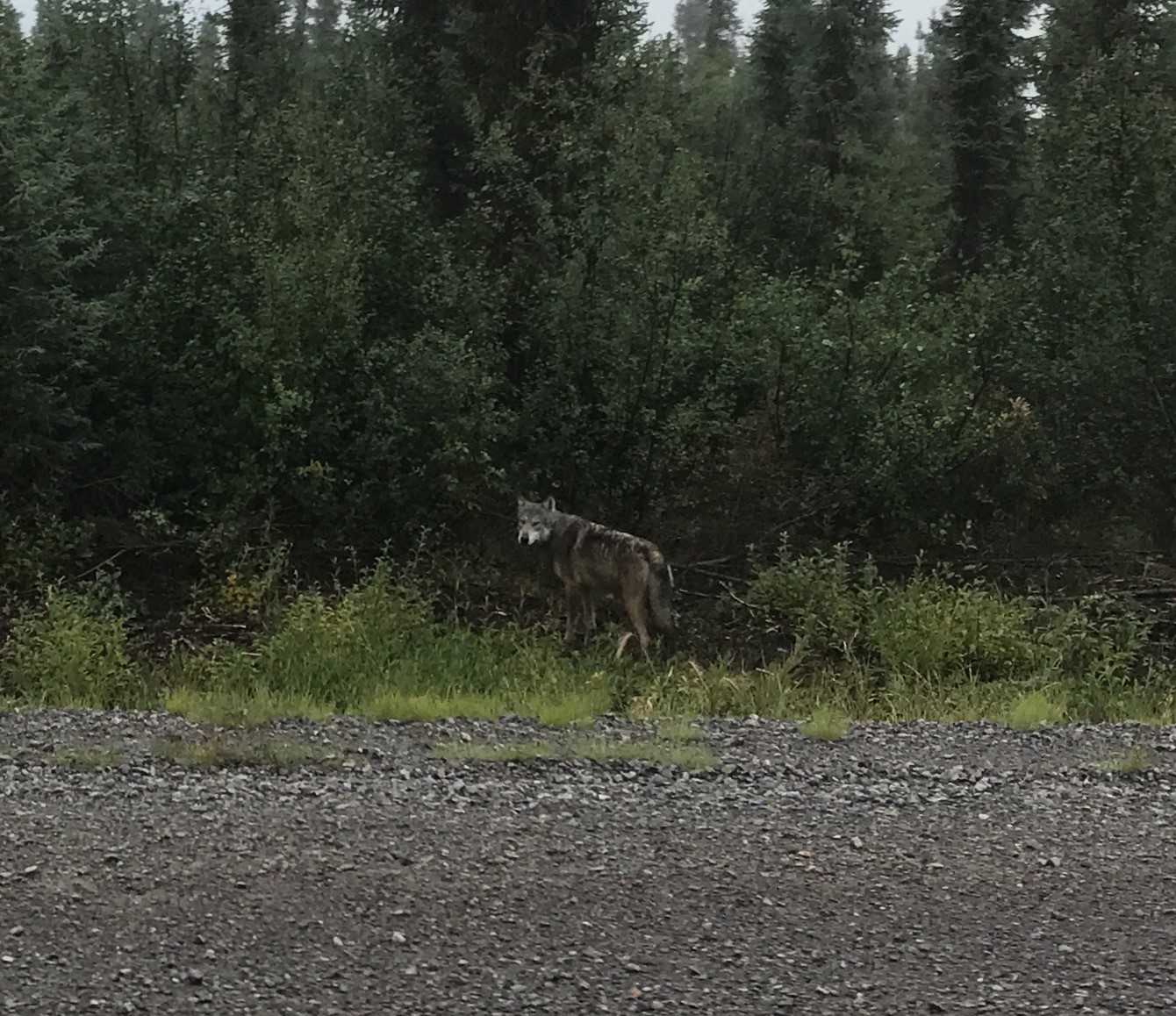
A wolf spotted while driving near Inuvik
20170810_1
20170810_2
Wednesday 9 Aug— AVIRIS-NG (Dynamic Aviation B-200 N53W) AIRSWOT (AFRC B-200 N801NA) ArctiC-C (Scientific Aviation Mooney N617DH) NEON Airborne Observing Platform (Twin Otter International N70AR)
-
Chip Miller is in Yellowknife Canada.
Peter Griffith is in Fairbanks.
9 August Wednesday
Sensor/Aircraft Location
P-band SAR (NASA G-III NASA2) Yellowknife NWT
AVIRIS-NG (Dynamic Aviation B-200 N53W) Yellowknife NWT
AirSWOT (NASA AFRC B-200 N801NA) Inuvik to Yellowknife NWT
ArctiC-C (Scientific Aviation Mooney N617DH) Grand Prairie AB
L-band SAR (NASA C-20 30502) Palmdale CA – will deploy after P-band flights completed, planned 2 Sept
NEON Airborne Observing Platform (Twin Otter International N70AR) no current report...
ABoVE flying over; awaiting preliminary data products
LVIS (Dynamic Aviation B-200T N44U)
CFIS (Twin Otter International DHC6 N331AR)
ASCENDS (NASA DC-8)
Weather & Science Operations Outlook
Day-1 Outlook
Valid 1500z 10 August through 2359z 10 August
Large aerosol optical depth values will be seen over much of western BC and between Lake Athabasca and Great Slave Lake. Smoke from Russian fires will blanket the northern portion of the state including Seward Peninsula with occasionally very large values of aerosol optical thickness especially near PASC and PABR. Clouds and rain will be present in and around PAFA for most of the period. Northern half of NWT and YKT will see clouds and rain by the end of the period. Most of the Mackenzie River area looks good south of Norman Wells including Yellowknife and vicinity. AB and SK will be partly to mostly cloudy with showers and thunderstorms likely in the northern half of those provinces. Cambridge Bay will be in and out of low clouds and rain.
Day-2 Outlook
Valid 1500z 11 August through 2359z 11 August
Smoke from Russian fires covers much of the western half of the state with moderate to occasionally large values of aerosol optical depth. Most of BC and southern portions of NWT and YKT will see moderate values of aerosol optical thickness. Clouds and heavy rain will overtake northwest AK early in the period leaving much of the state covered in clouds and rain by the end of the period. YKT and northeastern NWT will see scattered showers and thunderstorms becoming more widespread as the day progresses. Inuvik looks like it will be mostly clear. Yellowknife and Great Slave Lake look favorable. BC and all but eastern AB will be free of cloud and rain most of the period.
Day-3 Outlook
Valid 1500z 12 August through 2359z 12 August
Moderate to large values of aerosol optical thickness will be present in a wide band of smoke haze that stretches from southern BC up through NWT into Nunavut near Cambridge Bay. The western half of AK begins the period cloudy with bands of heavy rain. The cloudy and rainy conditions spread across the state by the end of the period with poor conditions present in and around the PAFA, PASC, and PABR areas. A frontal system approaches western BC bringing heavy rain to the coast. Clouds will be in and out of northern NWT and YKT. AB and southern NWT including Yellowknife, Great Slave Lake, and Lake Athabasca will have favorable mostly clear conditions.
Sensor/Aircraft Summaries
P-band SAR/JSC G-III (N992NA)
Wednesday 8/9: Great Slave Lake region. Flight hours: 6.5. All planned lines were acquired; last line of PLAN_1164 was flown with FMS because PPA couldn’t stay in tube. Lines flown were: lines 1-3, 4-6, 8-10 of PLAN_1164 and lines 1-2 of PLAN_1165. All lines required restarting/recycling PPA. This didn’t work for the last line despite 3 attempts. Field crews include Bourgeau-Chavez/French, Kasischke/Siqueira/Connon, Bill Quinton Crew at Scotty Creek
Thursday 8/10: no flight.
Friday: Transit Yellowknife (CYZF) to Fairbanks (PAFA), considering reflying Daring Lake, then to Fairbanks via Ft. Liard, Watson Lake, Wolf Creek, Kluane, Tok, Delta Junction; will need spectrum authorization for the Alaska part of the flight plan.
https://uavsar.jpl.nasa.gov/cgi-bin/report.pl?planID=PLAN_1165_v04#flightPlan (start with line 3 because lines 1-2 were flown today) AVIRIS-NG/N53W
Wednesday 8/9: : Flew lines up the Mackenzie Valley to Inuvik and Tuk Highway. Returned to Yellowknife after our teleconference.
Thursday: Follow the weather around Yellowknife.
AirSWOT/N801NA
Wednesday 8/9: AirSWOT delayed the takeoff time for WX and was able to complete the flight plane PAVE_0071 before landing in Yellowknife today. All the lines were collected without any issues. On board IR camera captured 1000+ pictures. Ground team also had a successful day yesterday.
8/10: No flight day
August 15-16th Peace-Athabaskan Delta ground team in place.
August 16-17 Saskatoon ground team in place.
NEON Airborne Observatory/N70AR
Near future plans: no current report. Stand by for updates.
ArctiC-C/N617DH
August campaign to start ~8/10 (weather dependent)
Attached Files
Katy Mersmann (NASA Office of Communications) interviews Meghan Taylor (postdoc at NAU) at the The Carbon in Permafrost Experimental Heating Research (CiPEHR) site near Eight Mile Lake. Yes, it really looks like this.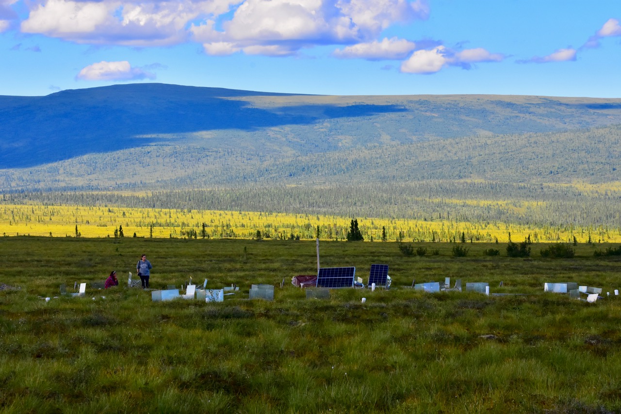
20170809
Mon 7 Aug— LVIS (Dynamic Aviation B-200T N44U) AVIRIS-NG (Dynamic Aviation B-200 N53W) CFIS (Twin Otter International DHC6 N331AR) AIRSWOT (AFRC B-200 N801NA) ArctiC-C (Scientific Aviation Mooney N617DH) NEON Airborne Observing Platform (Twin Otter International N70AR) ASCENDS (NASA DC-8)
-
Chip Miller is in Saskatoon Canada.
Peter Griffith is in Fairbanks.
7 August Monday
Sensor/Aircraft Location
P-band SAR (NASA G-III NASA2) Saskatoon to Yellowknife Canada
AVIRIS-NG (Dynamic Aviation B-200 N53W) Yellowknife NT
ASCENDS (NASA DC-8) Fairbanks to Palmdale
NEON Airborne Observing Platform (Twin Otter International N70AR) Fairbanks AK
AirSWOT (NASA AFRC B-200 N801NA) Inuvik NWT
ArctiC-C (Scientific Aviation Mooney N617DH) Grand Prairie AB
L-band SAR (NASA C-20 Nxxx) Palmdale CA — will deploy after P-band flights completed, planned 2 Sept
LVIS (Dynamic Aviation B-200T N44U) — ABoVE flying over; awaiting preliminary data products
CFIS (Twin Otter International DHC6 N331AR) — ABoVE flying over; awaiting preliminary data products
Weather & Science Operations Outlook
Day-1 Outlook
Valid 1500z 08 August through 2359z 08 August
Moderate to high values of aerosol optical thickness will be seen this period south and east of Great Slave Lake and through most of SK including Saskatoon. Much of southern BC is still an area with high values of aerosol optical thickness. Widely scattered showers and thunderstorms will be present in interior AK and along the northern parts of the state. Inuvik and the Mackenzie River Valley look clear early but quickly become cloudy and rainy as the day goes on. A line of showers and thunderstorms will stretch across southern SK near Saskatoon. Multiple layers of optically thin clouds are forecasted to stay just offshore of the panhandle of Alaska.
Day-2 Outlook
Valid 1500z 09 August through 2359z 09 August
Moderate to high values of aerosol optical thickness will be seen this period south and east of Great Slave Lake, in Southern Nunavut and northern MB. Much of southern BC is still an area with high values of aerosol optical thickness. Southwestern and northern Alaska will be under cloudy and rainy conditions most of the period. PAFA area eastward along with Whitehorse area look favorable. Great Slave Lake will be experiencing cloudy and rainy conditions with some improvement towards the end of the period. Inuvik is expected to be clear and rain free most of the period with some increasing cloudiness towards the end of the period.
Day-3 Outlook
Valid 1500z 10 August through 2359z 10 August
Moderate to high values of aerosol optical thickness will be seen this period along the north coast of Alaska, over Lake Athabasca stretching through the Hudson Bay northward. The western half of BC is an area with high values of aerosol optical thickness from south to north including portions of south eastern YKT. Moderate to heavy rain south of the Alaska Range pushes northward during the period and spreads over much of the southern half of the state. Far western Seward Peninsula remains mostly clear with clouds filling in near the end of the period. Clouds and rain will cover much of SK. Inuvik may be just to the south of a line of clouds and rain. Much of YKT and NWT will be rain free and partly cloudy during this period.
Sensor/Aircraft Summaries
P-band SAR/JSC G-III (N992NA)
Monday 8/7: Transit Ontario (ONT) — Saskatoon (CYXE); BERMS/Saskatoon area data collection
All planned lines were acquired (all 5 lines of plan 1163 and first 4 lines of plan 1162). One line had to be repeated due to possible PPA/nav problems (line was deviating from plan the first time but was nominal on second attempt). Cause is unknown.
Tuesday 8/8: transit Saskatoon to Yellowknife; takeoff: 1000 MDT; ETA Yellowknife 1430 MDT.
https://uavsar.jpl.nasa.gov/cgi-bin/report.pl?planID=PLAN_1162_v03#flightPlan (fly remaining 7 lines, lines 5-11; all lines in this version have been checked and corrected)
Crew: Ryan ("T-Rex"), Condon ("Trigger"), Tham ("Peachy"), Lee, Miller ("LAX"), Margolis ("Picard"), Brown, Gross(?), Austerberry (?), Hawkins (?)
8/9: Great Slave Lake Region (CYZF-CYZF) with media team from GNWT on board.
8/10: Contingency Day
8/11: Yellowknife (CYZF) — Fairbanks (PAFA)
AVIRIS-NG/N53W
Monday 8/7: Stayed on the ground most of the AM. However, weather cleared up west side of Great Slave Lake. Flew Mackenzie highway for a few lines just east of Yellowknife.
Tuesday 8/8: Ft. McMurray tomorrow for methane grid, will cover as much as possible and some lines for CFS and the fire disturbance group. Will have a discussion about it later with Chip.
WX looks clear to Ft. McMurray.
Wednesday: Inuvik area.
ASCENDS/NASA DC-8
Monday 8/7: Pack and prepare plane for transit back to Palmdale.
Tuesday 8/8: Spiral downs on Delta Junction and Whitehorse Yukon; coastal transit back to Palmdale. End of mission.
AirSWOT/N801NA
Monday 8/7: collected 5 Yukon Flat lines, 1 line transit from Yukon Flats to Old Crow, 3 lines over Old Crow and 1 line over Inuvik-Tuk Highway. Flight crew reported 50 % patch cloud coverage over YF, and sky clear over Old Crow & Inuvik area.
IR camera worked during the entire flight. KaSPAR had a minor recording issues during 2nd & 3rd lines over YF. Power cycle the system fixed the issue and there were no anomalies afterwards. Due to the time / fuel constraints, military exercises, flight crew weren’t able to repeat those two lines.
WX looks much better over Inuvik for Wednesday. There will be ground team over Inuvik area.
Tuesday 8/8: in position to maximize overlap with Inuvik ground team
NEON Airborne Observatory/N70AR
Near future plans:
Data collections in Delta Junction, Healy and CPCRW — location(s) to be determined by weather
ArctiC-C/N617DH
August campaign to start ~8/10 (weather dependent)
Attached Files
20170807_1
20170807_2
Sun 6 Aug— LVIS (Dynamic Aviation B-200T N44U) AVIRIS-NG (Dynamic Aviation B-200 N53W) CFIS (Twin Otter International DHC6 N331AR) AIRSWOT (AFRC B-200 N801NA) ArctiC-C (Scientific Aviation Mooney N617DH) NEON Airborne Observing Platform (Twin Otter International N70AR) ASCENDS (NASA DC-8)
-
Chip Miller is in Ontario CA.
Peter Griffith is in Fairbanks.
6 August Sunday
Sensor/Aircraft Location
AVIRIS-NG (Dynamic Aviation B-200 N53W) Yellowknife NT
ASCENDS (NASA DC-8) Fairbanks AK
NEON Airborne Observing Platform (Twin Otter International N70AR) Fairbanks AK
AirSWOT (NASA AFRC B-200 N801NA) Fairbanks AK
P-band SAR (NASA G-III N992NA) Ontario CA
ArctiC-C (Scientific Aviation Mooney N617DH) Grand Prairie AB
L-band SAR (NASA C-20 Nxxx) Palmdale CA — will deploy after P-band flights completed, planned 2 Sept
LVIS (Dynamic Aviation B-200T N44U) — ABoVE flying over; awaiting preliminary data products
CFIS (Twin Otter International DHC6 N331AR) — ABoVE flying over; awaiting preliminary data products
Weather & Science Operations Outlook
Day-1 Outlook
Valid 1500z 07 August through 2359z 07 August
Early in the period, a line of showers and thunderstorms stretch from near PAFA westward to near Kokrines and Galena and through to the Yukon Delta region. Seward Peninsula is cloudy early becoming partly cloudy later in the period. As the day progresses, low clouds and precipitation increase throughout the state. Inuvik, and Great Bear Lake look good throughout the period. Yellow knife begins the period partly cloudy but becomes clear later in the period. Mackenzie River area looks good for most of the period. Northern half of AB looks good. The areas with large values of aerosol optical thickness are out ahead of a frontal system stretching from the Hudson Bay south through Ontario and westward through the lower half of MM, SK, AB and especially the southern half of BC. In addition there are a few smaller areas like north of Lake Athabasca and the northern shores facing the Beaufort Sea where moderate values of aerosol optical thickness will be seen.
Day-2 Outlook
Valid 1500z 08 August through 2359z 08 August
A low pressure system just south of the Alaska Peninsula and the clouds and rain associated with it keep the southwest portion of the state fairly cloudy and rainy. The center section of the state sees clouds and rain approaching from the north with one frontal system, and clouds approaching from the southwest from another frontal system. A frontal system moves quickly across the southern Arctic Ocean and southern Beaufort Sea bringing with it clouds and rain across much of the northern third of Alaska. This same frontal system brings cloudy and rainy conditions to northern YKT and NWT. Although the Mackenzie River area looks clear early in the period, by the end of the period there will be clouds and scattered showers in the region. The frontal system stretching across the southern Canada and the northern US border drifts slowly to the south with showers and clouds covering southern AB and SK (including near Saskatoon). Large values of aerosol optical thickness continue to be present in the southern half of BC, southern portions of AB and SK. Some isolated patches of larger smoky hazy regions are seen near Great Slave Lake and Lake Athabasca.
Day-3 Outlook
Valid 1500z 09 August through 2359z 09 August
A ridge of high pressure extends northward through eastern Alaska keeping PAFA and Yukon Flats region looking favorable for flying. While Seward Peninsula should remain rain free, there will be low and middle clouds present during this period. Bethel and Yukon Delta region do not look favorable. A small but intense low pressure system in the Arctic Ocean will keep conditions poor near PABR and PASC for this period. Depending on the timing, Mackenzie River flights might work. Great Bear Lake is partly cloudy with showers early becoming clear as the period goes on. That area of clouds and rain moves south to Yellow Knife where conditions start out clear but deteriorate through the period. Whitehorse, Inuvik, and Old Crow all look good through this period. Moderate smoke haze will be seen in the Barrow region as smoke from Russian fires is advected into this region. Changing wind directions have spread large values of aerosol optical thickness through more of northern parts BC which had previously not seen much smoke. The southern two thirds of BC continues to show high values of aerosol optical thickness. An area stretching from northern Lake Winnipeg up to western Hudson Bay just south of Great Slave Lake and through northern SK and southern AB shows moderate values of aerosol optical thickness.
Sensor/Aircraft Summaries
AVIRIS-NG/N53W
Sun 8/6: Yellowknife direct to Norman Wells, flew south down the Mackenzie Valley to Fort Simpson then back to Yellowknife Satellite and AVCAM images suggest exceptionally clear skies
Near future plans:
7-9 Aug: Great Slave Lake region, Daring Lake, Scotty Creek & McKenzie Valley as weather allows
ASCENDS/NASA DC-8
Sun 8/6: Alaska Flight
Fairbanks — Fort Yukon — Kotzebue — Unalakleet — Platinum — McGrath — Fort Yukon — Fairbanks
Near future plans:
Mon 8/7: Pack and prepare plane for transit back to Plamdale
Tues 8/8: Alaska area targets and transit back to Palmdale
AirSWOT/N801NA
Sun 8/6: Yukon Flats
Ran all of the mapping lines near Fort Yukon for the Smith-Pavelsky project
Near future plans:
· Mon 8/7 — AM transit to Inuvik with data collection @ Old Crow Flats
· Tues 8/8 — in position to maximize overlap with Inuvki ground team
NEON Airborne Observatory/N70AR
TBC
Near future plans:
Data collections in Delta Junction, Healy and CPCRW — location(s) to be determined by weather
No other ABoVE or partner planes currently operating
ArctiC-C/N617DH
August campaign to start ~8/10 (weather dependent)
P-band SAR/JSC G-III (N992NA)
Sun 8/6: Plane staged to Ontario CA; flight crew, Margolis and Miller ready for Mon 8/7 departure for Saskatoon
Near-term schedule
8/7: Transit Ontario (ONT) — Saskatoon (CYXE); BERMS/Saskatoon area data collection
8/8: Saskatoon (CYXE) — Yellowknife (CYZF)
8/9: Great Slave Lake Region (CYZF-CYZF)
8/10: Contingecy Day
8/11: Yellowknife (CYZF) — Fairbanks (PAFA)
Sat 5 Aug— LVIS (Dynamic Aviation B-200T N44U) AVIRIS-NG (Dynamic Aviation B-200 N53W) CFIS (Twin Otter International DHC6 N331AR) AIRSWOT (AFRC B-200 N801NA) ArctiC-C (Scientific Aviation Mooney N617DH) NEON Airborne Observing Platform (Twin Otter International N70AR) ASCENDS (NASA DC-8)
-
Chip Miller is in Fairbanks.
Peter Griffith is in Fairbanks.
5 August Saturday
Sensor/Aircraft Location
AVIRIS-NG (Dynamic Aviation B-200 N53W) Yellowknife NT
ASCENDS (NASA DC-8) Fairbanks AK
NEON Airborne Observing Platform (Twin Otter International N70AR) Fairbanks AK
AirSWOT (NASA AFRC B-200 N801NA) Fairbanks AK
ArctiC-C (Scientific Aviation Mooney N617DH) Grand Prairie AB
P-band SAR (NASA G-III Nxxx) Houtson TX — Preparing for resumption of ABoVE science operations on 7 Aug
L-band SAR (NASA C-20 Nxxx) Palmdale CA — will deploy after P-band flights completed, planned 2 Sept
LVIS (Dynamic Aviation B-200T N44U) — ABoVE flying over; awaiting preliminary data products
CFIS (Twin Otter International DHC6 N331AR) — ABoVE flying over; awaiting preliminary data products
Weather & Science Operations Outlook
Day-1 Outlook
Valid 1500z 06 August through 2359z 06 August
The low pressure system near Cambridge Bay stays in place while the associated cold front brings clouds and precipitation southward through northern BC, AB, SK and MB. Clouds and rain from another frontal system approach Alaska and YKT from north. Low clouds will be present along the north coast from PABR to PASC. What starts out as a mostly clear day in terms of low cloud optical thickness, becomes mostly cloudy during the end of the period. Seward Peninsula and Yukon Flats both start out mostly cloud free early but become cloudy by the end of the period. A low pressure system south of the Alaska peninsula is pushing a band of clouds and precipitation northward over the Alaska range overspreading the southern 1/3 of Alaska. North McKenzie River Valley including Great Bear Lake looks partly cloudy becoming clear. Great Slave Lake and Yellow Knife are cloudy early becoming partly cloudy by end of period.
Areas of most troublesome aerosol optical depth continue to be southern 1/2 of BC and the air just ahead of the frontal system near Cambridge Bay and over the Hudson Bay.
Day-2 Outlook
Valid 1500z 07 August through 2359z 07 August
The low pressure system in north central Canada is now centered near northern Hudson Bay. The clouds and rain associated with this system stretch south across the Hudson Bay through southern sections of AB, SK, and central MB. Behind the front, high pressure builds in bringing mostly clean air, and fewer clouds to the northern YKT and most of NWT including McKenzie River and vicinity of Great Bear Lake and Yellow Knife. Northern portions of AB, SKT, and northwest MB will also see fairly clean and cloud free conditions. There may be a small window of opportunity early for the western Seward Peninsula as clouds from two separate frontal systems approach from the northwest and from the southeast. The questions are 1) Can the flight take place below the middle deck of clouds? and 2) Will the approaching systems allow enough time for a meaningful flight?
Locations of the largest aerosol optical thickness continue to be the southern 2/3 of BC and the air just ahead of the frontal system sweeping through southern Canada.
Day-3 Outlook
Valid 1500z 08 August through 2359z 08 August
A high pressure system is centered over SK keeping conditions over most of AB and SKT fairly clean and cloud free. Southern portions of McKenzie River look good especially near Great Slave Lake. Great Bear Lake will start the period cloudy and be in and out of clouds and rain in the period. There may be a window for flying over Yukon Flats which is partly cloudy early, then mostly clear for the middle of the period, becoming cloudy at the end of the period. At this time, Seward Peninsula is forecast to be cloudy and rainy through the period. Locations of the largest aerosol optical thickness continue to be the southern 2/3 of BC and southwestern AB along with portions of southern NWT and northern SK in the area south and east of Lake Athabasca and Great Slave Lake.
Sensor/Aircraft Summaries
AVIRIS-NG/N53W
Sat 8/5: Down Day/200-hour Maintenance
Near future plans:
6-9 Aug: Great Slave Lake region, Daring Lake, Scotty Creek & McKenzie Valley as weather allows
ASCENDS/NASA DC-8
Sat 8/6: Alaska Flight
Fairbanks — Nome — McGrath — St Mary´ s — Bethel — Fairbanks
Excellent flight, very clear over Nome, increasing clouds throughout the day
Spiral at Platinum cancelled due to dense cloud cover — rerouted to Bethel
Permission gained for profile over Fairbanks during return to PAFA
Visit from Dr Diane Wickland, former TE Program Manager and early nurturer of ABoVE & ASCENDS
Near future plans:
Sun 8/6: Alaska opportunities
Mon 8/7: Pack and prepare plane for transit back to Plamdale
Tues 8/8: Alaska area targets and transit back to Palmdale
AirSWOT/N801NA
Sat 8/5 — hard down day
Near future plans:
· Sun 8/6 — AM flight to Yukon Flats
· Mon 8/7 — AM transit to Inuvik with data collection @ Old Crow Flats
· Tues 8/8 — in position to maximize overlap with Inuvki ground team
NEON Airborne Observatory/N70AR
Sat 8/5: Flight to Caribou-Poker Creek Research Watershed (CPCRW)
Excellent conditions, both lidar and imaging spectroscopy data acquired
Near future plans:
Data collections in Delta Junction, Healy and CPCRW — location(s) to be determined by weather
Education & Public Outreach
Katy Mersmann (GSFC) arrived to coordinate social media
Fri 8/4: Snapchat postings about ABoVE, ASCENDS and the permafrost carbon feedback [expired after 24 hour limit, but mirrored to NASA site]
More than 175,000 hits as of 1600 AKDT 8/5
Sat 8/5: FaceBook Live event with P Griffith, J Abshire and C Miller during DC8 preflight activities (~0730 AKDT/1130 EDT)
More than 65,000 hits as of 1600 AKDT 8/5
No other ABoVE or partner planes currently operating
ArctiC-C/N617DH
August campaign to start ~8/10 (weather dependent)
P-band SAR/JSC G-III (N992NA)
Sat 8/5: 4 hour test flight over Sierra Nevada Mountains successfully completed. All planned lines acquired
Near-term schedule
Sun 8/6: Transit Palmdale (KMPD) — Ontario (ONT)
8/7: Transit Ontario (ONT) — Saskatoon (CYXE); BERMS/Saskatoon area data collection
8/8: Saskatoon (CYXE) — Yellowknife (CYZF)
8/9: Great Slave Lake Region (CYZF-CYZF)
8/10: Contingecy Day
8/11: Yellowknife (CYZF) — Fairbanks (PAFA)
Fri 4 Aug— LVIS (Dynamic Aviation B-200T N44U) AVIRIS-NG (Dynamic Aviation B-200 N53W) CFIS (Twin Otter International DHC6 N331AR) AIRSWOT (AFRC B-200 N801NA) ArctiC-C (Scientific Aviation Mooney N617DH) NEON Airborne Observing Platform (Twin Otter International N70AR) ASCENDS (NASA DC-8)
-
Chip Miller is in Fairbanks.
Peter Griffith is traveling to Fairbanks.
4 August Friday
Sensor/Aircraft Location
AVIRIS-NG (Dynamic Aviation B-200 N53W) Yellowknife NT
ASCENDS (NASA DC-8) Fairbanks AK
NEON Airborne Observing Platform (Twin Otter International N70AR) Fairbanks AK
AirSWOT (NASA AFRC B-200 N801NA) Fairbanks AK
ArctiC-C (Scientific Aviation Mooney N617DH) Grand Prairie AB
P-band SAR (NASA G-III Nxxx) Houtson TX — Preparing for resumption of ABoVE science operations on 7 Aug
L-band SAR (NASA C-20 Nxxx) Palmdale CA — will deploy after P-band flights completed, planned 2 Sept deployment
LVIS (Dynamic Aviation B-200T N44U) — ABoVE flying over; awaiting preliminary data products
CFIS (Twin Otter International DHC6 N331AR) — ABoVE flying over; awaiting preliminary data products
Weather & Science Operations Outlook
1500z 05 August through 2359z 05 August
On Saturday there will be three low pressure centers that will affect some parts of the mission region. One will be located over the Beaufort Sea which will have a band of frontal clouds and precipitation extending from it sweeping down into northwest Alaska, but this will be confined to the northwest corner of Alaska
(west of 150W and north of 65N). Another low will be found spinning off the central Aleutian Islands that will affect mainly the far southwest mainland and Aleutians. The third low will be found over western Nunavut, with a trailing frontal band of thick cloud cover and heavy precipitation bisecting the NWT roughly aligned with Great Slave Lake. Any major smoke restrictions will be confined on Saturday to the far southeast corner of the NWT and over southern BC. Light, to at times, moderate smoke haze may be seen over much of SK. A few isolated fires are seen just northwest of Bear Lake.
On Saturday, much of Alaska between 60-65N should see only scattered to broken high clouds with clear below. The far northeast corner (including PASC) should still be clear out ahead of the advancing cloud cover from the frontal system sweeping northwest Alaska.
Most of the YKT looks clear and on into the Inuvik area. Clouds become more prominent further east into the NWT associated with the third low pressure system listed above.
The Seward Peninsula appears to have scattered to broken low clouds.. and broken to overcast high clouds Saturday.
1500z 06 August through 2359z 06 August
* Sunday could be one of the clearest days of the mission area-wide according to recent runs of the GEOS model *
Over the north slope there could be scattered to broken deck of low clouds. The remainder of Alaska is looking remarkably cloud-free on Sunday.
The Seward Peninsula looks mainly clear through the day (just a few scattered high clouds central Seward Pen.). A small band of clouds and light showers may pop up in the late day over the terrain of the Arctic National Wildlife Refuge.
Most of the NWT from the Great Slave Lake on northward looks mainly clear. The YKT looks mainly clear. Localized moderate smoke haze near Ft. McPherson NWT, moderate to high smoke optical depths in and around the Athabasca Lake region. No other smoke restrictions for Sunday (keep away from southern BC!)
1500z 07 August through 2359z 07 August
The Seward Peninsula continues to look clear to partly cloudy on Monday.
The North Slope looks generally clear except for right along and just offshore the Arctic coastline.
A weak pressure pattern will keep most of Alaska settled with some diurnally driven showers and storms over interior and western mainland Alaska.
High pressure continues to keep things mainly sunny and clear over western Canada.
Sensor/Aircraft Summaries
AVIRIS-NG/N53W
Wed 8/2: Inuvik — Cambridge Bay
AM — transit
PM — data collection over the CHARS ERA
Thurs 8/3: Cambridge Bay / CHARS Experimental Research Area (ERA) watershed
AM & PM sorties over CHARS ERA
AM sortie cut short by problem with the instrument door that blocked part of its field of view. Landed and fixed door.
Fri 8/4: Cambridge Bay — Yellowknife transit;
Near future plans:
Sat 8/5: Down Day/200-hour Maintenance
6-9 Aug: Great Slave Lake region, Daring Lake, Scotty Creek & McKenzie Valley as weather allows
ASCENDS/NASA DC-8
Wed 8/2 — PAFA — Deadhorse — Inuvik — over land — Cambridge Bay — over ocean — Inuvik or Deadhorse — Fairbanks From Jim Abshire
We conducted another science flight on Wed 8/2, based out of Fairbanks AK. The takeoff time was 4:46 pm local and the flight duration was 6.6 hours.
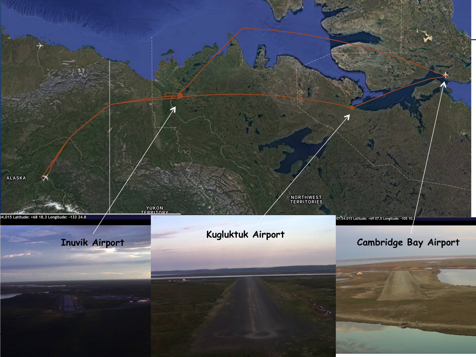
Given the weather conditions, this flight also targeted a northern loop in NWT. The flight went from Fairbanks to Inuvik, then east, then back north along Arctic Ocean, back to Inuvik then back to Fairbanks. We again used spiral-down maneuvers and missed approaches to allow comparing the lidar measurements of XCO2 against the in-situ measured CO2. We conducted those along the way in NWT above the airports at Inuvik NWT, Kugluktuk NWT , Cambridge Bay NU, and Inuvik again, and then return west and south Fairbanks.
I’ve attached an image showing our flight track and screen snaps from the forward camera of the DC-8 made as we approached each airport. No markings are on the Kugluktuk or Cambridge Bay “airports” because they are gravel-covered landing strips. No reports of wildlife for this one, although a few people were out watching our missed approach at Cambridge Bay.
The flight went well and was flown as planned. The majority (perhaps 65 %) of the flight was good for lidar measurements, and those included all four spiral down locations. As predicted, the path from Fairbanks to Inuvik was quite cloudy on the way to Inuvik and mostly cloudy to broken clouds on the return. As before we had some outages due to thick cirrus at altitude. Again the cloud structure were complex near the Arctic Ocean, and there were segments of broken cumulus that will provide opportunities for cloud slicing. Data from the in-situ sensors showed most structures in the vertical distribution of CO2 in most spiral downs. All instruments reported working well. Both the CO2 Sounder and ACES lidar reported good signals to the land and ocean surfaces when the surface was visible from the aircraft.
Thurs 8/3: Fairbanks — Yellowknife — Daring Lake — Baker Lake R/T
CANCELLED due to excessive cloud cover
Fri 8/4: No-fly Day
Near future plans:
5-6 Aug (Sat — Sun) — Alaska opportunities
Mon 8/7: Pack and prepare plane for transit back to Plamdale
Tues 8/8: Alaska area targets and transit back to Palmdale
AirSWOT/N801NA
NASA 801 arrived back in Fairbanks @ 1300 AKDT to resume science operations
Near future plans:
· Sat 8/5 — hard down day
· Sun 8/6 — AM flight to Yukon Flats
· Mon 8/7 — AM transit to Inuvik with data collection @ Old Crow Flats
· Tues 8/8 — in position to maximize overlap with Inuvki ground team
NEON Airborne Observatory/N70AR
8/4 — Flight to Healy box for baseline lidar acquisition; too many clouds for useful imaging spectroscopy
8/3 — poor weather, no flights
8/2 — light rain — no flights
Near future plans:
Data collections Saturday and Sunday — locations to be determined by weather
Education & Public Outreach
Katy Mersmann (GSFC) arrived to coordinate social media
Fri 8/4: Snapchat postings about ABoVE, ASCENDS and the permafrost carbon feedback (online for the next 24 hours only)
Sat 8/5: FaceBook Live event planned during DC8 preflight activities (~0730 AKDT/1130 EDT)
No other ABoVE or partner planes currently operating
ArcticC/N617DH
Decided to resume ABoVE flight operations ~10 August as previously scheduled to extend nearly constant
temporal coverage from campaign #3 to ASCENDS/DC-8 flights to Campaign #4 and better capture the transition from peak productivity/C uptake into senescence and the dominance of respiration signals
P-band SAR/JSC G-III (N992NA)
Beginning integration & test for a scheduled 8/7 departure from ONT for Saskatoon/BERMS area
Near-term schedule
8/8: Saskatoon — Yellowknife (CYZF)
8/9: Great Slave Lake Region (CYZF-CYZF)
8/10: Contingecy Day
8/11: Yellowknife (CYZF) — Fairbanks (PAFA)
Attached Files
20170804_1
20170804_2
Tues 2 Aug — LVIS (Dynamic Aviation B-200T N44U) AVIRIS-NG (Dynamic Aviation B-200 N53W) CFIS (Twin Otter International DHC6 N331AR) AIRSWOT (AFRC B-200 N801NA) ArctiC-C (Scientific Aviation Mooney N617DH) NEON Airborne Observing Platform (Twin Otter International N70AR) ASCENDS (NASA DC-8)
-
2 Aug Tuesday
Nearly midnight (again) by the time the ASCENDS flight returned to PAFA, so here is a short report — usu details later today/tonight
ASCENDS — good flight to Inuvik — Cambridge Bay NU.
Dense cloud cover over Beaufort Sea forced early deviation back over land
Partly to mostly cloudy conditions
Plan for Thurs 3AUG: Baker Lake NU — Yellowknife NT
Takeoff 1600 AKDT
Fri = no fly day
Sat/Sun = Interior Alaska and YK Delta opportunities appearing in the forecasts
Mon = pack
Tues = Return to Palmdale
NEON — No flight Wed 8/2 due to rain
AirSWOT/NASA 801
Tues 8/2 — Ka–band SAR passed calibration tests
On schedule to return to Fairbanks on Fri 8/4, resume science ops Sat 8/5
P-band SAR/NASA G-III
On schedule for 8/6 departure from ONT to Saskatoo
Peter Griffith will arrive in Fairbanks on Fri 8/4
Mon 31 July &Tues 1 Aug— LVIS (Dynamic Aviation B-200T N44U) AVIRIS-NG (Dynamic Aviation B-200 N53W) CFIS (Twin Otter International DHC6 N331AR) AIRSWOT (AFRC B-200 N801NA) ArctiC-C (Scientific Aviation Mooney N617DH) NEON Airborne Observing Platform (Twin Otter International N70AR) ASCENDS (NASA DC-8)
-
Chip Miller is in Fairbanks.
Peter Griffith is in Baltimore.
31 July Monday & 1 August Tuesday
Sensor/Aircraft Location
AVIRIS-NG (Dynamic Aviation B-200 N53W) Inuvik NT
ASCENDS (NASA DC-8) Fairbanks AK
NEON Airborne Observing Platform (Twin Otter International N70AR) Fairbanks AK
AirSWOT (NASA AFRC B-200 N801NA) Palmdale, CA
ArctiC-C (Scientific Aviation Mooney N617DH) Grand Prairie AB
P-band SAR (NASA G-III Nxxx) Houtson TX — Preparing for resumption of ABoVE science operations on 7 Aug
L-band SAR (NASA C-20 Nxxx) Palmdale CA — will deploy after P-band flights completed, planned 2 Sept deployment
LVIS (Dynamic Aviation B-200T N44U) — ABoVE flying over; awaiting preliminary data products
CFIS (Twin Otter International DHC6 N331AR) — ABoVE flying over; awaiting preliminary data products
Weather & Science Operations Outlook
1500z 01 August through 2359z 01 August
Precipitation continues over most of AK through this day, associated with a frontal system moving eastward.
Additional precipitation develops over central YKT and western NWT in the afternoon.
Sporadic low clouds will be present over south-east AK in the morning, with cloud covered areas increasing in the afternoon.
Possible targets could also be found over the northern portions of the NWT and from the Great Bear Lake and Great Slave Lake to Fort Simpson and Fort Liard until mid-afternoon. Additionally, the immediate vicinity of the Daring Lake will be cloud-free through this period.
1500z 02 August through 2359z 02 August
No improvement in the weather conditions over most of AK is seen through this forecast, as heavy precipitation continues. The mission targets over AK will be overcast through this forecast.
Possible options for flying can be found over the YKT and most of the NWT in the morning.
Sensor/Aircraft Summaries
AVIRIS-NG/N53W
Mon 7/31 & Tues 8/1: Inuvik / Mackenzie Delta
Took advantage of clear skies in the afternoons both days to complete the mapping of the Delta. On-board real-time quick-look processing revealed widespread CH4 emissions, consistent with previous airborne studies
flight lines from all 3 sorties attached
Near future plans:
Wed 8/2: Inuvik — Cambridge Bay
Thurs 8/3: Cambridge Bay / CHARS Experimental Research Area (ERA) watershed
Fri 8/4: Cambridge Bay — Yellowknife transit; Great Slave Lake Region sortie
Sat 8/5: Down Day/200-hour Maintenance
ASCENDS/NASA DC-8
Mon 7/31: Mackenzie Valley survey
Fairbanks — Deadhorse (spiral) — Inuvik (spiral) — Norman Wells (spiral) — Fort Simpson (spiral) — Yellowknife (spiral) — Inuvik (spiral) — Deadhorse — Fairbanks
From J Abshire:
Given the weather conditions, this flight targeted the NWT loop that we had previously planned. This went from Fairbanks to Inuvik, then primarily south, east, then back north along the Mackenzie River, then out of the Arctic Ocean, over Deadhorse AK, then back to Fairbanks. We used six spiral-down maneuvers to allow comparing the lidar measurements of XCO2 against the in-situ measured CO2. We conducted those along the way in NWT above the airports at Inuvik, Norman Wells, Fort Simpson, Yellowknife, and Inuvik again, and then over Deadhorse AK before the return route south to Fairbanks.
The flight went well and was flown almost exactly as planned. The majority (perhaps 70%) of the flight was good for lidar measurements, and those included all the spiral down locations. The segment from Norman Wells to Fort Simpson was somewhat hazy. We did have some outages due to thick cirrus at aircraft altitude approaching Inuvik and on the return leg from Inuvik over the Arctic ocean to Deadhorse. Although the cloud structure were complex (especially approaching Inuvik, and north of it), there were some segments along the way with fields of broken cumulus that will provide opportunities for cloud slicing. Wildlife sightings during the missed approaches included a black bear and cranes at Norman Wells and two moose on a road at Deadhorse.
As-flown lines attached
Tues 8/1 — Down Day
Near future plans:
Wed 8/2 — PAFA — Deadhorse — Inuvik — over land — Cambridge Bay — over ocean — Inuvik or Deadhorse — Fairbanks
Thurs 8/3: Fairbanks — Yellowknife — Daring Lake
Fri 8/4: Down Day
5-6 Aug (Sat — Sun) — Alaska opportunities
Mon 8/7: Pack and prepare plane for transit back to Plamdale
Tues 8/8: Alaska area targets and transit back to Palmdale
NEON Airborne Observatory/N70AR
Sun 7/30: The DEJU site was flown under cloudy conditions to collect initial coverage data. Lines 7-29
collected. DEJU was the priority site for today as it is projected that GPS jamming from military training exercises will affect the area the rest of the week.
Mon 7/31: Initial collect was attempted at Caribou Creek, but low clouds were causing laser eye-safety shutoffs. Crew diverted to Healy and collected 20 lines under red conditions.
No other ABoVE or partner planes currently operating
AirSWOT/N801NA
NASA 801 scheduled to return to Fairbanks by 4 August for the resumption of AirSWOT flight operations on 8/5
ArcticC/N617DH
Decided to resume ABoVE flight operations ~10 August as previously scheduled to extend nearly constant temporal coverage from campaign #3 to ASCENDS/DC-8 flights to Campaign #4 and better capture the transition from peak productivity/C uptake into senescence and the dominance of respiration signals
P-band SAR/JSC G-III (N992NA)
Beginning integration & test for a scheduled 8/7 departure from ONT for Saskatoon/BERMS area
Near-term schedule
8/8: Saskatoon — Yellowknife (CYZF)
8/9: Great Slave Lake Region (CYZF-CYZF)
8/10: Contingecy Day
8/11: Yellowknife (CYZF) — Fairbanks (PAFA)
Attached Files
fig.1 aviris 2017-07-31 large mac deltafig.2 avng sortie #1 large
fig.3 avng sortie 2
fig.4 ASCENDS as-flown lines — 2017-07-31
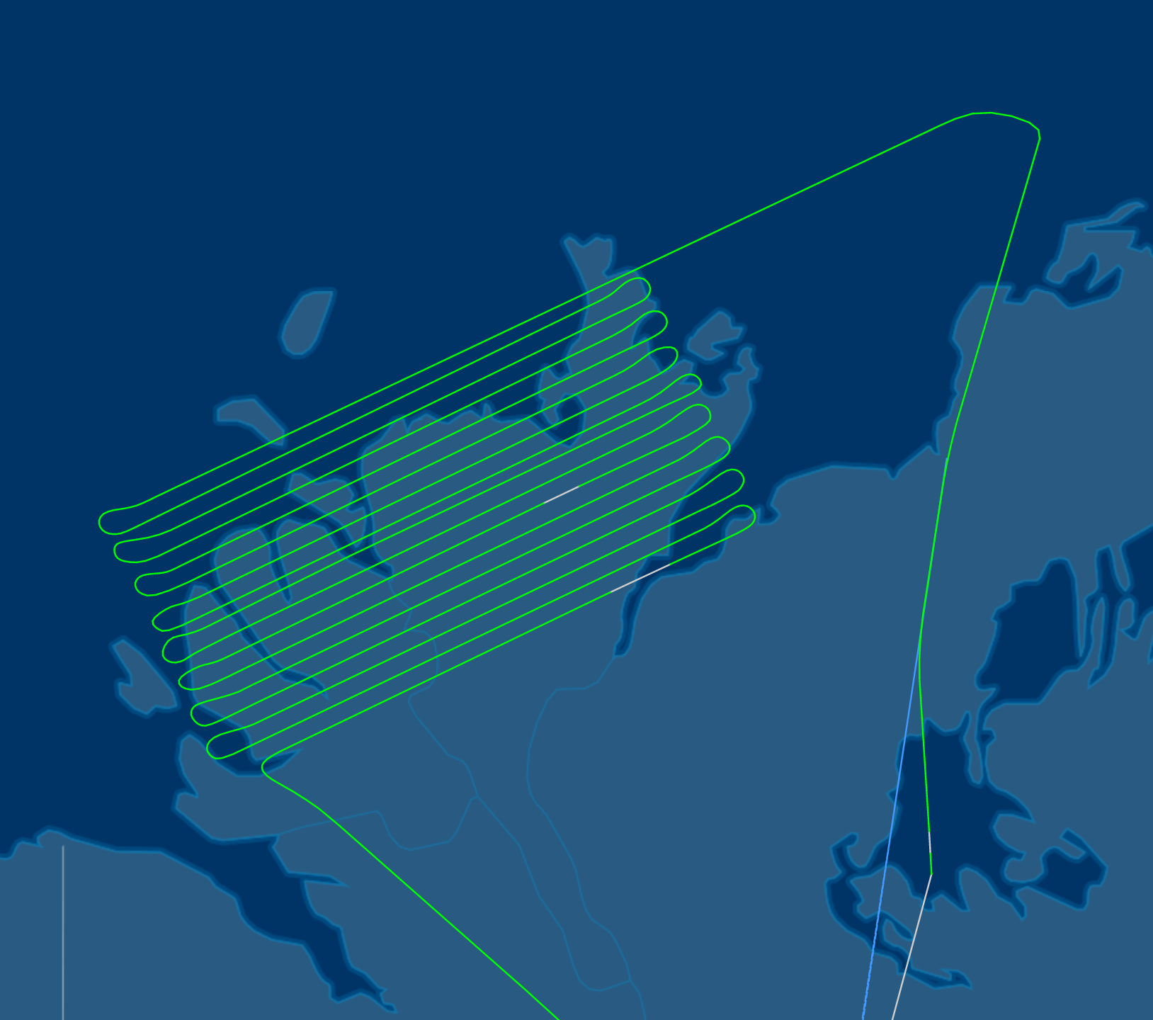
20170731_1
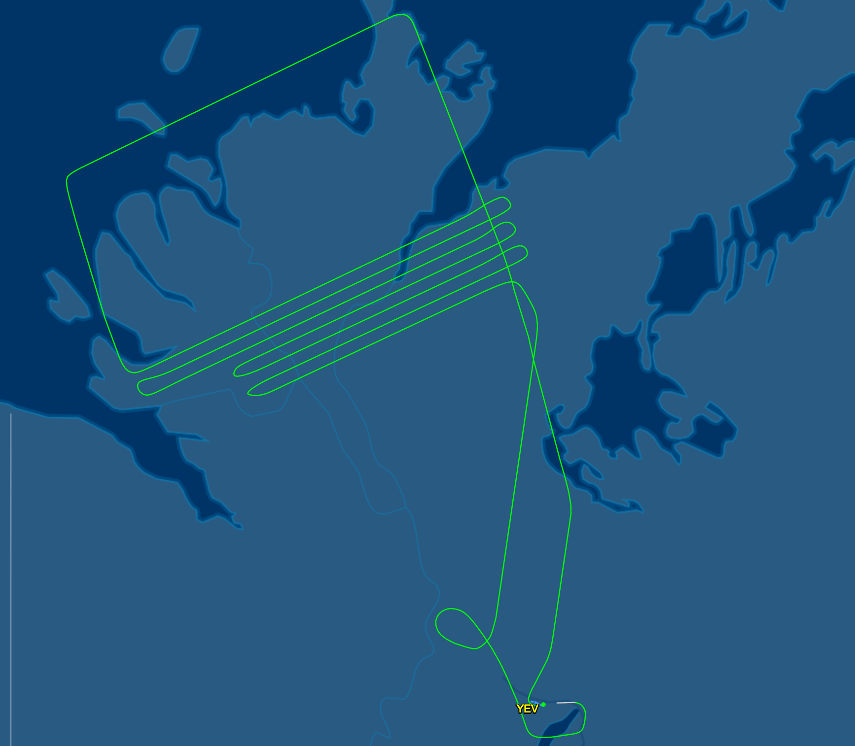
20170731_2

20170731_3

20170731_4
Sun 30 July— LVIS (Dynamic Aviation B-200T N44U) AVIRIS-NG (Dynamic Aviation B-200 N53W) CFIS (Twin Otter International DHC6 N331AR) AIRSWOT (AFRC B-200 N801NA) ArctiC-C (Scientific Aviation Mooney N617DH) NEON Airborne Observing Platform (Twin Otter International N70AR) ASCENDS (NASA DC-8)
-
Chip Miller is in Fairbanks.
Peter Griffith is in Baltimore.
30 July Sunday
Sensor/Aircraft Location
AVIRIS-NG (Dynamic Aviation B-200 N53W) Inuvik NT
ASCENDS (NASA DC-8) Fairbanks AK
NEON Airborne Observing Platform (Twin Otter International N70AR) Fairbanks AK
AirSWOT (NASA AFRC B-200 N801NA) Palmdale, CA
ArctiC-C (Scientific Aviation Mooney N617DH) Grand Prairie AB
P-band SAR (NASA G-III Nxxx) Houtson TX — Preparing for resumption of ABoVE science operations on 7 Aug
L-band SAR (NASA C-20 Nxxx) Palmdale CA — will deploy after P-band flights completed, planned 2 Sept deployment
LVIS (Dynamic Aviation B-200T N44U) — ABoVE flying over; awaiting preliminary data products
CFIS (Twin Otter International DHC6 N331AR) — ABoVE flying over; awaiting preliminary data products
Weather & Science Operations Outlook
1500z 31 July through 2359z 31 July
A frontal system begins to make its way through western AK, bringing heavy precipitation through most of the mission targets. The mission targets over AK will continue to mostly be under cloudy conditions through this forecast
Cloud free targets can be found between Inuvik to Norman Wells to the Great Bear Lake, with some sporadic clouds present. Areas between the Great Bear Lake, Great Slave Lake, and Daring Lake could also be possible targets in the morning.
1500z 01 August through 2359z 01 August
Precipitation continues over most of AK through this day, associated with a frontal system moving eastward.
Additional precipitation develops over central YKT and western NWT in the afternoon.
Sporadic low clouds will be present over south-east AK in the morning, with cloud covered areas increasing in the afternoon.
Possible targets could also be found over the northern portions of the NWT and from the Great Bear Lake and Great Slave Lake to Fort Simpson and Fort Liard until mid-afternoon. Additionally, the immediate vicinity of the Daring Lake will be cloud-free through this period.
1500z 02 August through 2359z 02 August
No improvement in the weather conditions over most of AK is seen through this forecast, as heavy precipitation continues. The mission targets over AK will be overcast through this forecast.
Possible options for flying can be found over the YKT and most of the NWT in the morning.
Sensor/Aircraft Summaries
AVIRIS-NG/N53W
Sun 7/30:
Plane returned to science operations capability. Transit Kenai — Fairbanks — Inuvik to be set for ideal conditions over Inuvik and the Mackenzie Delta on Monday 7/31
Upcoming plans
Mon 7/31: Inuvik / Mackenzie Delta
Tues 8/1: Inuvik — Norman Wells — Fort Simpson — Scotty Creek — Yellowknife
Wed 8/2: Yellowknife — Daring Lake — Cambridge Bay
Thurs 8/1: Cambridge Bay / CHARS Experimental Research Area (ERA) watershed
ASCENDS/NASA DC-8
Sun 7/30: Down Day
Mon 7/31: Mackenzie Valley survey — late afternoon take off (~1700)
Fairbanks — Deadhorse (spiral) — Inuvik (spiral) — Norman Wells (spiral) — Fort Simpson (spiral) — Yellowknife (spiral) — Inuvik (spiral) — Deadhorse — Fairbanks
Est 9 flight hours
Tues 8/1 — Down Day
Wed 8/2 — Cambridge Bay
PAFA — Deadhorse — Inuvik — over land — Cambridge Bay — over ocean — Inuvik or Deadhorse — Fairbanks
Thurs 8/3 down day
4-6 Aug (Fri — Sun) — Alaska opportunities
Mon 8/7: Pack and prepare plane for transit back to Plamdale
Tues 8/8: Alaska area targets and transit back to Palmdale
NEON Airborne Observatory/N70AR
Sun 7/30: Delta Junction flight
No other ABoVE or partner planes currently operating
AirSWOT/N801NA
NASA 801 scheduled to return to Fairbanks by 2 August for the resumption of AirSWOT flight operations
ArcticC/N617DH
Completed ABoVE circuit #3 and returned to Grand Prairies AB
Will resume ABoVE flight operations in early August with the potential to overlap with the ASCENDS/DC-8 flights
Attached Files
2017-07-30 - 2017 AAC Daily Report
Sat 29 July— LVIS (Dynamic Aviation B-200T N44U) AVIRIS-NG (Dynamic Aviation B-200 N53W) CFIS (Twin Otter International DHC6 N331AR) AIRSWOT (AFRC B-200 N801NA) ArctiC-C (Scientific Aviation Mooney N617DH) NEON Airborne Observing Platform (Twin Otter International N70AR) ASCENDS (NASA DC-8)
-
Chip Miller is in Fairbanks.
Peter Griffith is in Baltimore.
29 July Saturday
Sensor/Aircraft Location
AirSWOT (NASA AFRC B-200 N801NA) Palmdale, CA
ArctiC-C (Scientific Aviation Mooney N617DH) Grand Prairie AB
AVIRIS-NG (Dynamic Aviation B-200 N53W) Kenai AK
NEON Airborne Observing Platform (Twin Otter International N70AR) Deadhorse AK
ASCENDS (NASA DC-8) Palmdale CA
P-band SAR (NASA G-III Nxxx) Houtson TX — Preparing for resumption of ABoVE science operations on 7 Aug
L-band SAR (NASA C-20 Nxxx) Palmdale CA — will deploy after P-band flights completed, planned 2 Sept deployment
LVIS (Dynamic Aviation B-200T N44U) — ABoVE flying over; awaiting preliminary data products
CFIS (Twin Otter International DHC6 N331AR) — ABoVE flying over; awaiting preliminary data products
Weather & Science Operations Outlook
1500z 30 July through 2359z 30 July
Precipitation associated with a frontal system moving over northern
AK will deteriorate conditions in this area through this period.
An abundance of low clouds will be present over AK through this forecast period.
The north-western NWT will see sporadic
cloud clearing through the day. The best cloud-free flying targets through this period will be located over southern BC, AB, and SK, with southern SK becoming cloudy in the afternoon.
1500z 31 July through 2359z 31 July
A frontal system makes its way through AK, bringing heavy precipitation through most of the mission targets. Precipitation also develops along southern YKT, southern NWT, northern BC, and northern AB and SK. The mission targets over AK will continue to be under cloudy conditions through this forecast, with a very small morning window to fly over the Yukon Delta where sporadic clouds will be seen.
Cloud free targets can be found between Inuvik to Norman Wells to the Great Bear Lake, with some sporadic clouds present.
Areas between the Great Bear Lake, Great Slave Lake, and Daring Lake could be possible targets. Areas between the Great Slave Lake, northern most points of AB, and northern SK will be affected by large values of aerosol optical thickness, due to the fire near Fort Smith.
1500z 01 August through 2359z 01 August
Precipitation continues over most of AK and central YKT.
Another low pressure system moving eastward begins to affect western AK in the afternoon.
Possible targets could also be found over the northern portions of the NWT until mid-afternoon. The AK, AB, and SK areas will be mostly cloud covered.
Sensor/Aircraft Summaries
ASCENDS/NASA DC-8
Sat 7/29: Planned mission to Canada postponed due to increased cloud cover and deteriorating forecast.
Forecasts suggest Monday 7/31 or Tuesday 8/1 opportunity
Attached are pictures from the DC8 arrival in Fairbanks. Credit goes to Kris Voronin.
NEON Airborne Observatory/N70AR
Sat 7/29: Transiting from Deadhorse to Fairbanks to resume science operations at the Interior AK sites at Delta Junction, Healy and Caribou-Poker Creek
No other ABoVE or partner planes currently operating
AVIRIS-NG/N53W
Sat 7/29:
The new valves are scheduled to arrive in Anchorage at 1330. We plan to have someone ready to pick them up and travel back to Kenai. Peninsula Aero Technology seems happy to assist us tomorrow evening or Sunday morning to get things sorted out. This means we will likely have the RTS flight on Sunday late morning and if there are no further problems then we hope to transit Sunday afternoon. Paperwork is ready for a Sunday transit to Inuvik or if you prefer a transit to Fairbanks that's certainly an option as well. Transit to Inuvik would need to pass through Fairbanks as a point of departure.
All that to say if the RTS does not have any issues then we should be ready for science flights on Monday morning.
AirSWOT/N801NA
NASA 801 returned to Palmdale to support another mission; will return to Fairbanks by 2 August for the resumption of AirSWOT flight operations
ArcticC/N617DH
Completed ABoVE circuit #3 and returned to Grand Prairies AB
Will resume ABoVE flight operations in early August with the potential to overlap with the ASCENDS/DC-8 flights
Attached Files
DC8 arrival in Fairbanks. Credit goes to Kris Voronin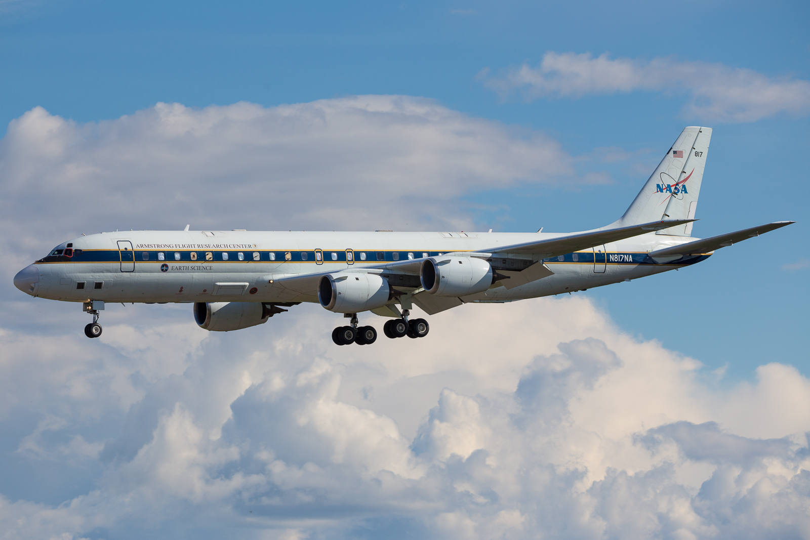
20170729_1
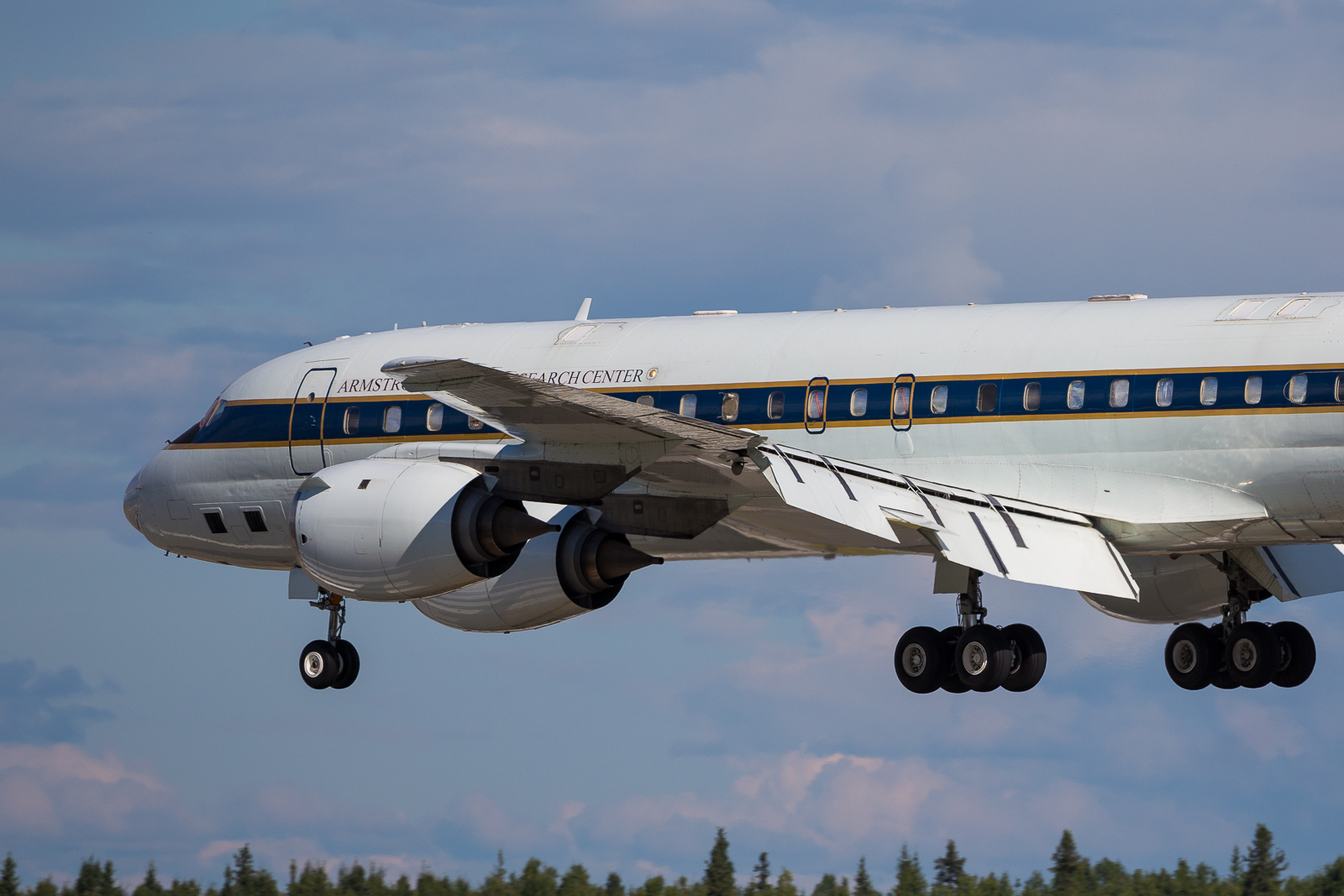
20170729_2
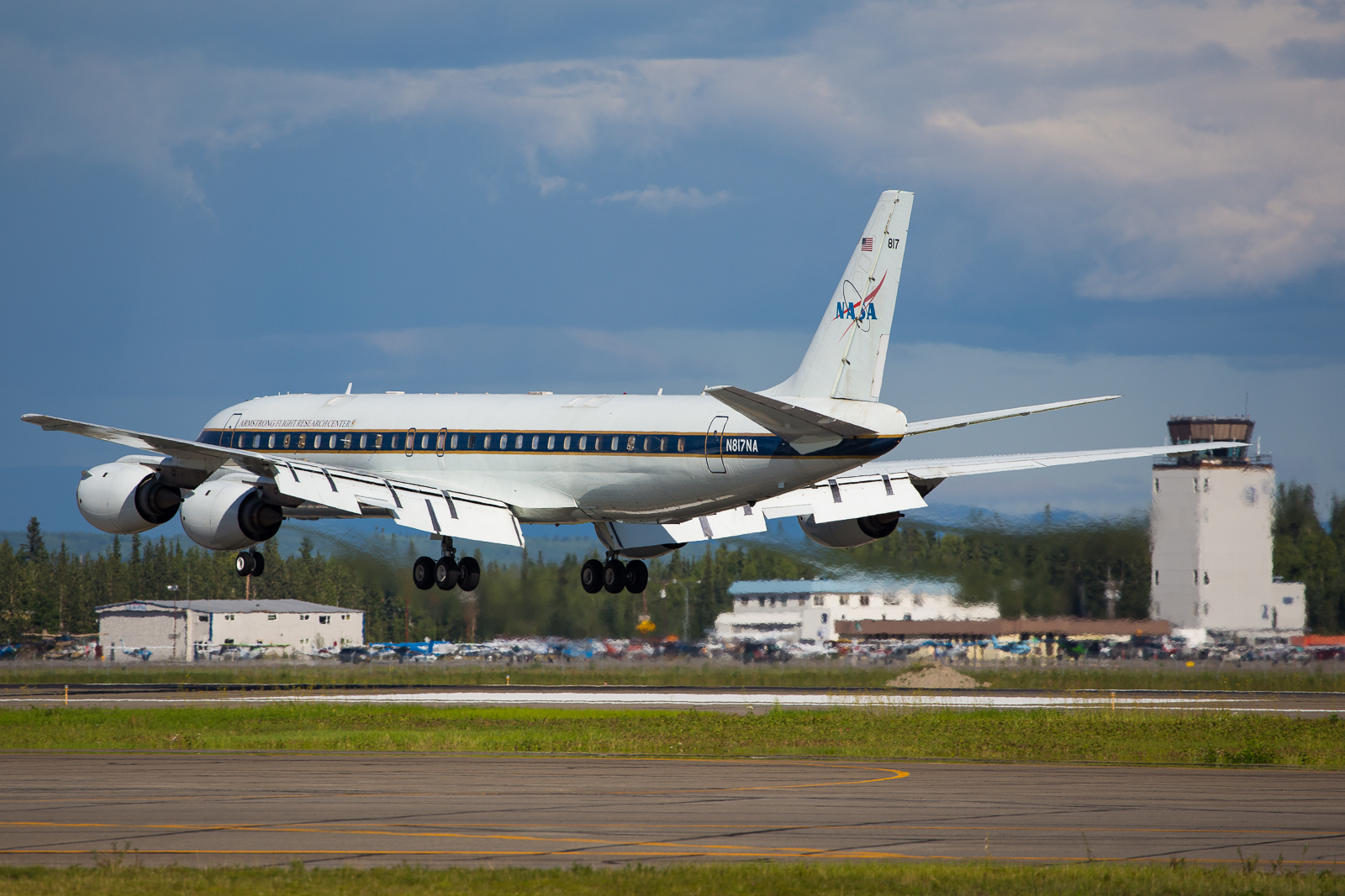
20170729_3
Wed-Thurs 26-27 July— LVIS (Dynamic Aviation B-200T N44U) AVIRIS-NG (Dynamic Aviation B-200 N53W) CFIS (Twin Otter International DHC6 N331AR) AIRSWOT (AFRC B-200 N801NA) ArctiC-C (Scientific Aviation Mooney N617DH) NEON Airborne Observing Platform (Twin Otter International N70AR) ASCENDS (NASA DC-8)
-
Chip Miller is in Fairbanks.
Peter Griffith is in Baltimore.
26-27 July Wednesday — Thursday
Sensor/Aircraft Location
AVIRIS-NG (Dynamic Aviation B-200 N53W) Kenai AK
ASCENDS (NASA DC-8) Fairbanks AK
NEON Airborne Observing Platform (Twin Otter International N70AR) Fairbanks AK
AirSWOT (NASA AFRC B-200 N801NA) Palmdale, CA
ArctiC-C (Scientific Aviation Mooney N617DH) Grand Prairie AB
P-band SAR (NASA G-III Nxxx) Houtson TX — Preparing for resumption of ABoVE science operations on 7 Aug
L-band SAR (NASA C-20 Nxxx) Palmdale CA — will deploy after P-band flights completed, planned 2 Sept deployment
LVIS (Dynamic Aviation B-200T N44U) — ABoVE flying over; awaiting preliminary data products
CFIS (Twin Otter International DHC6 N331AR) — ABoVE flying over; awaiting preliminary data products
Weather & Science Operations Outlook
1500z 29 July through 2359z 29 July
Precipitation over western and interior AK develops through the day, deteriorating weather conditions in the region. Unfortunately, most of AK will be under cloudy conditions through this forecast. The areas between PASC and PABR could be possible targets to fly, with the low cloud boundary approaching this region during mid/late afternoon.
Areas in the northern most points of the YKT (mainly north of 67N) will see some clear skies. Clear sky conditions could be also found between Inuvik to Norman Wells to the Great Bear Lake.
1500z 30 July through 2359z 30 July
A frontal system begins to move over western AK. Simultaneously, a low pressure system begins to makes its way through northern BC. These two weather systems contribute to the increase in precipitation and clouds over most of AK, YKT, northern BC, and western NWT. Conditions over AK do not improve in this forecast period.
1500z 31 July through 2359z 31 July
The mission targets over AK and YKT will continue to be under cloudy conditions through this forecast. A frontal system continues its way through AK, bringing heavy precipitation through most of the mission targets.
Precipitation also develops along the YKT, southern NWT, northern BC, and the northern most portions of AB and SK.
Cloud free targets can be found between Inuvik to Norman Wells to the Great Bear Lake until early afternoon.
Areas between the Great Slave Lake and the northern most portions of SK will see large aerosol optical thickness values due to a fire near Fort Smith.
Sensor/Aircraft Summaries
ASCENDS/NASA DC-8
Thurs 7/27: Transit from Palmdale to Fairbanks. Vertical profiles collected over Grand Island NE, Minot ND, Loon Lake AB, and Norman Wells NT. Partly cloudy to cloudy conditions over most of the ABoVE domain, but CO2 lidar teams still able to capture reasonable signals in clear patches. An 8-10 ppm gradient in background CO2 values was observed during the northward transition.
Fri 7/28: prep day
Sat 7/29: plans for a ~10-hour sortie to Inuvik, Norman Wells, Fort Simpson and Yellowknife with a return to Fairbanks
AVIRIS-NG/N53W
Fri 7/27:
The aircraft G-1000 upgrade is complete including software & magnetometer calibrations.
Thursday night a leak was found in the static system that gives us our altitude. Parts were ordered. We are waiting for confirmation from Beechcraft on an arrival time. Once we receive the parts in Kenai we anticipate about a half day for installation, paperwork completion, and RTS flight.
NEON Airborne Observatory/N70AR
Thurs 7/27: Barrow lines collected
Lines 2-35 (Yellow)* Only southern half collected lines 2-20
Collections started at 16:30L pushing collection beyond the end of the solar angle hour for the day. A very low cloud deck remained present over the ocean and the northern section of the survey area and thus for 20 out of 35 lines only the southern section was collected. However, this encompasses nearly all of the land in the survey box minus a spit in the northern section.
We had a nice visit in Barrow with Craig Tweedie of UTEP and ABoVE and a group of colleagues and students at the plane.
Fri 7/28: pack up
Sat 7/29: Relocate to Fairbanks
See pictures below
AirSWOT/N801NA
NASA 801 returned to Palmdale to support another mission; will return to Fairbanks by 2 August for the resumption of AirSWOT flight operations
ArcticC/N617DH
Completed ABoVE circuit #3 and returned to Grand Prairies AB
Will resume ABoVE flight operations in early August with the potential to overlap with the ASCENDS/DC-8 flights
CFIS/N331AR
Completed ABOVE flight operations with a revisit of the BERMS flux towers on Sat 7/22
Attached Files
fig.1 Tweedie group visits NEON plane in Barrowfig.2 Low clouds over ocean and Barrow coastline
fig.3 Barrow data collections

20170727_1
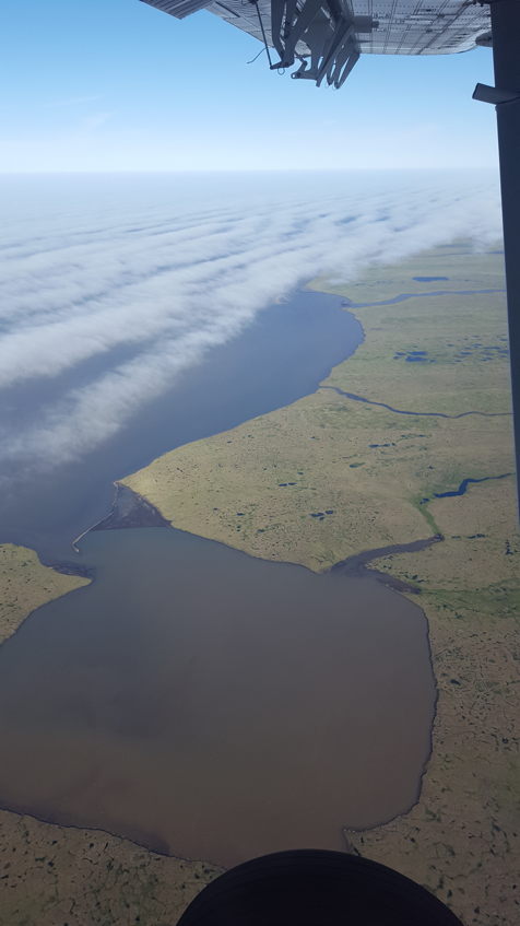
20170727_2
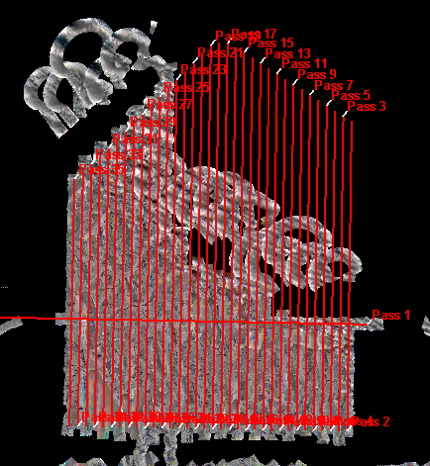
20170727_3
Tues 25 July— LVIS (Dynamic Aviation B-200T N44U) AVIRIS-NG (Dynamic Aviation B-200 N53W) CFIS (Twin Otter International DHC6 N331AR) AIRSWOT (AFRC B-200 N801NA) ArctiC-C (Scientific Aviation Mooney N617DH) NEON Airborne Observing Platform (Twin Otter International N70AR) ASCENDS (NASA DC-8)
-
Chip Miller is in LA.
Peter Griffith is in Baltimore.
25 July Tuesday
Sensor/Aircraft Location
AirSWOT (NASA AFRC B-200 N801NA) Palmdale, CA
ArctiC-C (Scientific Aviation Mooney N617DH) Grand Prairie AB
AVIRIS-NG (Dynamic Aviation B-200 N53W) Kenai AK
NEON Airborne Observing Platform (Twin Otter International N70AR) Deadhorse AK
ASCENDS (NASA DC-8) Palmdale CA
P-band SAR (NASA G-III Nxxx) Houtson TX — Preparing for resumption of ABoVE science operations on 7 Aug
L-band SAR (NASA C-20 Nxxx) Palmdale CA — will deploy after P-band flights completed, planned 2 Sept deployment
LVIS (Dynamic Aviation B-200T N44U) — ABoVE flying over; awaiting preliminary data products
CFIS (Twin Otter International DHC6 N331AR) — ABoVE flying over; awaiting preliminary data products
Weather & Science Operations Outlook
Friday 28 July: ECMWF forecast suggests possible flight day for Barrow AK — mostly sunny skies from 0900 — 1700+
AirSWOT/N801NA
NASA 801 returned to Palmdale to support another mission; will return to Fairbanks by 2 August for the resumption of AirSWOT flight operations
ArcticC/N617DH
Completed ABoVE circuit #3 and returned to Grand Prairies AB
Will resume ABoVE flight operations in early August with the potential to overlap with the ASCENDS/DC-8 flights
AVIRIS-NG/N53W
Tues 7/25: no new updates
On schedule for completion on Friday 28 July, resumption of science flight operations on 29 July
If forecasts are favorable, AVIRIS / N53W will remain in Alaska 29-31 July for reflight opportunities over Seward Peninsula, Barrow and YK Delta.
Plan to transition to the Canadian portion of the domain no later than 1 August
CFIS/N331AR
Completed ABOVE flight operations with a revisit of the BERMS flux towers on Sat 7/22
See photos for CFIS team engaging Iowa State and USDA researchers in ABoVE outreach in Ames IA
NEON Airborne Observatory/N70AR
Tues 7/25: Today was a crew rotation day and the weather was poor. So poor in fact, Abe´s commercial flight
was not able to land in Barrow for a scheduled stopover. No flights attempted
North Slope operations window closes on Friday 28 July — but there may be a flight opportunity to Barrow on 7/28
ASCENDS/NASA DC-8
ASCENDS Science Calibration Flight successfully completed
Thurs 7/27: Transit to Fairbanks
Attached Files
CFIS team engaging Iowa State and USDA researchers in ABoVE outreach in Ames IA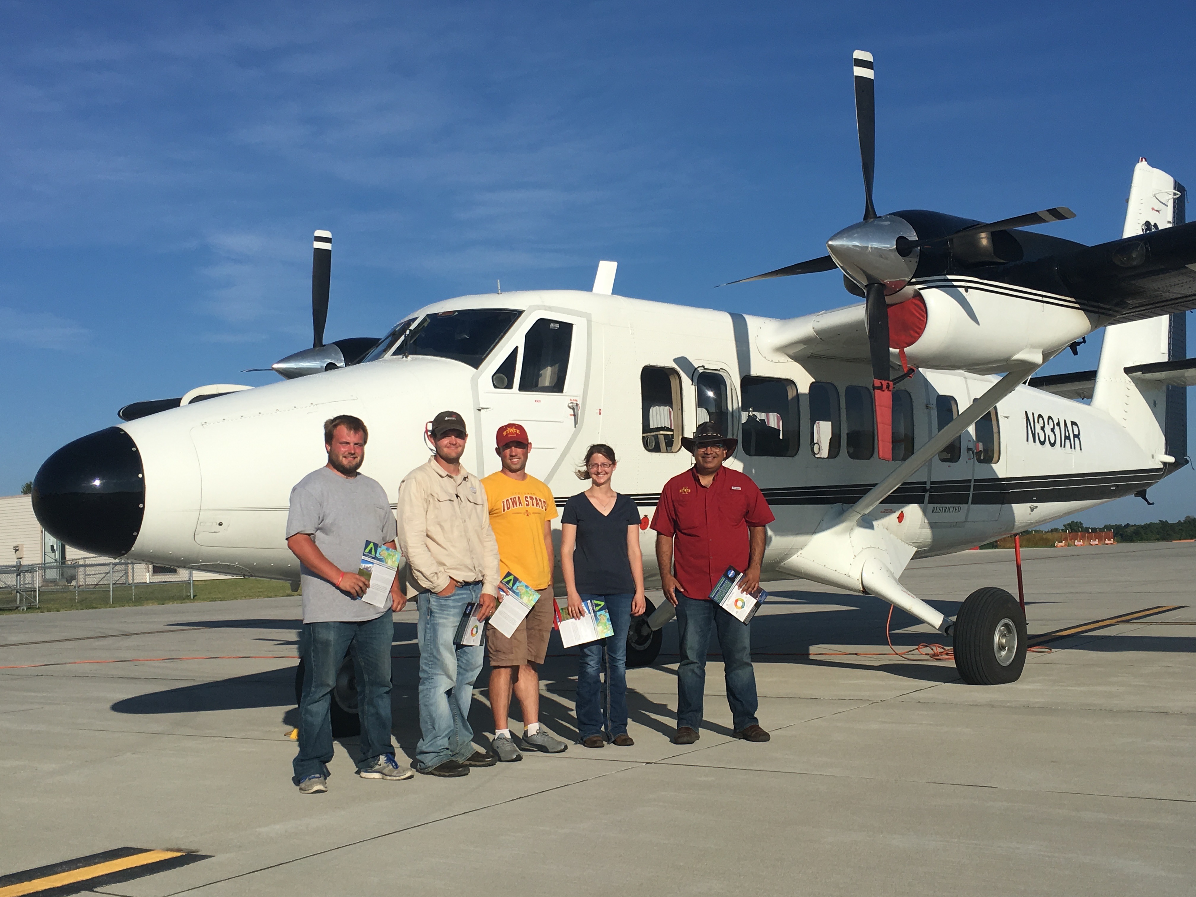
20170725
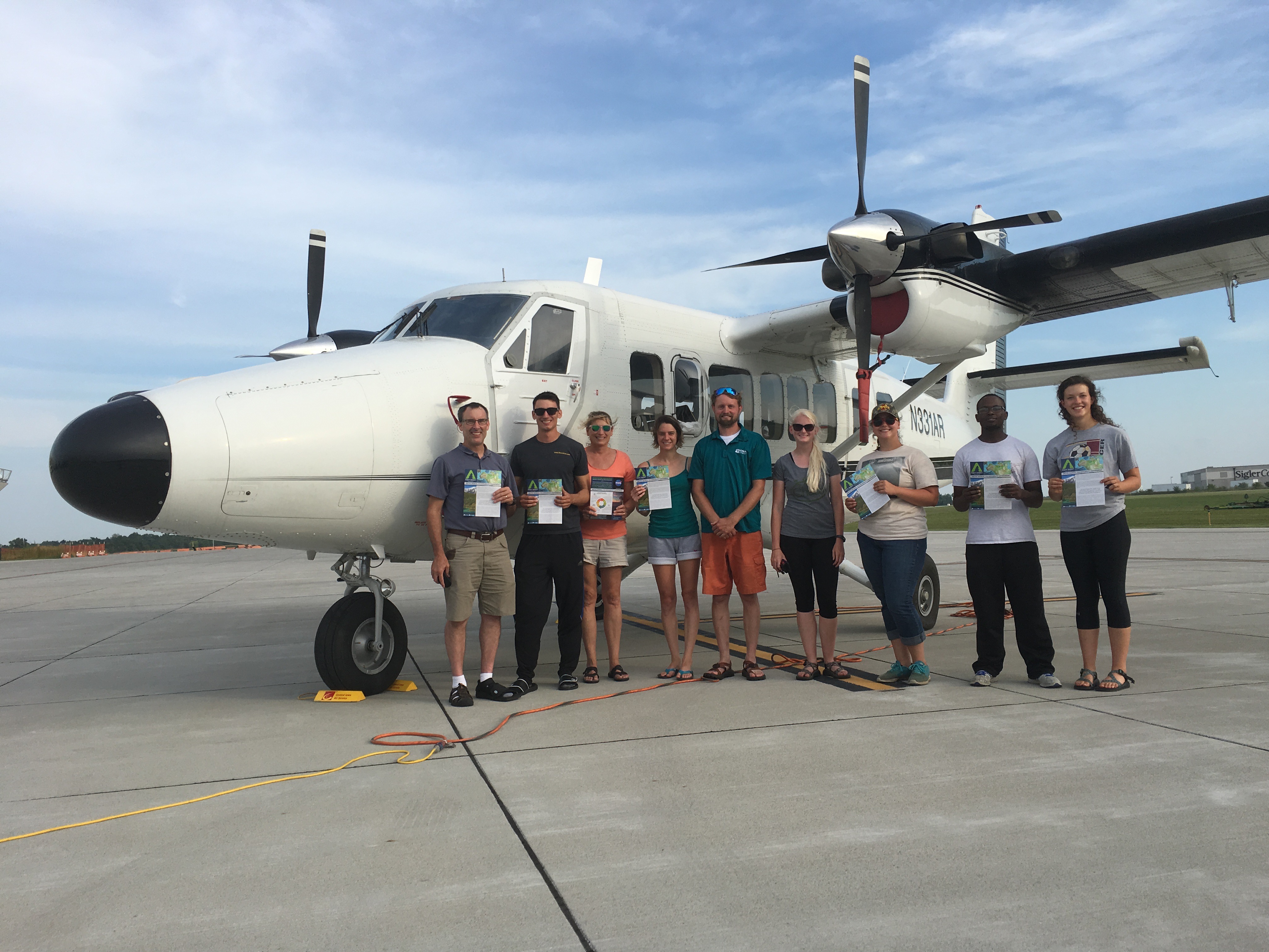
20170725_2
Mon 24 July— LVIS (Dynamic Aviation B-200T N44U) AVIRIS-NG (Dynamic Aviation B-200 N53W) CFIS (Twin Otter International DHC6 N331AR) AIRSWOT (AFRC B-200 N801NA) ArctiC-C (Scientific Aviation Mooney N617DH) NEON Airborne Observing Platform (Twin Otter International N70AR) ASCENDS (NASA DC-8)
-
Chip Miller is in Fairbanks.
Peter Griffith is in Baltimore.
24 July Monday
Sensor/Aircraft Location
AirSWOT (NASA AFRC B-200 N801NA) Palmdale, CA
ArctiC-C (Scientific Aviation Mooney N617DH) Grand Prairie AB
AVIRIS-NG (Dynamic Aviation B-200 N53W) Kenai AK
NEON Airborne Observing Platform (Twin Otter International N70AR) Deadhorse AK
ASCENDS (NASA DC-8) Palmdale CA
P-band SAR (NASA G-III Nxxx) Houtson TX — Preparing for resumption of ABoVE science operations on 7 Aug
L-band SAR (NASA C-20 Nxxx) Palmdale CA — will deploy after P-band flights completed, planned 2 Sept deployment
LVIS (Dynamic Aviation B-200T N44U) — ABoVE flying over; awaiting preliminary data products
CFIS (Twin Otter International DHC6 N331AR) — ABoVE flying over; awaiting preliminary data products
Weather & Science Operations Outlook
Weather forecasts on hiatus until 7/27
AirSWOT/N801NA
NASA 801 returned to Palmdale to support another mission; will return to Fairbanks by 2 August for the resumption of AirSWOT flight operations
ArcticC/N617DH
Completed ABoVE circuit #3 and returned to Grand Prairies AB
Will resume ABoVE flight operations in early August with the potential to overlap with the ASCENDS/DC-8 flights
AVIRIS-NG/N53W
Mon 7/24
N53W navigation system modifications are coming along well.
—The old Garmin system is fully removed and the new one just arrived.
—The pilots chose to replace one of the old fuel bags and found it has a non-standard attachment scheme, using Velcro instead of clips. They have reviewed the issue with higher-ups at dynamic air and have ordered the proper replacement part. The plan is to have it installed Wednesday night or Thursday morning, depending on when it arrives Wednesday.
On schedule for completion on Friday 28 July, resumption of science flight operations on 29 July
If forecasts are favorable, AVIRIS / N53W will remain in Alaska 29-31 July for reflight opportunities over Seward Peninsula, Barrow and YK Delta.
Plan to transition to the Canadian portion of the domain no later than 1 August
CFIS/N331AR
Completed ABOVE flight operations with a revisit of the BERMS flux towers on Sat 7/22
NEON Airborne Observatory/N70AR
Persistent clouds and rain on the North Slope have prevented science flights over Barrow
All Toolik Lake flight lines have been acquired, but all were under yellow or red conditions
North Slope operations window closes on Friday 28 July
ASCENDS/NASA DC-8
ASCENDS Science Calibration Flight successfully completed
Thurs 7/27: Transit to Fairbanks
Thurs 20 July— LVIS (Dynamic Aviation B-200T N44U) AVIRIS-NG (Dynamic Aviation B-200 N53W) CFIS (Twin Otter International DHC6 N331AR) AIRSWOT (AFRC B-200 N801NA) ArctiC-C (Scientific Aviation Mooney N617DH) NEON Airborne Observing Platform (Twin Otter International N70AR) ASCENDS (NASA DC-8)
-
Chip Miller is in Fairbanks.
Peter Griffith is in Baltimore.
20 July Thursday
AirSWOT (NASA AFRC B-200 N801NA) Fairbanks AK
ArctiC-C (Scientific Aviation Mooney N617DH) Whitehorse YT
AVIRIS-NG (Dynamic Aviation B-200 N53W) Kenai AK
CFIS (Twin Otter International DHC6 N331AR) Saskatoon SK
NEON Airborne Observing Platform (Twin Otter International N70AR) Deadhorse AK
ASCENDS (NASA DC-8) Palmdale CA
LVIS (Dynamic Aviation B-200T N44U) - ABoVE flying over; awaiting preliminary data products
Weather & Science Operations Outlook
Fri 7/21
King Salmon to Fairbanks — clear
Sag River region looks clear, but there are chances of mid or high level clouds
Later in the day is better
BERMS area will be cloudy
Sat 7/22
Multi-layer clouds and precipitation will accompany the passage of a front from Barrow early in the day to Deadhorse around 21z, then reaching Inuvik by the end of the day.
Much of the rest of Alaska will be relatively cloud-free on Saturday, except for the Aleutians and the Seward Peninsula. The southern half of Alaska looks pristine from an aerosol perspective.
Fires are still an issue over BC. Smoke from these fires will spread eastward into most of AB and SK on Saturday. From a meteorological viewpoint, except for far northern SK, the Prairie Provinces will have fair weather on Saturday. Up over the YKT and NWT on Saturday, expect a region of mainly clear skies over the majority of the YKT as well as north and west of the large lakes of the NWT.
AirSWOT/N801NA
Thurs 7/20 — Yukon Flats; Ground team in Yukon Flats ready for Thurs 7/20 overflight
Camera failure
Replaced with Camera #3 for flight opp on Fri 7/21
*** Had dinner in Fairbanks with Pavelsky ground team. They were planning an early departure to be on the North Slope for Firday’s overlfight ***
Fri 7/21: Repeat of North Slope joint ground-air sortie along Dalton Hwy
Forecast for early day clouds, so delay take off until 1300 — fly 1300-1700+ for best sky conditions
ArcticC/N617DH
Thurs 7/20: weather down day
Fri 7/21: Transit Whitehorse YT — Yellowknife NT
AVIRIS-NG/N53W
Thurs 7/20: Flew Yukon Delta early afternoon under clear to partly cloudy conditions. Coastal site lines acquired
Refueled in Bethel then transited to Kenai to begin avionics system modifications
7/21 — 7/28: Avionics modifications
Sat 7/29: Scheduled to resume science operations
Will assess opportunities for Alaska acquisitions prior to heading to Canada on ~1 Aug
Priorities:
Seward Peninsula
Barrow
YK Delta or any unflown lines
ABoVE flight are available for view at the AVIRIS-NG Data Portal.
To see the lines: Go to https://avirisng.jpl.nasa.gov/alt_locator/
Input "Miller" into the "Investigator" field and click Submit.
Review of the quick-look data products revealed an apparent offset in the actual acquisitions relative to the planned lines. The quick-look products suggest that the key NGEE-Arctic field sites may have been missed in multiple lines. AVIRIS team are investigating.
CFIS/N331AR
Thurs 7/20: Acquired data over all 4 BERMS area flux towers (Old Black Spruce, Old Jack Pine, Old Aspen and Fen)
Fri 7/21: Forecast suggests weather down day
Sat 7/22: repeat of the BERMS flux towers flight
NEON Airborne Observatory/N70AR
Thurs 7/20: Low clouds and rain on the North Slope today prevented flights from being possible.
Fri 7/21: Forecast suggests possible Barrow flight — could collect additional lines for ABOVE if conditions allow
ASCENDS/NASA DC-8
Thurs 7/20: ASCENDS Science Check Flight #1
Fri 7/21: ASCENDS Science Calibration Flight
Thurs 7/27: Transit to Fairbanks
Other Teams
LVIS
Awaiting quick-look data products
P-band SAR
8/1 — 8/5: Integration and test
8/6: Palmdale — ONT
8/7: ONT — Saskatoon, start Campaign #2
~8/21: complete campaign, return to Palmdale CA
L-band SAR
Nominal schedule, final dates TBC
8/22 — 9/1: Integration and Test
9/2: Palmdale – Saskatoon, Start Campaign #2
ATOM
1st week of Oct: vertical profiles of CO2, CH4, CO and other trace gases over multiple Alaskan and Canadian sites
4th week of Oct: vertical profiles of CO2, CH4, CO and other trace gases over multiple Inuvik, Norman Wells, Yellowknife (TBC), Alaska on return from Greenland to Anchorage
Wed 19 July— LVIS (Dynamic Aviation B-200T N44U) AVIRIS-NG (Dynamic Aviation B-200 N53W) CFIS (Twin Otter International DHC6 N331AR) AIRSWOT (AFRC B-200 N801NA) ArctiC-C (Scientific Aviation Mooney N617DH) NEON Airborne Observing Platform (Twin Otter International N70AR) ASCENDS (NASA DC-8)
-
Chip Miller is in Fairbanks.
Peter Griffith is in Baltimore.
19 July Wednesday
AirSWOT (NASA AFRC B-200 N801NA) Fairbanks AK
ArctiC-C (Scientific Aviation Mooney N617DH) Whitehorse YT
AVIRIS-NG (Dynamic Aviation B-200 N53W) Fairbanks AK
CFIS (Twin Otter International DHC6 N331AR) Saskatoon SK
NEON Airborne Observing Platform (Twin Otter International N70AR) Deadhorse AK
ASCENDS (NASA DC-8) Palmdale CA
LVIS (Dynamic Aviation B-200T N44U) - ABoVE flying over; awaiting preliminary data products
Weather & Science Operations Outlook
Thurs 7/20
Hazy across most of Alaska — mix of low and mid-level clouds
Sew Pen southern side — Nome, Norton Sound until 1300
YK Delta/Bethel OK until 1400
Mackenzie Valley south of Inuvik — good target area, not as clear
Old Crow — clear
BERMS — clear 1100 — 1400, clouds increasing after 1400
Fri 7/21
King Salmon to Fairbanks — clear
Sag River region looks clear, but there are chances of mid or high level clouds
AirSWOT/N801NA
Wed 7/19: North Slope joint ground-air sortie along Dalton Hwy
Ground team on Toolik Lake — Deadhorse lines
Cloudy, so will refly on Friday 7/21
Thurs 7/20 — Yukon Flats; Ground team in Yukon Flats ready for Thurs 7/20 overflight
Fri 7/21: Repeat of North Slope joint ground-air sortie along Dalton Hwy, weather permitting
ArcticC/N617DH
Wed 7/19: Transit Fairbanks — Whitehorse YT
Thurs 7/20: Transit Whitehorse YT — Yellowknife NT
AVIRIS-NG/N53W
Wed 7/19 — 2 sorties
#1 — Old Crow YT
#2 — Whitehorse YT
Thurs 7/20: Potential opportunity for Yukon Delta late morning/early afternoon, then transit to Kenai to begin avionics system modifications
Scheduled to complete work on 7/28, resume operations 7/29
CFIS/N331AR
Wed 7/19: Transited Fort Smith — Fort McMurray — Saskatoon
Acquired data south of Fort Smith, more data south of Ft McMurray
20-23 July — Multiple flights over BERMS/BOREAS area flux towers, as weather permits
NEON Airborne Observatory/N70AR
Wed 7/19: Low clouds in both flight areas with rain in Barrow prevented any collection flights today
ASCENDS/NASA DC-8
Thurs 7/20: ASCENDS Science Check Flight #1
Thurs 7/27: Transit to Fairbanks
Sun 16 July— LVIS (Dynamic Aviation B-200T N44U) AVIRIS-NG (Dynamic Aviation B-200 N53W) CFIS (Twin Otter International DHC6 N331AR) AIRSWOT (AFRC B-200 N801NA) ArctiCC (Scientific Aviation Mooney N617DH) NEON Airborne Observing Platform (Twin Otter International N70AR)
-
Chip Miller is in Fairbanks.
Peter Griffith is in Fairbanks.
16 July Sunday
LVIS (Dynamic Aviation B-200T N44U) Wokal Field/Glasgow International Airport (GGW) Montana
AVIRIS-NG (Dynamic Aviation B-200 N53W) Fairbanks AK
CFIS (Twin Otter International DHC6 N331AR) Fort Simpson NT
AIRSWOT (NASA AFRC B-200 N801NA) Inuvik NT
ArctiCC (Scientific Aviation Mooney N617DH) Fairbanks AK
NEON Airborne Observing Platform (Twin Otter International N70AR) Deadhorse AK
Weather & Science Operations Outlook
Sun 7/16: low clouds everywhere in Alaska; morning clear around Inuvik
Mon 7/17: Yukon flats AM; Fairbanks, Denali, SW to King Salmon; North Slope near BRW, ATQ but patchy clouds; AM — BERMS region
Tues 7/18: Interior AK (morning) all the way to Deadhorse;
Afternoon — convective activity & increasing clouds across AK
Scotty Creek — absolute clear 0900-1400
LVIS/N44U
Sun 7/16: transited to GGW to be in position for BERMS/BOREAS area flights
Mon 7/17: BERMS/BOREAS area flight lines
Tues: weather down day
Wed 7/19: Contingency opportunity for BERMS/BOREAS area flight lines
AVIRIS-NG/N53W
Sun 7/16: Hard down day; clocks reset until 7/20 transit to Kenai for avionics system repair
Mon 7/17: Interior Alaska opportunities TBC
Tues 7/18: Interior Alaska opportunities TBC
CFIS/N331AR
Sun 7/16: Weather down day
7/17-7/18: Waiting for opportunity to do diurnal sampling of Scotty Creek flux towers
AirSWOT/N801NA
Sun 7/16: Acquired Inuvik NT area lines; camera worked without error
Mon 7/17: Transit to Fairbanks, weather permitting
7/17 — 7/21: Surveys of Yukon Flats intensive sampling area
ArcticC/N617DH
Sun 7/16: Hard down day 7/17 — 7/20: Opportunities to collect additional profiles in Alaska
NEON Airborne Observatory/N70AR
Sun 7/16: Weather down day — Low clouds at Barrow and rain at Toolik prevented flights from occurring today
Mon 7/17: crew rotation day; no flights planned
Thurs 13 July—
-
Information received after our ABoVE telecon this evening:
The NEON airborne observatory completed surveys over almost half of the Toolik Lake site today Thurs 7/13. Given that AVIRIS also flew lines over the same Toolik Lake box, we have an excellent opportunity for a sensor-sensor inter comparison that will help us in future use of the NEON data at Toolik Lake and other Alaskan sites.
Wed 12 July— LVIS (Dynamic Aviation B-200T N44U) AVIRIS-NG (Dynamic Aviation B-200 N53W) CFIS (Twin Otter International DHC6 N331AR) AIRSWOT (AFRC B-200 N801NA) ArctiCC (Scientific Aviation Mooney N617DH)
-
Chip Miller is in Fairbanks.
Peter Griffith is in Fairbanks.
12 July Wednesday
LVIS (Dynamic Aviation B-200T N44U) Fairbanks AK
AVIRIS-NG (Dynamic Aviation B-200 N53W) Fairbanks AK
CFIS (Twin Otter International DHC6 N331AR) Fairbanks AK
AIRSWOT (NASA AFRC B-200 N801NA) Yellowknife NT
ArctiCC (Scientific Aviation Mooney N617DH) Fairbanks AK
Weather & Science Operations Outlook
Thurs 7/13: Deadhorse area; Yukon Delta
Fri 7/14: Excellent weather expected — Yukon Flats, North Slope, Inuvik, Mackenzie Valley, Fort Simpson, Yellowknife
Sat 7/15: Lots of low cloud cover, may have openings at Fort Yukon, Yukon Flats; in Canada — Fort Simpson, Fort Liard
Sun 7/16: low clouds everywhere
LVIS/N44U
Down due to fuel bag repairs; fuel bladders replaced
Will perform test flight early Thursday to confirm readiness to resume science operations
AVIRIS-NG/N53W
Collected 8 lines over the Seward Peninsula — beautiful skies, expect high quality data
NGEE-Arctic team notified for simultaneous ground and UAS observations
CFIS/N331AR
Weather down day
Targeting Fri 7/14 transit to Canada via Inuvik and Mackenzie River Valley — offers return sampling opportunity
AirSWOT/N801NA
Radar ch5 can not be repaired without offloading instrument; will proceed sing Ch3
Replacement camera held up in customs; AFRC have forwarded necessary paperwork to expedite release
Anticipate completing
Fri 7/14: planning for Daring Lake transect
ArcticC/N617DH
Arrived from Inuvik approx 1400 AKDT, overnighted in Fairbanks
Thurs 7/13: plan to fly to Deadhorse and Barrow
Fri 7/14: Barrow — Nome — Bethel — Fairbanks
Mon 10 July, Tues 11 July— LVIS (Dynamic Aviation B-200T N44U) AVIRIS-NG (Dynamic Aviation B-200 N53W) CFIS (Twin Otter International DHC6 N331AR) AIRSWOT (AFRC B-200 N801NA) ArctiCC (Scientific Aviation Mooney N617DH)
-
Chip Miller is in Fairbanks.
Peter Griffith is in Fairbanks.
10-11 July Monday-Tuesday
LVIS (Dynamic Aviation B-200T N44U) Barrow AK
AVIRIS-NG (Dynamic Aviation B-200 N53W) Fairbanks AK
CFIS (Twin Otter International DHC6 N331AR) Barrow AK
AIRSWOT (NASA AFRC B-200 N801NA) Yellowknife NT
ArctiCC (Scientific Aviation Mooney N617DH) Inuvik NT
Weather & Science Operations Outlook
Mon 7/10: Alaska forecast for poor conditions statewide – Hard down day for LVIS, AVIRIS teams after long days on North Slope
Tues 7/11: Possible clearings in Yukon Flats, Western Alaska
Wed 7/12 — Fri 7/14: Excellent weather expected in western Alaska — possible Seward Peninsula & Yukon Delta combined flight plan
LVIS/N44U
Mon 7/10: Mechanic arrived in Barrow to help fix the fuel leak
Tues 7/11: Leak sources identified and stopped; plan to ferry the plane back to Fairbanks for further repair
Wed 7/12: Complete repairs
Thurs 7/13: Test flight (if needed), return to science operations
AVIRIS-NG/N53W
Mon 7/10: Hard down day
Tues 7/11: Yukon Flats/Old Crow Flats acquisitions attempted but dense low level smoke encountered
CFIS/N331AR
Mon 7/10: Return to Fairbanks
Tues 7/11: Weather down day
Waiting for opportunity to fly Fairbanks — Whitehorse YT — Fort Simpson; investigating possibility of flying Fairbanks — Inuvik — Fort Simpson if better weather and observing conditions
AirSWOT/N801NA
Mon 7/10: Down day — assess
Tues 7/11: Awaiting replacement camera; determined can move forward with radar using Ch3 instead of Ch5 antenna
Waiting for clear weather to fly Yellowknife — Daring Lake transect
ArcticC/N617DH
Mon 7/10: Yellowknife — Inuvik
Tues 7/11: weather down day
Wed 7/12: Inuvik — Fairbanks
July 9— LVIS (Dynamic Aviation B-200T N44U) AVIRIS-NG (Dynamic Aviation B-200 N53W) CFIS (Twin Otter International DHC6 N331AR) AIRSWOT (AFRC B-200 N801NA) ArctiCC (Scientific Aviation Mooney N617DH)
-
Chip Miller is in Fairbanks.
Peter Griffith is in Fairbanks.
5 (!) planes in the air at once, 3 near Barrow AK and 2 in the NT
9 July Sunday
LVIS (Dynamic Aviation B-200T N44U) Barrow AK
AVIRIS-NG (Dynamic Aviation B-200 N53W) Fairbanks AK
CFIS (Twin Otter International DHC6 N331AR) Barrow AK
AIRSWOT (NASA AFRC B-200 N801NA) Yellowknife NT
ArctiCC (Scientific Aviation Mooney N617DH) Yellowknife NT
Weather & Science Operations Outlook
Alaska: Forecast for clear skies on western North Slope (Barrow and Atqasuk) early, with increasing clouds after 1300 AKDT
Canada:
Mon 7/10: Alaska forecast for poor conditions statewide — Hard down day for LVIS, AVIRIS teams after long days on North Slope
Tues 7/11: Excellent weather expected in western Alaska — possible Seward Peninsula & Yukon Delta combined flight plan
LVIS/N44U
Sun 7/9: Acquired multiple lines over Atqasuk, Barrow and eastern North Slope
Experienced fuel leak after refueling in Barrow; plane grounded until further notice; exploring options
Next flight TBD
AVIRIS-NG/N53W
Sun 7/9: Acquired multiple lines over Atqasuk, Barrow and eastern North Slope
Mon 7/10: Hard down day
Tues 7/11: Seward Peninsula & YK Delta
CFIS/N331AR
Sun 7/9: Deadhorse —> Barrow, 2x rosettes over both Barrow and Atqasuk flux towers + some coverage of other AVIRIS/LVIS lines; overnight in Barrow
Mon 7/10: Return to Fairbanks
Tues 7/11: Fairbanks to Whitehorse YT
AirSWOT/N801NA
Sun 7/9: Saskatoon —> Fort McMurray —> Yellowknife with multiple lines over Peace-Athabasca Delta and Slave Delta
Mon 7/10: Yellowknife — Daring Lake transect
ArcticC/N617DH
Sun 7/9: Grand Prairie — Yellowknife — Daring Lake — Yellowknife; profile acquired over the Daring Lake flux towers
Mon 7/10: Yellowknife — Inuvik
Attached Files
Fig 1: Barrow as seen by CFIS on approach to PABRFig 2: N44U (foreground) and N53W at Alaska Aerofuel, Fairbanks, preparing to depart for Barrow
Fig 3: LVIS team
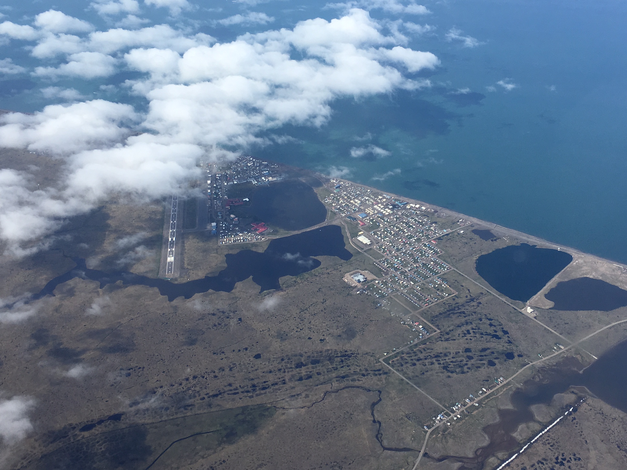
20170709_1
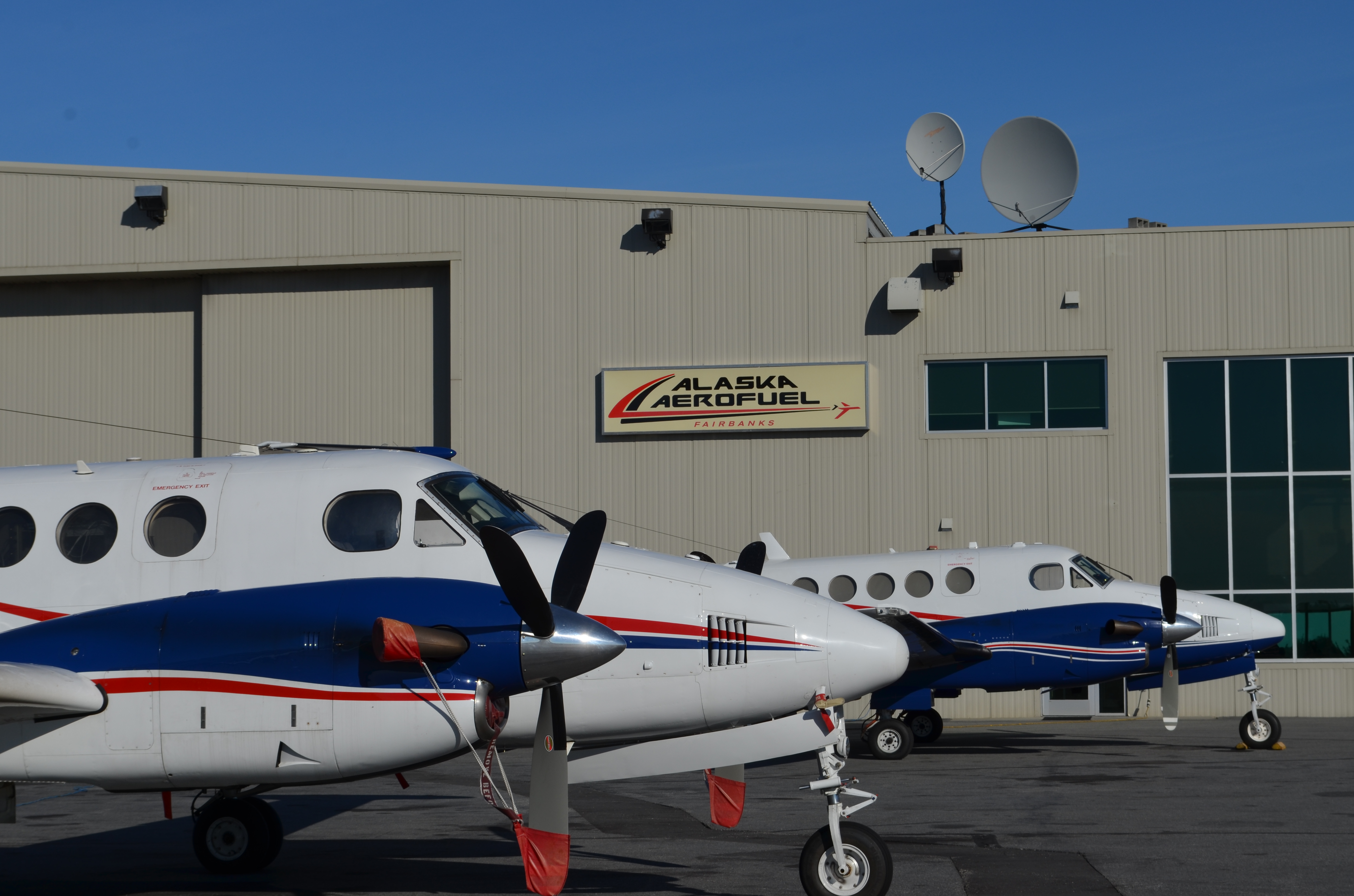
20170709_2

20170709_3
July 8— LVIS (Dynamic Aviation B-200T N44U) AVIRIS-NG (Dynamic Aviation B-200 N53W) CFIS (Twin Otter International DHC6 N331AR) AIRSWOT (AFRC B-200 N801NA)
-
Chip Miller is in Fairbanks.
Peter Griffith is in Fairbanks.
8 July Saturday
LVIS (Dynamic Aviation B-200T N44U) Fairbanks AK
AVIRIS-NG (Dynamic Aviation B-200 N53W) Fairbanks AK
CFIS (Twin Otter International DHC6 N331AR) Deadhorse AK
AIRSWOT (NASA AFRC B-200 N801NA) Saskatoon SK
Weather & Science Operations Outlook
Forecast for very clear skies on eastern North Slope (Deadhorse to Toolik Lake) and in Yukon Flats
Sun 7/9: Clear skies expected morning into early afternoon at Barrow
Mon 7/10: poor conditions — Hard down day for LVIS, AVIRIS teams after long days on North Slope
Tues 7/11: Excellent weather expected in western Alaska — possible Seward Peninsula & Yukon Delta combined flight plan
LVIS/N44U
Sat 7/8: fuel leak issues prevented LVIS/N44U from flying today. Problems believed solved and ready for Sun
7/9 opportunity to Barrow
Sun 7/9: Fairbanks —> Barrow
AVIRIS-NG/N53W
Sat 7/8: Lines acquired in Fort Yukon area; smoke prevented further acquisitions east into the Old Crow YT region; redirected to the North Slope and acquired data under VFR; refueled in Deadhorse and ran several lines of the Deadhorse grid; returned to Fairbanks with acquisitions along the Dalton Hwy
Sun 7/9: Fairbanks —> Barrow
CFIS/N331AR
Sat 7/9: repeat flights of Toolik Lake, Imnavait flux towers, Anaktuvuk River fire scar and flux towers
Sun 7/9: Deadhorse —> Barrow with goal of multiple passes over Barrow and Atqasuk flux towers
AirSWOT/N801NA
Sat 7/9: Saskatoon —> Fort McMurray —> Yellowknife
Sun 7/10 — Mon 7/11: Wait for opportunity to acquire Daring Lake transect
Attached Files
Figure 1: AVIRIS/N53W and CFIS/N331AR teams @ Deadhorse Airport (PASC)Figure 2: AirSWOT/N801NA on the ramp

20170708_1

20170708_2
July 6— LVIS (Dynamic Aviation B-200T N44U) AVIRIS-NG (Dynamic Aviation B-200 N53W) CFIS (Twin Otter International DHC6 N331AR) AIRSWOT (AFRC B-200 N801NA)
-
Chip Miller is in Fairbanks.
Peter Griffith is in Fairbanks.
6 July Wednesday
LVIS (Dynamic Aviation B-200T N44U) Fairbanks AK
AVIRIS-NG (Dynamic Aviation B-200 N53W) Fairbanks AK
CFIS (Twin Otter International DHC6 N331AR) Fairbanks AK
AIRSWOT (NASA AFRC B-200 N801NA) Minot ND
Weather & Science Operations Outlook
Expect clear sky areas to rotate clockwise around AK over the next several days
Fri 7/7: Yukon Delta and Toolik Lake/Deadhorse areas should be good opportunities
Sat 7/8: Partly cloudy, not as good
Sun 7/9: Excellent conditions on the North Slope
LVIS/N44U
Thurs 7/6: Kluane Lake YT, SE Alaska, Delta Junction and Fairbanks area lines acquired; some clouds on the southernmost end of Kluane Lake, otherwise optimal conditions; active Military Operations Area (MOA) near Delta Junction prevented acquisition of lines 255, 256
Fri 7/7: Yukon Delta with possibility of picking up Healy area lines on the return leg – planned departure by 0800
AVIRIS-NG/N53W
Thurs 7/6: Flew morning and afternoon sorties
Morning: SE Alaska, Delta Junction, Healy and Fairbanks area lines acquired; 2 short navigation flags that self corrected
Afternoon: Fairbanks area and north to Poker Creek; multiple navigation flags/heading loss — overcome by flying VFR
Team is confident they can operate effectively south of Fairbanks, but not any further north
Fri 7/7: Yukon Delta
CFIS/N331AR
Thurs 7/6: Flew morning and afternoon sorties
Morning: Bonanza Creek flux towers to capture early day signals
Afternoon: Bonanza Creek and Delta Junction area flux towers each flown multiple times; some challenges accessing the Delta Junction tower due to proximity to the MOA
Fri 7/7 — Sun 7/9: Toolik Lake and Deadhorse for multi-day observations on the North Slope; will make a departure decision in the morning based on revised weather forecasts
AirSWOT/N801NA
Thurs 7/6: Transit Edwards AFB — Hill AFB — Minot ND; smooth flights;
Fri 7/7: Joint air and ground data acquisition in Saskatoon area
Attached Files
Fig 1. 4 ABoVE aircraft flying on 7/6/17Fig 2. N801NA in Minot ND
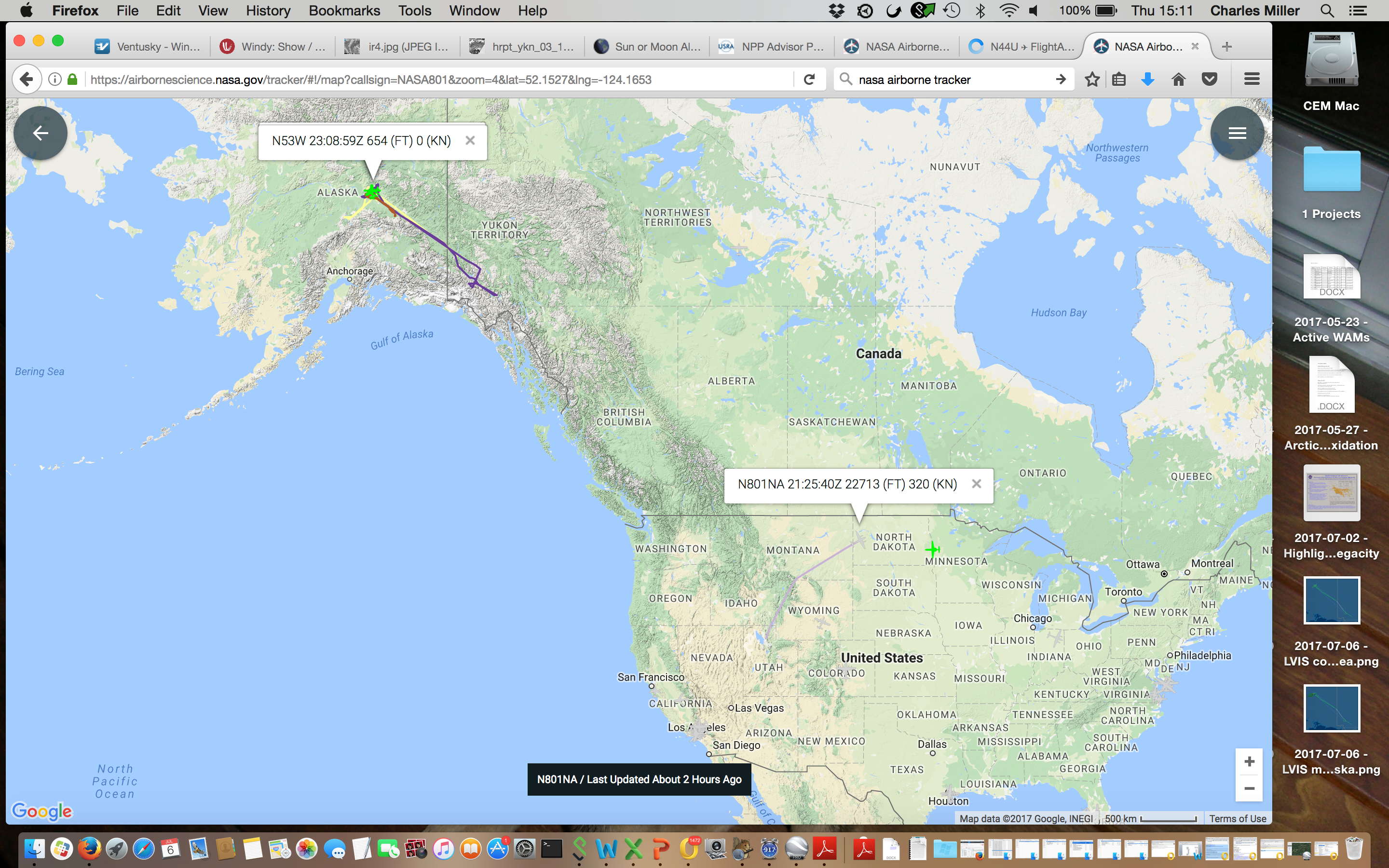
20170706_1
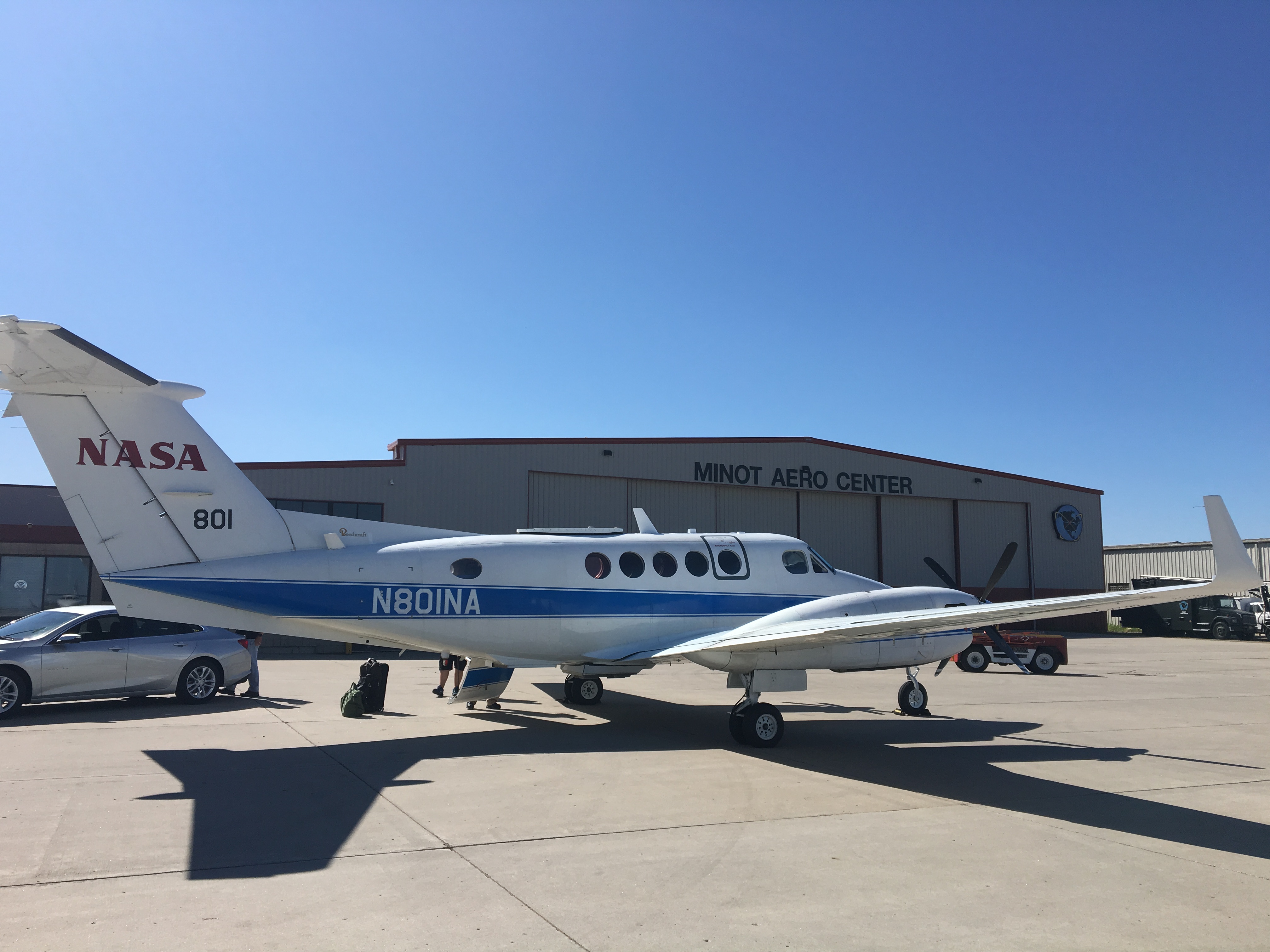
20170706_2
July 5— LVIS (Dynamic Aviation B-200T N44U) AVIRIS-NG (Dynamic Aviation B-200 N53W) CFIS (Twin Otter International DHC6 N331AR) AIRSWOT (AFRC B-200 N801NA)
-
Chip Miller is in Fairbanks.
Peter Griffith is in Fairbanks.
5 July Tuesday
LVIS (Dynamic Aviation B-200T N44U) Fairbanks AK
AVIRIS-NG (Dynamic Aviation B-200 N53W) Fairbanks AK
CFIS (Twin Otter International DHC6 N331AR) Fairbanks AK
AIRSWOT (AFRC B-200 N801NA)
Weather & Science Operations Outlook
Wed 7/5: Nice warm day, but too many clouds for optical instrument work
Expect clear areas to rotate clockwise around AK over the next several days
Thurs 7/6: SE Alaska — Delta Junction
Fri 7/7: Yukon Delta
Sat 7/8: Seward Peninsula and North Slope
LVIS/N44U
7/5: Weather Down Day — no flights
Wed 7/6: Fairbanks — Whitehorse; Kluane Lake, Delta Junction
AVIRIS-NG/N53W
7/5: Weather Down Day — no flights
Wed 7/6: Delta Junction, Fairbanks area, Bonanza Creek
CFIS/N331AR
7/5: Weather Down Day — no flights
Wed 7/6: Delta Junction, Fairbanks area, Bonanza Creek — early departure for morning BNZ flights
AirSWOT/N801NA
7/6: Planned departure from Palmdale to Salt Lake City
July 4— LVIS (Dynamic Aviation B-200T N44U) AVIRIS-NG (Dynamic Aviation B-200 N53W) CFIS (Twin Otter International DHC6 N331AR)
-
Chip Miller is in Fairbanks.
Peter Griffith is in Fairbanks.
4 July Monday
LVIS (Dynamic Aviation B-200T N44U) Fairbanks AK
AVIRIS-NG (Dynamic Aviation B-200 N53W) Fairbanks AK
CFIS (Twin Otter International DHC6 N331AR) Fairbanks AK
Weather & Science Operations Outlook
Wed 7/5: Interior Alaska
Thurs 7/6: Yukon Delta
LVIS/N44U
Weather Down Day — no flights
Next opportunity Wed 7/5
AVIRIS-NG/N53W
Weather down day — no flights
Next opportunity Wed 7/5
CFIS/N331AR
Weather down day
Next opportunity Wed 7/5
Attached Files
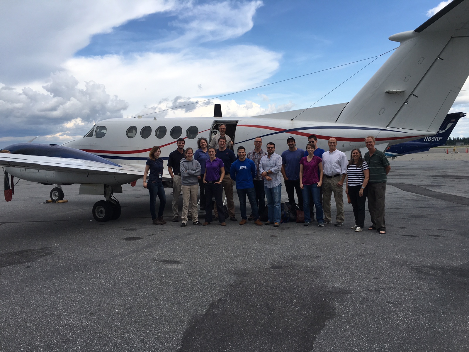
20170704
July 3— LVIS (Dynamic Aviation B-200T N44U) AVIRIS-NG (Dynamic Aviation B-200 N53W) CFIS (Twin Otter International DHC6 N331AR)
-
Chip Miller is in Fairbanks.
Peter Griffith is in Fairbanks.
3 July Monday
LVIS (Dynamic Aviation B-200T N44U) Fairbanks AK
AVIRIS-NG (Dynamic Aviation B-200 N53W) Fairbanks AK
CFIS (Twin Otter International DHC6 N331AR) Fairbanks AK
Weather & Science Operations Outlook
Tues 7/4: Fort Yukon Clear
Wed 7/5: Interior Alaska
Thurs 7/6: Yukon Delta
LVIS/N44U
Flew Yellowknife — Whitehorse — Fairbanks; data acquisition over Scotty Creek; all other areas too cloudy for acquisition
Arrived Fairbanks approx 1630 AKDT
Next opportunity Wed 7/5
AVIRIS-NG/N53W
Weather down day — no flights
Next opportunity Wed 7/5
CFIS/N331AR
Weather down day
Next opportunity Wed 7/5
July 1— LVIS (Dynamic Aviation B-200T N44U) AVIRIS-NG (Dynamic Aviation B-200 N53W) CFIS (Twin Otter International DHC6 N331AR)
-
Chip Miller is in Yellowknife.
Peter Griffith is in Fairbanks.
1 July Saturday
LVIS (Dynamic Aviation B-200T N44U) Yellowknife NT
AVIRIS-NG (Dynamic Aviation B-200 N53W) Fairbanks AK
CFIS (Twin Otter International DHC6 N331AR) Fairbanks AK
LVIS/N44U
Flew r/t to Daring Lake. Clear skies on site, 50-60% cloudy along western half of transit line. Afternoon clouds prevented any additional acquisitions in the Great Slave Lake region,
Navigational system operated nominally
Outlook for 7/2: Afternoon flight to Scotty Creek/Fort Simpson area with possible revisit of Fort Providence area on return
Outlook for 7/3: Possible northern transit to Fairbanks via Norman Wells or Inuvik —> Old Crow —> Yukon Flats
AVIRIS-NG/N53W
Tested nav system with flight west to Ruby AK area — functioned properly
Turned north towards Huslia and experienced nav dropout
Returned to Fairbanks
Outlook for 7/2: Hard Down Day
Outlook for 7/3: Seward Peninsula, Huslia, Selawik, Noatak
CFIS/N331AR
Weather down day
Outlook for 7/2: Waiting for optimum 2–3 day window on North Slope for diurnal surveys
Outlook for 7/3: Bonanza Creek flux towers, Yukon Flats
June 30— LVIS (Dynamic Aviation B-200T N44U) AVIRIS-NG (Dynamic Aviation B-200 N53W) CFIS (Twin Otter International DHC6 N331AR)
-
Chip Miller is in Yellowknife.
Peter Griffith is in Fairbanks.
30 June Friday
LVIS (Dynamic Aviation B-200T N44U) Yellowknife NT
AVIRIS-NG (Dynamic Aviation B-200 N53W) Fairbanks AK
CFIS (Twin Otter International DHC6 N331AR) Fairbanks AK
LVIS/N44U
Flew r/t to Fort Good Hope, Fort McPherson, Inuvik and the Mackenzie Delta. Excellent data collected over all of these lines.
Navigational system operated nominally
Outlook for 7/1: Flight around Great Slave Lake region, maybe Daring Lake transect in the afternoon if conditions clear
AVIRIS-NG/N53W
Attempted flight to Deadhorse, but navigation system experienced magnetometer issues again. Flight aborted after 20 min (just across 65 N latitude line), return to base
Outlook for 7/1: Look for option to west or south near Fairbanks as weather allows to check nav system perfromance
CFIS/N331AR
Flew multiple morning pass over the Inuvik flux tower, Old Crow, Yukon Flats. Arrived Fairbanks
Outlook for 7/1: Weather down day — waiting for optimum 2–3 day window on North Slope for diurnal surveys
June 29— LVIS (Dynamic Aviation B-200T N44U) AVIRIS-NG (Dynamic Aviation B-200 N53W) CFIS (Twin Otter International DHC6 N331AR)
-
Assets Deployed
LVIS (Dynamic Aviation B-200T N44U) Yellowknife NT
AVIRIS-NG (Dynamic Aviation B-200 N53W) Fairbanks AK
CFIS (Twin Otter International DHC6 N331AR) Inuvik NT
Chip Miller is in Yellowknife.
Peter Griffith is in Fairbanks.
29 June Thursday
LVIS/N44U
Flew Saskatoon to Yellowknife with acquisitions en route. Clouds prevented complete line acquisitions for some BERMS and Fort McMurray area lines. Slave Delta not flown due to cloud cover.
Refueled in Yellowknife and went after Great Slave Lake region lines in the afternoon.
Navigational system operated nominally.
Outlook for 6/30: day trip to Inuvik/Mackenzie River Valley
AVIRIS-NG/N53W
Flew from Ketchikan AK to Fairbanks AK. Navigational system operated nominally
Outlook for 6/30: Deadhorse, Dalton Highway, Toolik Lake, Anaktuvuk fire scars; Yukon Flats if time and fuel permit
Outlook for 7/1: Barrow
CFIS/N331AR
Flew multiple temporal passes over the Inuvik and Trail Valley Creek flux towers
Outlook for 6/30: Deadhorse, North Slope
Outlook for 7/1: Barrow
June 28— LVIS (Dynamic Aviation B-200T N44U) AVIRIS-NG (Dynamic Aviation B-200 N53W) CFIS (Twin Otter International DHC6 N331AR)
-
Assets Deployed
LVIS (Dynamic Aviation B-200T N44U) Saskatoon SK
AVIRIS-NG (Dynamic Aviation B-200 N53W) Ketchikan AK
CFIS (Twin Otter International DHC6 N331AR) Inuvik NT
Chip Miller is in Yellowknife.
Peter Griffith is in Fairbanks.
28 June Wednesday
LVIS
Received GO for operations assessment from WFF flight authority after review of navigation system issues
Plan for 0800 MDT/1400 Z departure for Yellowknife on Thurs 6/29 with data collection Fort McMurray — Slave River and the potential for a short afternoon sortie around the Yellowknife area
AVIRIS-NG
Departed Yellowknife for Ketchikan AK at 1000 MDT / 1600 Z. All systems behaved nominally south of 58N. Expected early afternoon arrival in Fairbanks on Thurs 6/29.
CFIS
Weather down day in Inuvik. Thurs 6/29: fly local towers around Inuvik, collecting diurnal variability over ~4 acquisitions.
June 27— LVIS (Dynamic Aviation B-200T N44U) AVIRIS-NG (Dynamic Aviation B-200 N53W) CFIS (Twin Otter International DHC6 N331AR)
-
Assets Deployed
LVIS (Dynamic Aviation B-200T N44U) Saskatoon
AVIRIS-NG (Dynamic Aviation B-200 N53W) Yellowknife
CFIS (Twin Otter International DHC6 N331AR) Inuvik
Chip Miller is in Yellowknife.
Peter Griffith is in Fairbanks.
27 June Tuesday
LVIS
In Saskatoon waiting for weather to clear to make transit to Yellowknife. Solution for navigation system issues implemented. Planned acquisitions over BERMS, Fort McMurray, and Slave River watershed on Wednesday 6/28.
AVIRIS-NG
In Yellowknife preparing for transit to Fairbanks where it is thought that the navigation issues will not prevent operations. Anticipate Wed 6/28 departure and 1.5 day transit via SE Alaska.
CFIS
In Inuvik. Down day — Weather. Darren Drewry will ride with the Sonnentag team to visit the flux tower at Trail Valley Creek. Monday 6/26 — Downday — Weather. The CFIS team hiked to the Havipak Creek flux tower. Anticipate Wed 6/28 departure for Old Crow Flats, Yukon Flats, and Fairbanks.
June 23–25— LVIS (Dynamic Aviation B-200T N44U) AVIRIS-NG (Dynamic Aviation B-200 N53W) CFIS (Twin Otter International DHC6 N331AR)
-
23 June Friday
Assets Deployed
LVIS (Dynamic Aviation B-200T N44U) Saskatoon SK
AVIRIS-NG (Dynamic Aviation B-200 N53W) Yellowknife, NT
CFIS (Twin Otter International DHC6 N331AR) Yellowknife, NT
LVIS
Rockford IL — Saskatoon SK transit completed. Customs processing completed.
Recurrence of navigation issue identified in MD test flights; working issue with Dynamic and Garmin
Ready to fly north to Yellowknife with data collections
AVIRIS-NG
Began Great Slave Lake region flight, landing gear light issue immediately after take off. Flight aborted, returned safely to base. Detection switch problem identified and fixed.
Ready to resume data collection.
CFIS
Flew Edmonton — Fort McMurray — Yellowknife with data collections en route. Tracker not working
24 June Saturday
Assets Deployed
LVIS (Dynamic Aviation B-200T N44U) Saskatoon SK
AVIRIS-NG (Dynamic Aviation B-200 N53W) Yellowknife, NT
CFIS (Twin Otter International DHC6 N331AR) Norman Wells NT
LVIS
Grounded pending resolution of navigation problem; working issue with Dynamic and Garmin
Ready to fly north to Yellowknife with data collections
AVIRIS-NG
Began Great Slave Lake region flight with 1043 local/1643Z take off. Lines successfully acquired from Wrigley to Fort Simpson; encountered ~50% cloud cover on Scotty Creek line — will need to be reflown.
Recurrence of navigation issue identified during Calgary — Yellowknife transit on Thurs 6/22. Remainder of flight aborted, return to base.
CFIS Flew Yellowknife — Scotty Creek — Fort Simpson (refuel) — Wrigley/Smith Creek — Norman Wells with data collections en route. Tracker not working
25 June Sunday
LVIS (Dynamic Aviation B-200T N44U) Saskatoon SK
AVIRIS-NG (Dynamic Aviation B-200 N53W) Yellowknife, NT
CFIS (Twin Otter International DHC6 N331AR) Inuvik NT
LVIS
Grounded pending resolution of navigation problem. Dynamic and Garmin working problem. Software upgrade installed.
Ready to fly north to Yellowknife with data collections.
AVIRIS-NG
Grounded pending resolution of navigation problem. Dynamic and Garmin working problem. Not the same issue as affecting LVIS/N44U.
Instrument performing well. Team rested and ready to resume data acquisistion.
CFIS
Flew Norman Wells — Inuvik with data collections en route. Refueled and acquired data in Inuvik area — limited by cloud cover.
Tracker not working.
June 23— LVIS (Dynamic Aviation B-200T N44U) AVIRIS-NG (Dynamic Aviation B-200 N53W) CFIS (Twin Otter International DHC6 N331AR)
-
Assets Deployed
LVIS (Dynamic Aviation B-200T N44U) Yellowknife
AVIRIS-NG (Dynamic Aviation B-200 N53W) Yellowknife
CFIS (Twin Otter International DHC6 N331AR) Yellowknife
Chip Miller is in Yellowknife.
Peter Griffith is in Fairbanks.
23 June Friday
UAVSAR L-Band
Returned to Palmdale. "Congratulations on a job well done” - Franz Meyer
LVIS
In Saskatoon addressing a problem with the plane and with the radar.
AVIRIS-NG
Began a science flight but the aircraft had an issue with the landing gear that required return to base. Problem resolved. Should be able to do a science flight on Saturday.
CFIS
Reached Yellowknife at about 1900 local. Tracker not working.
June 22— UAVSAR L-Band (AFRC C-20A) LVIS (Dynamic Aviation B-200T N44U) AVIRIS-NG (Dynamic Aviation B-200 N53W) CFIS (Twin Otter International DHC6 N331AR)
-
Assets Deployed
UAVSAR L-Band (AFRC C-20A) Fairbanks, Alaska
LVIS (Dynamic Aviation B-200T N44U) Rockford, Illinois
AVIRIS-NG (Dynamic Aviation B-200 N53W) Yellowknife, Northwest Territories
CFIS (Twin Otter International DHC6 N331AR) Edmonton, Alberta
Chip Miller is in Yellowknife.
Peter Griffith is in Fairbanks.
22 June Thursday
UAVSAR L-Band
On board: Troy Asher, Andy Barry, Sam Choi, Tim Miller. Successfully got lines 2, 3 and 4 from Mackenzie Valley flight plan https://uavsar.jpl.nasa.gov/cgi-bin/report.pl?planID=PLAN_1132_v05#summary
Friday: Return to Palmdale.
LVIS
Reached Rockford Illinois. Friday: refuel/customs at Saskatoon, assess weather and crew time, and if possible, fly lines to Yellowknife.
AVIRIS-NG
Due to icing conditions, flew direct from Calgary to Yellowknife. Standing by for weather opportunity in coming days.
CFIS
Reached Edmonton. Tracker not working. Friday: Edmonton to Yellowknife with data collection depending on weather.
Attached Files
JPL UAVSAR / AFRC C-20A Crew and GSFC SOB say farewell at Ursa Major.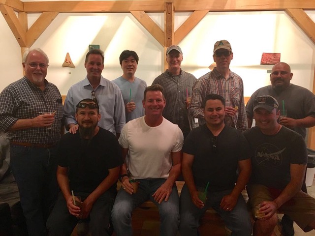
20170622
June 21— UAVSAR L-Band (AFRC C-20A)
-
Assets Deployed
UAVSAR L-Band (AFRC C-20A) Fairbanks
UAVSAR L-Band
21 June Wednesday
Crew briefing at 0845.
On board: Troy Asher, Andy Barry, Peter Griffith, Sam Choi, Tim Miller, Ian “Romeo Foxtrot" Tan.
Takeoff at 0946 for North Slope flight plan https://uavsar.jpl.nasa.gov/cgi-bin/report.pl?planID=PLAN_1141_v02#map
Elchin Jafarov and NGEE team in Barrow doing ground validation measurements.
Line 6 permaf_18519 Deadhorse flatlined with 40km to go. Got the whole thing on the second try.
Post-flight debrief at 1600 local.
Guest walk-through of the plane at 1700.
22 June Thursday
Backup Day
On board: Troy Asher, Andy Barry, Sam Choi, Tim Miller.
Retry lines 2, 3 and 4 from Mackenzie Valley flight plan
https://uavsar.jpl.nasa.gov/cgi-bin/report.pl?planID=PLAN_1132_v05#summary
23 June Friday
Return to Palmdale
Join telecons at:
USA Toll Free #: 1-844-467-4685
Participant Passcode: #: 106475
USA Local/Toll #: 1-720-259-7012
and if needed https://gsfc610.adobeconnect.com/above4/
Attached Files
The Alaska Satellite Facility User Working Group visited the UAVSAR plane and crew.
20170621
June 20— UAVSAR L-Band (AFRC C-20A)
-
Assets Deployed
UAVSAR L-Band (AFRC C-20A) Fairbanks
UAVSAR L-Band
19 June Monday
Update!
https://uavsar.jpl.nasa.gov/cgi-bin/report.pl?planID=PLAN_1133_v01#map
The quicklook product showed that we got enough of line 10 for science, so we don’t need to try again.
20 June Tuesday
Crew briefing at 0845.
On board: Troy Asher, Andy Barry, Peter Griffith, Sam Choi, Tim Miller.
Takeoff at 1035 for Mackenzie Valley flight plan
https://uavsar.jpl.nasa.gov/cgi-bin/report.pl?planID=PLAN_1132_v02#summary
The radar behaved erratically during much of the flight, but we got data from all lines except 3 and 4, which we will consider flying on the backup day.
21 June Wednesday
North Slope flight plan
https://uavsar.jpl.nasa.gov/cgi-bin/report.pl?planID=PLAN_1141_v02#map
Post-flight debrief at 1700 local.
22 June Thursday
Backup Day
23 June Friday
Return to Palmdale
Join telecons at:
USA Toll Free #: 1-844-467-4685
Participant Passcode: #: 106475
USA Local/Toll #: 1-720-259-7012
and if needed https://gsfc610.adobeconnect.com/above4/
Attached Files
" The End of The Road" Tuktoyaktuk, Northwest Territories, Canada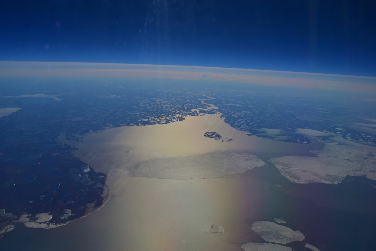
20170620
June 19— UAVSAR L-Band (AFRC C-20A) Mooney (ATM-C)
-
Assets Deployed
UAVSAR L-Band (AFRC C-20A) Palmdale to Yellowknife
ATM-C (Mooney) in Kenai waiting for weather to clear for Whitehorse - Yellowknife
UAVSAR L-Band
19 June Monday
Crew briefing at 0845
On board: Asher, Barry, Griffith, Choi, Miller, and Yunling Lou
Takeoff at 1006 for Seward Peninsula flight plan
https://uavsar.jpl.nasa.gov/cgi-bin/report.pl?planID=PLAN_1135_v01#map
Margaret Torn and the DOE NGEE-Arctic field team were on the Seward Peninsula at Council (line 3).
Line 4: Radar precursor error, circled and acquired. Note the kml isocline file has errors in the flight line (PRE and STO are misplaced).
Line 6 PRMLEG_08502: radar flatlined about 75% completed. Opted not to retry.
Line 8: Radar precursor error, circled and acquired.
Line 10: Radar flatlined, circled to redo x2, failed to complete. Will try again Tuesday or Wednesday.
Post-flight debrief at 1700 local.
20 June Tuesday
Crew briefing at 0845.
Takeoff at 1000 for Mackenzie Valley flight plan
https://uavsar.jpl.nasa.gov/cgi-bin/report.pl?planID=PLAN_1132_v02#summary
Post-flight debrief at 1700 local.
21 June Wednesday
North Slope flight plan
https://uavsar.jpl.nasa.gov/cgi-bin/report.pl?planID=PLAN_1141_v02#map
Post-flight debrief at 1700 local.
22 June Thursday
Backup Day
23 June Friday
Return to Palmdale
ATM-C
19 June Monday
The Mooney flew from Homer to Whitehorse on Sunday and on to Yellowknife Monday to complete campaign #2 (of 6).
Join telecons at:
USA Toll Free #: 1-844-467-4685
Participant Passcode: #: 106475
USA Local/Toll #: 1-720-259-7012
and if needed https://gsfc610.adobeconnect.com/above4/
Attached Files
Yunling Lou and Tim Miller discuss the care and feeding of the L-Band SAR while Sam Choi runs the precision autopilot.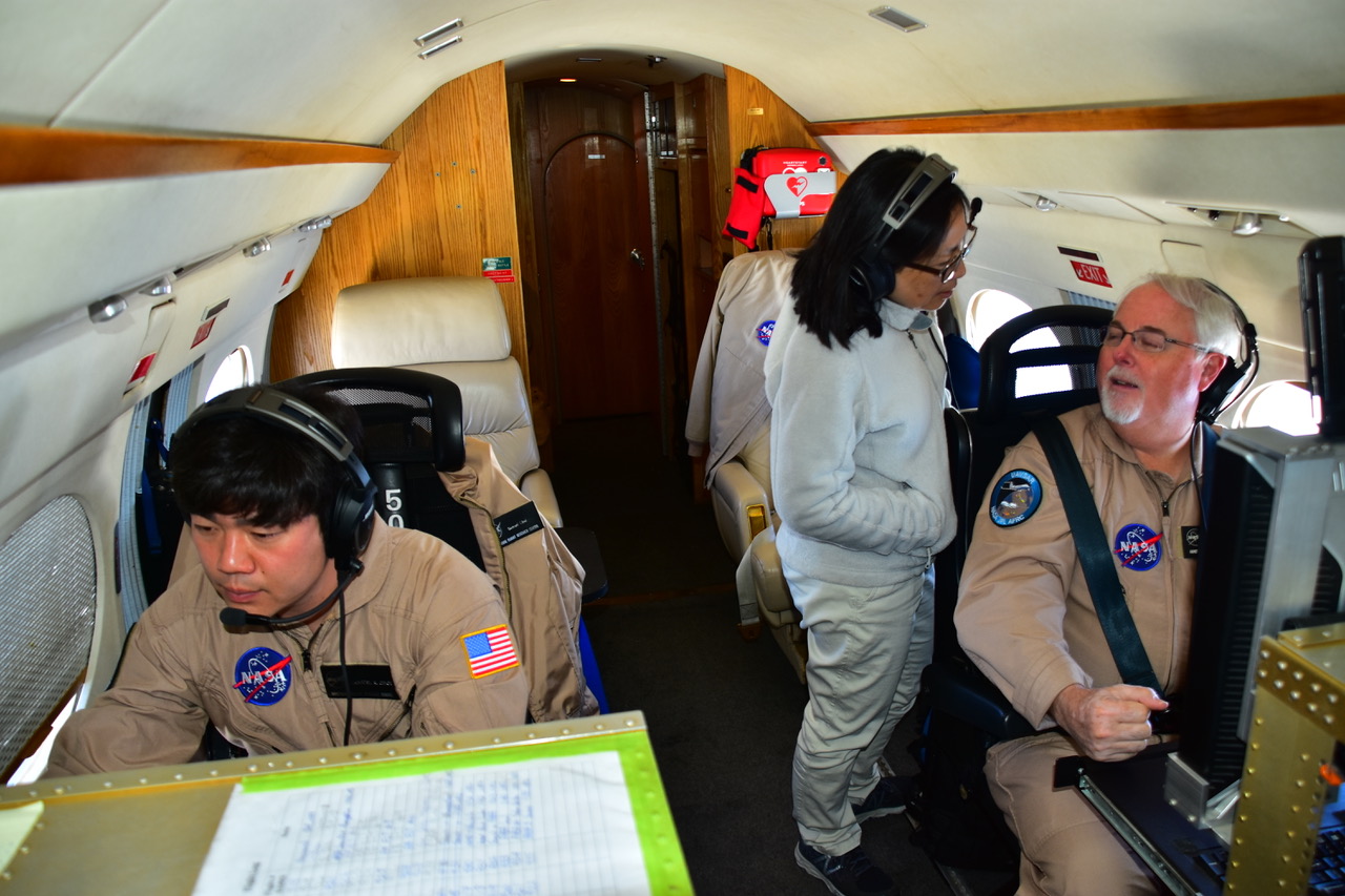
20170619
June 17— UAVSAR L-Band (AFRC C-20A) Mooney (ATM-C)
-
Assets Deployed
UAVSAR L-Band (AFRC C-20A) Palmdale to Yellowknife
ATM-C (Mooney) in Kenai waiting for weather to clear for Whitehorse - Yellowknife
UAVSAR L-Band
17 June Saturday
Post-flight debrief and pre-flight weather telecon at 0800 local Fairbanks.
Takeoff at 1030 for the YK Delta flight plan
https://uavsar.jpl.nasa.gov/cgi-bin/report.pl?planID=PLAN_1135_v03#map
the revised plan includes redoing lines 1 and 5 from https://uavsar.jpl.nasa.gov/cgi-bin/report.pl?planID=PLAN_1140_v02#summary
Radar flatlined during line 4 YUKDEL_26906. Retried successfully.
Radar configuration failed on line 7 poorma_08911. This is the third failure for this line. Nailed it on the 4th try.
There were teams in Delta Junction (Kasischke) and Eight Mile Lake - Denali (Schuur).
Post-flight debrief 1700 local.
18 June Sunday
This day is scheduled as a "hard down" day with no flights.
19 June Monday
Crew briefing at 0845 Craig Dobson and Yunling Lou will join the flight on Monday. Takeoff at 1000 for Seward Peninsula flight plan https://uavsar.jpl.nasa.gov/cgi-bin/report.pl?planID=PLAN_1133_v01#map
Contact me if you're in the field at any of these sites.
Post-flight debrief at 1600 local.
Weather still looking like Mackenzie Valley on Tuesday and North Slope on Wednesday. Stay tuned…
The UAVSAR calendar has the complete timeline of when flights will occur over regions (depending on weather).
If you are doing ground work associated with these flights and want live updates during the course of the flights, email support@cce.nasa.gov and ask to subscribe to above_airborne_live@cce.nasa.gov.
ATM-C
14 June Wednesday
The ATM-C Mooney flew through Delta Junction to Tok, and then to the Kenai Peninsula.
TBD: Fairbanks to Whitehorse to Yellowknife, completing campaign #2.
Join telecons at:
USA Toll Free #: 1-844-467-4685
Participant Passcode: #: 106475
USA Local/Toll #: 1-720-259-7012
and if needed https://gsfc610.adobeconnect.com/above4/
Attached Files
Franz Meyer, ABoVE PI and chief scientist for NASA's SAR archive center, the Alaska Satellite Facility, came by the plane for a walk through.Left to right: John McGrath, Troy Asher, Andy Barry, Peter Griffith, Franz Meyer, Tim Miller.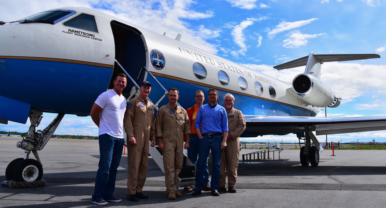
20170617
June 16— UAVSAR L-Band (AFRC C-20A) Mooney (ATM-C)
-
Assets Deployed
UAVSAR L-Band (AFRC C-20A) Palmdale to Yellowknife
ATM-C (Mooney) in Kenai waiting for weather to clear for Whitehorse - Yellowknife
UAVSAR L-Band
16 June Friday
Post-flight debrief and pre-flight weather telecon held at 0730 local Fairbanks.
Takeoff at 1000 for the Southwest Alaska flight plan
https://uavsar.jpl.nasa.gov/cgi-bin/report.pl?planID=PLAN_1140_v02#summary
There was a team in the field at Bonanza Creek.
Military exercises require us to deviate course around closed air space and acquire line 1 manually, losing a few kilometers at the beginning of the line. Radar flatlined during Line 5. We re-flew it but had the same issue with the radar. We will re-try both lines on Saturday.
17 June Saturday
Post-flight debrief and pre-flight weather telecon at 0800 local Fairbanks.
Takeoff at 1030 for the YK Delta flight plan
https://uavsar.jpl.nasa.gov/cgi-bin/report.pl?planID=PLAN_1135_v02#map
There will be teams in Delta Junction and Eight Mile Lake (Denali).
18 June Sunday
This day is scheduled as a "hard down" day with no flights.
The UAVSAR calendar has the complete timeline of when flights will occur over regions (depending on weather).
If you are doing ground work associated with these flights and want live updates during the course of the flights, email support@cce.nasa.gov and ask to subscribe to above_airborne_live@cce.nasa.gov.
ATM-C
14 June Wednesday
The ATM-C Mooney flew through Delta Junction to Tok, and then to the Kenai Peninsula.
TBD: Fairbanks to Whitehorse to Yellowknife, completing campaign #2.
Join telecons at:
USA Toll Free #: 1-844-467-4685
Participant Passcode: #: 106475
USA Local/Toll #: 1-720-259-7012
and if needed https://gsfc610.adobeconnect.com/above4/
Attached Files
Cone of the volcano Ugashik-Peulik shrouded by clouds.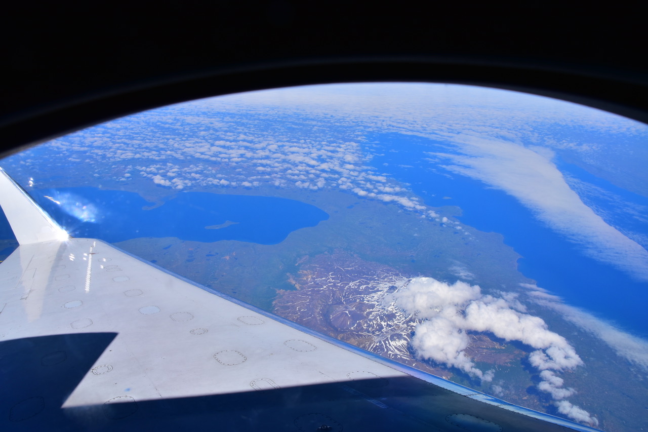
20170616
June 15— UAVSAR L-Band (AFRC C-20A) Mooney (ATM-C)
-
Assets Deployed
UAVSAR L-Band (AFRC C-20A) Palmdale to Yellowknife
ATM-C (Mooney) in Kenai waiting for weather to clear for Whitehorse - Yellowknife
UAVSAR L-Band
15 June Thursday
Takeoff at 1200 for Transit to Fairbanks https://uavsar.jpl.nasa.gov/cgi-bin/report.pl?planID=PLAN_1143_v02#map
Eric Kasischke and team were in the field at Delta Junction.
10 of 10 lines collected.
16 June Friday
Post-flight debrief and pre-flight weather telecon at 0730 local Fairbanks.
Takeoff at 1000 for the Southwest Alaska flight plan
https://uavsar.jpl.nasa.gov/cgi-bin/report.pl?planID=PLAN_1140_v02#summary
There will be a team in the field at Bonanza Creek.
17 June Saturday
Post-flight debrief and pre-flight weather telecon at 0800 local Fairbanks.
Takeoff at 1030 for the YK Delta flight plan
https://uavsar.jpl.nasa.gov/cgi-bin/report.pl?planID=PLAN_1135_v02#map
There will be teams in Delta Junction and Eight Mile Lake (Denali).
The UAVSAR calendar has the complete timeline of when flights will occur over regions (depending on weather).
If you are doing ground work associated with these flights and want live updates during the course of the flights, email support@cce.nasa.gov and ask to subscribe to above_airborne_live@cce.nasa.gov.
ATM-C
14 June Wednesday
The ATM-C Mooney flew through Delta Junction to Tok, and then to the Kenai Peninsula.
TBD: Fairbanks to Whitehorse to Yellowknife, completing campaign #2.
Join telecons at:
USA Toll Free #: 1-844-467-4685
Participant Passcode: #: 106475
USA Local/Toll #: 1-720-259-7012
and if needed https://gsfc610.adobeconnect.com/above4/
Attached Files
The glaciers of Kluane National Park in Yukon punched through the clouds for a moment.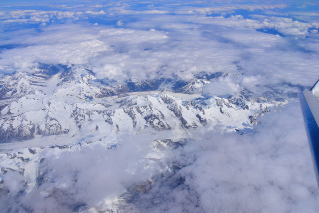
20170615_1
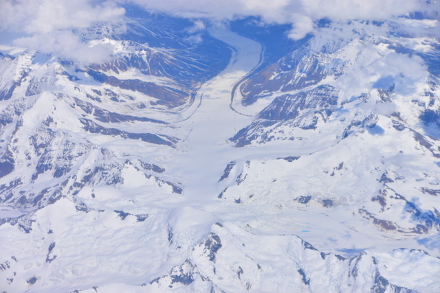
20170615_2

20170615_3
June 14— UAVSAR L-Band (AFRC C-20A) Mooney (ATM-C)
-
Assets Deployed
UAVSAR L-Band (AFRC C-20A) Palmdale to Yellowknife
ATM-C (Mooney) in Fairbanks waiting for weather to clear for Whitehorse - Yellowknife
UAVSAR L-Band
14 June Wednesday
Post-flight debrief and pre-flight weather telecon at 0830 local.
Takeoff at 1100 local for Flight Plan Great Slave Lake Region https://uavsar.jpl.nasa.gov/cgi-bin/report.pl?planID=PLAN_1142_v02#map
Line 1 wrigle_15406: radar reset itself at about 80% completion.
In contrast to the end of May, Great Slave Lake is now ice-free, but Great Bear Lake still has 80% ice cover.
The larger lakes out by Daring Lake are still ice covered, and there’s a bit of snow left on north-facing slopes.
There was a field team at Scotty Creek.
VIP walk-through after landing (1600 local) was a great success, attracting about 30 people.
15 June Thursday
Telecon time TBA. Transit to Fairbanks https://uavsar.jpl.nasa.gov/cgi-bin/report.pl?planID=PLAN_1143_v02#map
Eric Kasischke will be in the field at Delta Junction.
16 June Friday
Southwest Alaska flight plan
https://uavsar.jpl.nasa.gov/cgi-bin/report.pl?planID=PLAN_1140_v02#summary
There will be a team in the field at Bonanza Creek.
The UAVSAR calendar has the complete timeline of when flights will occur over regions (depending on weather).
If you are doing ground work associated with these flights and want live updates during the course of the flights, email support@cce.nasa.gov and ask to subscribe to above_airborne_live@cce.nasa.gov.
ATM-C
14 June Wednesday
The ATM-C Mooney flew through Delta Junction to Tok, and then to the Kenai Peninsula.
TBD: Fairbanks to Whitehorse to Yellowknife, completing campaign #2.
Join telecons at:
USA Toll Free #: 1-844-467-4685
Participant Passcode: #: 106475
USA Local/Toll #: 1-720-259-7012
and if needed https://gsfc610.adobeconnect.com/above4/
Attached Files
This young Yellowknifer's t-shirt says "Forget Princess, I want to be an Astrophysicist". She was very excited to tour a NASA aircraft. Her father participated in the Earth to Sky Workshop in April 2017.
20170614
June 13— Mooney (ATM-C) UAVSAR L-band
-
Assets Deployed
UAVSAR L-Band (AFRC C-20A) Palmdale to Yellowknife
ATM-C (Mooney) in Fairbanks waiting for weather to clear for Whitehorse – Yellowknife
UAVSAR L-Band
13 June Tuesday
1225 local departure for direct transit and science flight Palmdale to Yellowknife.
Flight Plan https://uavsar.jpl.nasa.gov/cgi-bin/report.pl?planID=PLAN_1134_v02#map
Collected 7 of 7 data lines. However, the radar flatlined about 60% into line 1 causing loss of a fraction of the line. With quick work Tim manually restarted and successfully acquired the final segment of the line into the Ft. McMurray area. We expect to have the quicklook product 24 hours after we arrive in Fairbanks. When we have the quicklook we can assess how much of line 1 we acquired. Because of Tim's quick work I am optimistic that it will be a high percentage and will be useful for Larry Smith's and Laura Bourgeau–Chavez's needs. Radar and PPA performed properly for lines 2-7.
14 June Wednesday
Post-flight debrief and pre-flight weather telecon at 0830 local.
Takeoff at 1100 local for Flight Plan Great Slave Lake Region https://uavsar.jpl.nasa.gov/cgi-bin/report.pl?planID=PLAN_1142_v02#map
VIP walk-through after landing (1600 local).
15 June Thursday
Telecon time TBA.
Transit to Fairbanks https://uavsar.jpl.nasa.gov/cgi-bin/report.pl?planID=PLAN_1143_v02#map
The UAVSAR calendar has the complete timeline of when flights will occur over regions (depending on weather).
If you are doing ground work associated with these flights and want live updates during the course of the flights, email support@cce.nasa.gov and ask to subscribe to ABoVE live emails.
ATM-C
13 June Tuesday
The ATM-C completed a "flight of opportunity" to revisit the North Slope because weather was good and bad in Whitehorse. Acquired data from Ivotuk – Atqasuk-Barrow-Deadhorse-Umiat-Toolik and back to Fairbanks.
14 June Wednesday
Fairbanks to Whitehorse to Yellowknife, completing campaign #2.
Attached Files
20170613
June 11— Mooney (ATM-C) UAVSAR L-band
-
Assets Deployed
UAVSAR L-Band (AFRC C-20A) Palmdale to Yellowknife
ATM-C (Mooney) in Fairbanks waiting for weather to clear for Whitehorse - Yellowknife
UAVSAR L-Band
11 June Sunday
Peter Griffith flew commercially from Fairbanks to Burbank - Palmdale to be the "SOB" for L-Band flights.
1800 local Palmdale weather and ops telecon.
12 June Monday
0900 local departure for transit and science flight Palmdale to Yellowknife, with customs and refueling in Calgary.
Flight Plan https://uavsar.jpl.nasa.gov/cgi-bin/report.pl?planID=PLAN_1134_v02#map
ETA Yellowknife is 2000 local, too late for a telecon on Monday.
13 June Tuesday
Post-flight and pre-flight weather telecon at 1000 local.
Take off at 1300 local for Flight Plan “Great Slave Lake Region" https://uavsar.jpl.nasa.gov/cgi-bin/report.pl?planID=PLAN_1142_v02#map
The UAVSAR calendar has the complete timeline of when flights will occur over regions (depending on weather).
If you are doing ground work associated with these flights and want live updates during the course of the flights, email support@cce.nasa.gov and ask to subscribe to the ABoVE live emails.
ATM-C
11 June Sunday
The ATM-C pilots Justin and Bear are making great headway on campaign #2, having gone Yellowknife to Inuvik to Fairbanks to Nome and back to Fairbanks. They got in late Friday night after a grueling 10 hour flight (1500 nm) and will take a day to rest and relax. Weather does not look great for heading back to Yellowknife and Whitehorse until Tuesday.
Attached Files
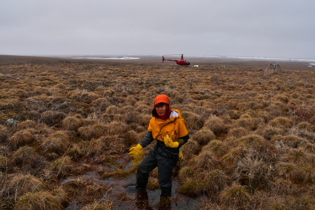
20170611_1
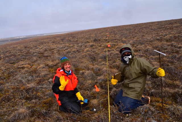
20170611_2
June 7—UAVSAR P-band (AirMOSS) Mooney (ATM-C) UAVSAR L-band
-
Assets Deployed
UAVSAR P-Band (JSC G-III) Fairbanks
UAVSAR L-Band (AFRC C-20) Palmdale
ATM-C (Mooney) Yellowknife
UAVSAR P-band (AirMOSS)
6 June Tuesday
Take of at 1054 for the North Slope plan. Go Iwahana and crew were at the Anaktuvuk Fire Scar.
Lines 7, 8 from https://uavsar.jpl.nasa.gov/cgi-bin/report.pl?planID=PLAN_745_v03#summary
Lines 1, 2, 3 from https://uavsar.jpl.nasa.gov/cgi-bin/report.pl?planID=PLAN_1117_v01#summary
Line 9 from https://uavsar.jpl.nasa.gov/cgi-bin/report.pl?planID=PLAN_745_v03#summary
All lines were completed without incident. Go reported that it was snowing on him and his team.
Landed Fairbanks 1454
1600 Post-flight telecon
7 June Wednesday
The aircraft will return to AFRC in Palmdale to unload the radar pod and the data recorder for use for the UAVSAR L-Band flights.
Chip Miller ("LAX") will return to Palmdale with the crew.
UAVSAR L-Band
8 June Thursday
Integration of data recorder and engineering testing.
11 June Sunday
Peter Griffith will fly commercially from Fairbanks to Burbank - Palmdale to be the "SOB" for L-Band flights.
12 June Monday
Transit and science flight Palmdale to Yellowknife.
The UAVSAR calendar has the timeline of when flights will occur over regions (and soon with links to specific swaths).
ATM-C
June 6 Tuesday
Science flight from Yellowknife to Daring Lake and return.
Science flight from Yellowknife to Inuvik, weather permitting.
Overnight in Inuvik.
June 7 Wednesday
Science flight from Inuvik to Fairbanks to Deadhorse, weather permitting.
Overnight in Deadhorse.
June 8
Deadhorse to Barrow and other North Slope points of interest.
Destination Nome, weather permitting.
Attached Files
20170607.jpeg
June 6—UAVSAR P-band (AirMOSS)
-
Instrument: UAVSAR P-band (AirMOSS)
5 June Monday
1200 Officially returned to service after a test flight with flight crew (T-Rex, Duster, Rocky)
Actually took for the Science flight at 1406. Flew the Mackenzie Valley plan.
https://uavsar.jpl.nasa.gov/cgi-bin/report.pl?planID=PLAN_1115_v01#summary
With T-Rex, Duster, Rocky, Thor, SOB, LAX on board
Circled 3 times at line 1 (once for PPA misbehavior, twice for Radar)
Line 2 was flown with a navigation issue with PPA that will have to be assessed. This could require recalculation of the L-Band and AirSWOT lines. There are no ground sites in this swath.
Landed 2006, too late for a telecon.
Science summary to come after Quick Looks are produced.
6 June Tuesday
Estimated take of at 1100 for the North Slope plan. Go Iwahana and crew are at the Anaktuvuk Fire Scar.
Lines 7, 8 from https://uavsar.jpl.nasa.gov/cgi-bin/report.pl?planID=PLAN_745_v03#summary
Lines 1, 2, 3 from https://uavsar.jpl.nasa.gov/cgi-bin/report.pl?planID=PLAN_1117_v01#summary
Line 9 from https://uavsar.jpl.nasa.gov/cgi-bin/report.pl?planID=PLAN_745_v03#summary
1600 Post-flight telecon
7 June Wednesday
The aircraft will return to AFRC in Palmdale to unload the radar pod and the data recorder for use for the UAVSAR L-Band flights.
Chip Miller ("LAX") will return to Palmdale with the crew.
Some of you have asked for a best-guess schedule for L-Band flights. The UAVSAR calendar has the timeline of when flights will occur over regions (and soon with links to specific swaths). Departure Palmdale to Yellowknife will be on 12 June if all goes well.
Signing off with this photo of a Boreal Owl, who was not on our flight because she was busy protecting her eggs.
Attached Files
20170606.jpeg
June 4—UAVSAR P-band (AirMOSS)
-
Instrument: UAVSAR P-band (AirMOSS)
4 June Sunday
Repairs on the G-III look good for a flight Monday.
5 June Monday
0800 Officially return to service after a test flight with flight crew (T-Rex, Duster, Rocky)
1130 Science flight. Weather conditions favor flying the Mackenzie Valley plan first.
https://uavsar.jpl.nasa.gov/cgi-bin/report.pl?planID=PLAN_1115_v01#summary
With T-Rex, Duster, Rocky, Thor, SOB, LAX on board
1800 Post-flight telecon
6 June Tuesday
1000 North Slope plan
https://uavsar.jpl.nasa.gov/cgi-bin/report.pl?planID=PLAN_1117_v01#summary
plus lines 6-10 from https://uavsar.jpl.nasa.gov/cgi-bin/report.pl?planID=PLAN_745_v03#summary
1600 Post-flight telecon
7 June Wednesday
The aircraft will return to AFRC in Palmdale to unload the radar pod and the data recorder for use for the UAVSAR L-Band flights.
Some of you have asked for a best-guess schedule for L-Band flights. The UAVSAR calendar has the timeline of when flights will occur over regions (and soon with links to specific swaths). Departure Palmdale to Yellowknife will be on 12 June if all goes well.
This is flying weather!
Attached Files

20170604.jpeg
June 2—UAVSAR P-band (AirMOSS)
-
Instrument: UAVSAR P-band (AirMOSS)
2 June Friday
Repairs on the G-III continue. Most of the required disassembly was completed today while we wait for parts to arrive.
Flights will resume no earlier than Monday June 5. Stay tuned.
After the North Slope and Mackenzie Valley flights are completed, the aircraft will return to AFRC in Palmdale to unload the radar pod and the data recorder for use for the UAVSAR L-Band flights.
Some of you have asked for a best-guess schedule for L-Band flights. The UAVSAR calendar has the timeline of when flights will occur over regions (and soon with links to specific swaths), assuming direct transit to Palmdale on June 7 (this is optimistic and will be revised as needed).
June 1—UAVSAR P-band (AirMOSS)
-
Instrument: UAVSAR P-band (AirMOSS)
1 June Thursday
Repairs on the G-III that was struck by lightning require replacement of the left elevator. The replacement elevator will be trucked from Georgia to Kentucky where it will fly into Anchorage, Alaska, then be trucked into Fairbanks for delivery Saturday.
Flights will resume no sooner than Monday. Stay tuned.
After the North Slope and Mackenzie Valley flights are completed next week, the aircraft will return to AFRC in Palmdale to unload the radar pod and the data recorder for use for the UAVSAR L-Band flights.
US Army Corp of Engineers CRREL long-term study site near Fairbanks
Attached Files
20170602.png
May 31—UAVSAR P-band (AirMOSS)
-
Attached please find the 2017 AAC daily report for AirMOSS flight #6 (Flight Plan 1116 v02) covering the Seward Peninsula, Noatak, southern North Slope, and Yukon Flats NWR.
The crew are all safe after a lightning strike to the plane at the end of the flight; however, further acquisitions are on hold until the plane can be inspected and any necessary repairs implemented.
Attached Files
2017-05-29 - AirMOSS (P-band SAR) - Seward Peninsula - 2017 AAC Daily Report - v2.pptx
May 30—UAVSAR P-band (AirMOSS)
-
Instrument: UAVSAR P-band (AirMOSS)
30 May Tuesday
The G-III was struck by lightning yesterday just prior to landing. As a result, there are some inspections and possibly mechanical work that need to be performed before we can fly again. There won't be flights today or tomorrow, and probably not for the rest of this week. I will provide another update tomorrow when we have more information. Please stay tuned.
There will not be a telecon today (30 May 2017).
Trailing edge of the underside of the left elevator. Bright spots are bare metal reflecting the camera flash.
Attached Files
20170530
May 29—UAVSAR P-band (AirMOSS)
-
Instrument: UAVSAR P-band (AirMOSS)
- lines 2, 3, 4, 6 of legacy plan
- all 3 lines in https://uavsar.jpl.nasa.gov/cgi-bin/report.pl?planID=PLAN_1129_v01#flightPlan
- lines 4, 5, 6: Yukon Flats Landed at 1512 local Fairbanks
- 1. nwells_30013 – red
- 2. gdhope_31616 – red
- 3. aklavi_25701 – green
- 4. mcpher_05604 – red
- 5. tukhwy_01812 – red
- 6. oldcro_20605 – red
- 7. oldcro_24400 – yellow
- 7. permaf_34505 red
- 8. permaf_15010 red from https://uavsar.jpl.nasa.gov/cgi-bin/report.pl?planID=PLAN_1117_v01#summary
- 1. calmns_04600 green
- 2. permaf_16404 red
- 3. permaf_34407 red from https://uavsar.jpl.nasa.gov/cgi-bin/report.pl?planID=PLAN_745_v03#summary
- 9. permaf_18517 red
29 May Monday
Weather check at 0830
Take off at 1012 local Fairbanks for SW Alaska.
Crew: Ryan ("T-Rex"), "Duster", Chao ("Thor"), Elliot, Miller ("SOB") Seward Peninsula successfully completed:
30 May Tuesday
Estimated take of at 1000 local Fairbanks
Mackenzie Valley
31 May Wednesday
Estimated take of at 1000 local Fairbanks
North Slope from https://uavsar.jpl.nasa.gov/cgi-bin/report.pl?planID=PLAN_745_v03#summary
red= must fly; yellow= refly next day if possible; green= attempt but don't refly
Attached Files
20170529_1.jpeg
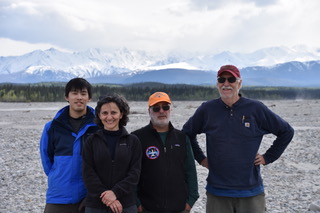
20170529_2.jpeg
20170529_3.jpeg
May 29—UAVSAR P-band (AirMOSS)
-
Attached please find the 2017 AAC daily report for AirMOSS flight #5 (Flight Plan 1114) covering the YK Delta and Innoko NWRs. Extra fuel and flight time allowed us to pick up 4 lines from Flight plan 1116 as well.
Good flying conditions and radar operation have enabled us to accelerate a number of planned acquisitions. We will continue to adjust flight plans with this strategy as the situation allows.
Attached Files
2017-05-27 - AirMOSS (P-band SAR) - YK Delta - 2017 AAC Daily Report
May 28—UAVSAR P-band (AirMOSS)
-
Today, Sunday 28 May, is a hard down day for the ABoVE AirMOSS team in Fairbanks. Eric Kasichke is leading a tour of fire burn scars south of Delta Junction for the scientists.
We plan to resume flights again on Monday 29 May with a flight covering the Seward Peninsula, lines on the southern edge of the North Slope, and in the Yukon Flats. Working hard on weekends and holidays, as always when in the field.
May 27—UAVSAR P-band (AirMOSS)
-
Attached please find the 2017 AAC daily report for AirMOSS flight #5 (Flight Plan 1114) covering the YK Delta and Innoko NWRs. Extra fuel and flight time allowed us to pick up 4 lines from Flight plan 1116 as well.
Good flying conditions and radar operation have enabled us to accelerate a number of planned acquisitions. We will continue to adjust flight plans with this strategy as the situation allows.
Attached Files
2017-05-27 - AirMOSS (P-band SAR) - YK Delta - 2017 AAC Daily Report
May 26—UAVSAR P-band (AirMOSS)
-
Attached please find the 2017 AAC daily report for AirMOSS flight #4 (Flight Plan 1121) – a tour of the Southwest Alaska Network (SWAN) vegetation and soil moisture ground truth. Extra fuel and flight time allowed us to pick up 2 lines from Flight plan 1114 as well.
Attached Files
2017-05-26 - AirMOSS (P-band SAR) - SW Alaska-YK Delta - 2017 AAC Daily Report
May 26—UAVSAR P-band (AirMOSS)
Instrument: UAVSAR P-band (AirMOSS)
-
Today's flight: Southwest Alaska / Delta Junction; takeoff: 1000 ADT, landing:
- 6 lines of PLAN_1121 flownLine 1 had to be attempted out of order as airplane could not get to altitude in time
- Line 3 had recorder issues and file did not close properly; will need Joanne's magic to recover data
- Also flew lines 1and 6 of PLAN_1114 over Delta Junction (part of YK Delta plan)
- No PPA problems
- Clouds throughout; no major precip
- Kasischke and Chen in the field at Delta Junction
- Next flights: 27 May 2017, Yukon Delta, plus one line from Seward Peninsula plan; takeoff: 1030 ADT (transmit window opens 1000 ADT)
- Latest flight plans: Yukon Delta: have only lines 2, 3, 4, 5 left to do
- Seward Peninsula: lines 1 and 6
- Crew: Ryan ("T-Rex"), Reagan ("Bonz"), Chao ("Thor"), Elliot, Margolis (“ 'card”), Miller, Moghaddam
- Airplane status, NASA 992 (NASA2): nominal, no issues
- Radar status: nominal, no issues
- Spectrum authorization status:
- Authorization was received per Bruce Klein: "UAVSAR P-band is authorized to transmit with the following restriction on May 27, 2017 ADT: Operation: Alaska, AK. Start: 10:00 ADT May 27, Stop: 23:59 ADT May 27, (May 27/1700–May 27/0659 UTC), Max Alt: 41K feet."
-
Weather over YK Delta lines:
- Chevak: https://www.wunderground.com/q/zmw:99563.1.99999
- Newton: https://www.wunderground.com/q/zmw:99690.6.99999
- Skageluk: https://www.wunderground.com/q/zmw:99665.1.99999 (*some chance of rain 27 May)
- Field crew:
- Kasischke & Chen continuing measurements at Delta Junction
- Next telecon: 27 May 2017, 16:30 ADT / 17:30 PDT
- Please note ABoVE science phone number (not the AirMOSS radar number): 1-844-467-4685 ….106475
- Will run through the agenda items as above
- Other notes:
- Peter checked with NGEE arctic for Sew-Pen field work and they won't be ready until Monday 29 May. However, JJ Frost and Kevin Schaefer don't have restrictions for field work for YK Delta and therefore we can fly those lines Saturday 27 May.
- Radar GPS receiver license expires on June 1; Yunling working license renewal; with advancing flights by one day we hope to be done by 31 May.
- Abhishek et al. will be providing weather briefings for flight lines starting Tuesday 30 May 2017; Seward Peninsula shows precip tomorrow
- Peek ahead:
- 28 May 2017: down day; Griffith, Margolis, Moghaddam joining Kasischke and Chen in the field at Delta Junction
- 29 May 2017: Seward Peninsula
- Latest flight plan for Seward Peninsula–lines 4,7,9 are new lines; the rest are legacy lines
- Weather– Seward Peninsula lines:
- General notes (repeated):
- If PPA deviates more than 30m, still press forward and collect.
- Joanne is regularly uploading radar quick-look image products: check subfolder for each flight under the Quicklook Images folder
- Radar telecon notes will be sent to JSC team, radar instrument team, radar science team, ABoVE leadership. Peter and/or Chip will forward to larger science team.
- On the flight plan link, be sure to check “mission guidelines” to see designation of each line as red, yellow, or green. In case of mid-flight hiccups, colors mean the following: Red: must re-take, yellow: re-take if time and fuel allow, green: proceed without re-taking. For red and yellow re-takes, scientist on-board will make call whether enough of the line has been acquired to proceed or not. If no scientist on-board, need to make sure locations of that day's field surveys have been collected.
- All radar flights will be acquired as “repeat pass InSAR” and therefore PPA must operate within the nominal tube (30 m is sufficient for P-band; radar operator to make call by looking at the tube plot)
May 25—UAVSAR P-band (AirMOSS)
-
Instrument: UAVSAR P-band (AirMOSS)
25 May
Take off was at 1010 local Yellowknife for Transit to Fairbanks.
Crew: Ryan ("T-Rex"), Reagan ("Bonz"), Chao ("Thor"), Elliot, Fennel, Scott, Shimada, Griffith ("S.O.B."), Margolis, Kasischke.
Line #5 that was skipped on 22 May was acquired first
Followed by transit to Fairbanks via Slave River Delta, Lake Kakisa, Scotty Creek, Ft. Liard, Watson Lake, Wolf Creek, Kluane, Tok, Delta Junction.
The first 7 lines of the plan were acquired, although time was spent restarting two lines. We had to skip lines 8 and 9 at Kluane Lake to maintain fuel reserves required at landing. Radar had to be reset on Line 11 at around 50% complete. Peter elected not to re-fly it in order to preserve Lines 12/13 at Delta Junction which were flown without incident. Landed at 1422 local in Fairbanks.
Quick-looks will be sent in the next 48 hours.
26 May
Weather check at 0830
Estimated take of at 1000 local Fairbanks for SW Alaska. Crew: Ryan ("T-Rex"), Reagan ("Bonz"), Chao ("Thor"), Elliot, Griffith ("S.O.B"), Moghaddam
Weather permitting, we will fly the SW Alaska plan with the addition of line 6 (Delta Junction) from plan
Post-flight telecon at 1530 local Fairbanks.
27 May
Likely to fly YK Delta
28 May
Down day.
May 25—UAVSAR P-band (AirMOSS)
-
Attached please find the 2017 AAC daily report for AirMOSS flight #3 – a transit from Yellowknife NT to Fairbanks AK. Key acquisitions occurred over the Slave River Delta (Fort Resolution), Scotty Creek, Fort Liard, Kluane Lake, and Delta Junction.
Fuel and time pressures forced the descope of 2 lines over Kluane Lake, but these will be acquired with L-band radar and the optical sensors later in the campaign.
Attached Files
2017-05-25 - AirMOSS (P-band SAR) - Yellowknife-Fairbanks - 2017 AAC Daily Report.pptx
May 23—UAVSAR P-band (AirMOSS)
23 May
Take off was at 0931 local Yellowknife for Great Slave Lake Region.
Crew: Ryan ("T-Rex"), Reagan ("Bonz"), Chao ("Thor"), Elliot, Griffith
Successful completion of Flight Plan
Line #5 from 22 May was not acquired.
Kasischke and team were in the field around Ft. Providence.
Update on that is coming soon.
Post-flight telecon was held at 1800 local.
24 May
Backup Day.
Open House for Yellowknifers 1600-1800.
Pre-flight telecon at 1800 local.
25 May
Estimated take off 1000 local Yellowknife for Transit to Fairbanks.
Crew: Ryan ("T-Rex"), Reagan ("Bonz"), Chao ("Thor"), Elliot, Fennel, Scott, Shimada, Griffith, Margolis, Kasischke.
Line #5 from 22 May will be acquired first
Followed by transit to Fairbanks via Slave River Delta, Lake Kakisa, Scotty Creek, Ft. Liard, Watson Lake, Wolf Creek, Kluane, Tok, Delta Junction.
https://uavsar.jpl.nasa.gov/cgi-bin/report.pl?planID=PLAN_1119_v02#summary
Post-flight telecon at 1800 local Fairbanks.
Attached Files
Image 1
May 23—UAVSAR P-band (AirMOSS)
22 May
Take off was at 1000 local from Palmdale CA; landed 1700 local in Yellowknife.
Crew: Ryan ("T-Rex"), Reagan ("Bonz"), Chao ("Thor"), Elliot, Fennel, Griffith, Scott, Shimada.
Flight Plan
The first four out of five flight lines were acquired. If conditions allow, we will do the 5th on May 23.
Chip Miller will send a full report when quick looks are available in the next 24 hours or so.
23 May
Estimated take off 1000 local Yellowknife for Great Slave Lake Region.
Crew: Ryan ("T-Rex"), Reagan ("Bonz"), Chao ("Thor"), Elliot, Griffith, Margolis (tentative).
Flight Plan
Plus line #5 from 22 May if possible.
Post-flight telecon at 1800 local.
24 May
Backup Day.
Open House for Yellowknifers 1600-1800.
Attached Files
Image 1
Image 2
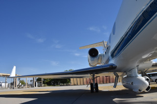
Image 3
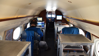
Image 4
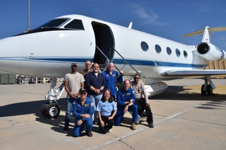
Image 5
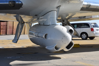
Image 6
May 22—UAVSAR P-band (AirMOSS)
Thanks to Mahta for the excellent telecon notes. We will forward a post-flight daily summary after the flight.
Looking ahead:
Mon 22 May: Transit Palmdale – Yellowknife
Tues 23 May: Fort Providence & Fort Simpson areas
Telecon notes, 17:00 PDT 21 May 2017
Instrument: UAVSAR P-band (AirMOSS)
-
Next flights: 22 May 2017, Palmdale transit to Yellowknife via Ft. McMurray, PA Delta, Ft. Smith. Takeoff 10:00 PDT, ETA Yellowknife
17:30 MDT
Flight plan
Crew: Ryan ("T-Rex"), Reagan ("Bonz"), Chao ("Thor"), Elliot, Fennel, Griffith, Scott, Shimada - Airplane status, NASA 992 (NASA2): nominal, no issues
- Radar status: nominal, no issues (flatlines experienced during two of the engineering flight lines last week but successful re-start)
- Spectrum authorization status: non needed for Canada; DIP clearances in hand
- Weather: no adverse conditions expected
anywhere within planned lines
Ft. McMurray
Ft. Chipewyan
Ft. Smith
Ft. Resolution
Yellowknife
Peek ahead for 23 May 2017 flights:
Latest flight plan
Rae-Edzo
Ft. Providence
Ft. Simpson - Field crew: none for this set of flights.
- Other notes:
–On the flight plan link, be sure to check "mission guidelines" to see designation of each line as red, yellow, or green. In case of mid-flight hiccups, colors mean the following: Red: must re-take, yellow: re-take if time and fuel allow, green: proceed without re–taking. For red and yellow re-takes, scientist on-board will make call whether enough of the line has been acquired to proceed or not. If no scientist on-board, need to make sure locations of that day's field surveys have been collected.
–All radar flights will be acquired as "repeat pass InSAR" and therefore PPA must operate within the nominal tube (30 m is sufficient for P-band; radar operator to make call by looking at the tube plot)
May 21—UAVSAR P-band (AirMOSS)
-
Instrument: UAVSAR P-band (AirMOSS)
Today: 21 May
We are go for May 22 Transit to Yellowknife
Airplane status, NASA 992 (NASA2): nominal, no issues
Radar status: nominal, no issues (flatlines experienced during two of the engineering flight lines last week but successful re-start)
Spectrum authorization status: non needed for Canada; DIP clearances in hand
Weather: no adverse conditions expected anywhere within planned lines
24 hours: 22 May
Estimated take off 1000 local Palmdale CA for Transit to Yellowknife
Crew: Ryan ("T-Rex"), Reagan ("Bonz"), Chao ("Thor"), Elliot, Fennel, Griffith, Scott, Shimada
Flight Plan https://uavsar.jpl.nasa.gov/cgi-bin/report.pl?planID=PLAN_1118_v01#summary
Subscribers to the ABoVE Airborne Live list will get an email at takeoff.
Operational go/no go telecon 1900 local Yellowknife for 23 May flight
Teams positioned at tomorrow's sites may report conditions by joining the telecon or by email or text
48 hours: 23 May
Estimated take off 1000 local Yellowknife for Great Slave Lake Region
Flight Plan https://uavsar.jpl.nasa.gov/cgi-bin/report.pl?planID=PLAN_1120_v01#summary
May 20—UAVSAR P-band (AirMOSS)
-
Today:
20 May
No flights
24 hours:
21 May
Operational go/no go telecon 1700 local Palmdale CA
Teams positioned at tomorrow's sites may report conditions by joining the telecon or by email or text
48 hours:
22 May
Go/no go at 0800 local
Estimated take off 1000 local Palmdale CA
Flight Plan https://uavsar.jpl.nasa.gov/cgi-bin/report.pl?planID=PLAN_1118_v01#summary
Subscribers to our Airborne Live list will get an email at takeoff
May 18—UAVSAR P-band (AirMOSS)
-
NASA and the Government of Northwest Territories are having an open house for the public to visit the G-III in Yellowknife, on May 24th, nominally a "down day" according to the plan.
Attached Files
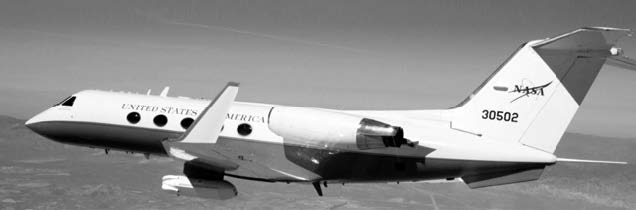
NASA G–III Aircraft Open House
May 16—UAVSAR P-band (AirMOSS) UAVSAR L-band
-
The AirMOSS instrument on the JSC G-III is scheduled to depart Palmdale CA on Monday May 22. Estimated 1000L departure from KPMD, and arrival into CYZF around 1630L. First data collections will be done during transit to Yellowknife. AirMOSS will be in Fairbanks by May 25 and return south June 1.
Note that the UAVSAR instrument on the AFRC C-20 will head north about a week after the return of AirMOSS.
Please use the UAVSAR Calendar to view both UAVSAR and AirMOSS scheduling. Each day of the week has a flight plan with site names and a link to show the location of the swaths and the planned timing to reach each swath during the course of the flight. Find the UAVSAR Calendar, the overall deployment schedule, and much more, on the Airborne Dashboard
May 4—Mooney (ATM-C)
-
The NASA Airborne Tracker shows the ATM-C team nearing Fort Liard on their way to Yellowknife 1347 PDT/2047 UTC
https://airbornescience.nasa.gov/tracker/#!/map?callsign=N617DH&mapid=hybrid&zoom=6&lat=60.1593&lng=-124.2092&n0q=
May 4—Mooney (ATM-C) on May 3
-
The ATM-C team flew from Fairbanks to Whitehorse YT. They plan to stay ahead of the weather and fly from Whitehorse to Yellowknife NT today Thursday 4 May. That would complete the first ABoVE domain circuit for 2017.
May 4—Mooney (ATM-C) on May 1
-
On Monday 1 May the AMT-C team executed a marathon 1400 nautical mile excursion from Nome across the North Slope to Fairbanks. Conditions across the North Slope were still frigid, but areas south of the Brooks Range showed significant signs of thaw. Attached please find the summary of that flight.
Thanks to Colm and Justin for the photos and to Kathryn and Sonja for data analysis.
Attached Files
2017-05-01 - Atmospheric C - Nome-North Slope-Fairbanks - 2017 AAC Daily Report
May 4—Mooney (ATM-C) on Apr 30
-
The ATM–C team flew a 2–leg sortie from Fairbanks – Bethel – Nome on Sunday 30 April. Interior Alaska showed regions of mixed snow and exposed land, with corresponding enhancements in the near surface CO2 and CH4 signals. Western Alaska still seemed in the grip of late winter, although there are the first hints of spring in the CO2 and CH4 data.
Thanks to Colm and Justin for the photos and a good flight.
Attached Files
2017-04-30 - Atmospheric C - Fairbanks-Bethel-Nome - 2017 AAC Daily Report.pptx
May 2—Mooney (ATM-C) on May 1
-
The ATM-C team flew a marathon sortie: Nome – Kotzebue – Inuvik – Atqasuk – Barrow – Deadhorse – Umiat – Toolik Lake – Fairbanks and covered more than 1200 naut miles. Given this and the previous flights over the last week, they are taking today Tuesday 2 May as a down day.
72 hour Plan (weather permitting):
Wed 3 May‐ Fairbanks – Whitehorse
Thurs 4 May‐ Whitehorse – Yellowknife
Fri 5 May‐ Yellowknife – Boulder (TBC)
May 1—Mooney (ATM-C)
-
Weather conditions over Alaska have been variable and changing over the last few days, making it difficult to provide accurate 24-72 hour advance schedules. The ATM-C team continues to make excellent progress with a flight 30 April from Fairbanks to Nome.
Monday 1 May 1530 EDT/1130 AKDT – the team left Nome, overflew Council and Kougarok, and are off to the North Slope. The goal is to reach Deadhorse today, but there is dense cloud cover along the Arctic coast which may force them to return to Nome/Kotzebue/Fairbanks. You may track progress at https://airbornescience.nasa.gov/tracker/#!/map?callsign=N617DH&mapid=hybrid&zoom=7&lat=65.7394&lng=-163.1622&n0q=
We will keep you updated on today's flight and future plans as weather conditions evolve.
Apr 30 —Mooney (ATM-C) on Apr 29
-
Saturday 29 April saw the Atmospheric Carbon flights continue from Inuvik to Fairbanks. The flight was originally planned to go to Deadhorse, but conditions were superior for follow-on flights in Central Alaska, so the decision was made to go to Fairbanks instead. This allowed for a Sunday 30 April flight to Nome and the Seward Peninsula.
Conditions from Inuvik to Old Crow to Fort Yukon dominated by frozen lakes and snow cover; however, the vertical profiles in all locations show clear indications of elevated near surface CO2 and CH4 concentrations. This suggests that the spring thaw is under way.
Thanks to Colm Sweeney, Steve Conley, Justin Pifer and the ATM–C team for photos, data quick-looks, etc.
Attached Files
2017-04-29 - Atmospheric C - Inuvik-Fairbanks - 2017 AAC Daily Report.pptx
Apr 30 Mooney (ATM-C) on Apr 28 & 29
-
The 2017 ABoVE Airborne Campaign continues with flights by the Atmospheric Carbon measurements team
- Thursday 4/28 from Yellowknife to Daring Lake and back
- Friday 4/29 from Yellowknife to Inuvik
There are clear signs of regional scale spring thaw in the vertical profile data – enhanced levels of CO2 and CH4 above background, although the enhancements near the surface are small suggesting that much of the signal is coming from outside the ABoVE domain.
Attached Files
2017-04-28 - Mooney Yellowknife-Inuvik - 2017 AAC Daily Report.pptx
2017-04-29 - Atmospheric C - Inuvik-Fairbanks - 2017 AAC Daily Report.pptx
Apr 27 Mooney (ATM-C) on Apr 26
-
Attached please find a brief summary of the kick off of the ABoVE 2017 Airborne Campaign. The Mooney/Atmospheric CO2/CH4/CO project led by Colm Sweeney and Steve Conley took advantage of the weather and transited all the way from Boulder to Yellowknife, collecting data along the way (see attached).
- Yellowknife – Daring Lake – Yellowknife
- Vertical Profile over Daring Lake flux tower
- Yellowknife – Inuvik
- Vertical profiles over Fort Simpson, Wrigley/Smith Creek flux tower, Norman Wells, Inuvik
- Inuvik – Fort Yukon – Deadhorse
- Vertical profiles over Old Crow, Fort Yukon, Toolik Lake, Deadhorse
The Mooney is currently heading toward Daring Lake for an out-and-back flight from Yellowknife. You can follow its progress at https://airbornescience.nasa.gov/tracker/#!/map?callsign=N617DH&mapid=hybrid&zoom=4&lat=65.2674&lng=-112.0218&n0q=
Looking ahead (all plans weather dependent)
IN PROGRESS – Thursday 27 April 2017 (DOY 118):
Friday 28 April 2017 (DOY 119):
Saturday 29 April 2017 (DOY 120):
Attached Files
2017-04-26 - Mooney Transit to Yellowknife - 2017 AAC Daily Report.pptx
Apr 26 Mooney (ATM-C)
-
The Mooney aircraft departed Boulder this morning and is scheduled to reach Yellowknife in 2 days time. It will be recording atmospheric CO2, CH4, and CO measurements and vertical profiles across the ABoVE domain. Congratulations to Colm Sweeney, Steve Conley and their team for getting us on track.
You can follow the plane's progress at https://airbornescience.nasa.gov/tracker/#!/map?callsign=N617DH&mapid=Dark%20Gray&zoom=7&lat=43.6043&lng=-105.2203&n0q= As of this writing, they were over Wyoming and b-lining north.
They plan to transit Wednesday & Thursday to Yellowknife and start their loop going counterclockwise on Friday. Stopping points are planned for Yellowknife – Inuvik – Deadhorse – Nome – Fairbanks – Whitehorse – Yellowknife.